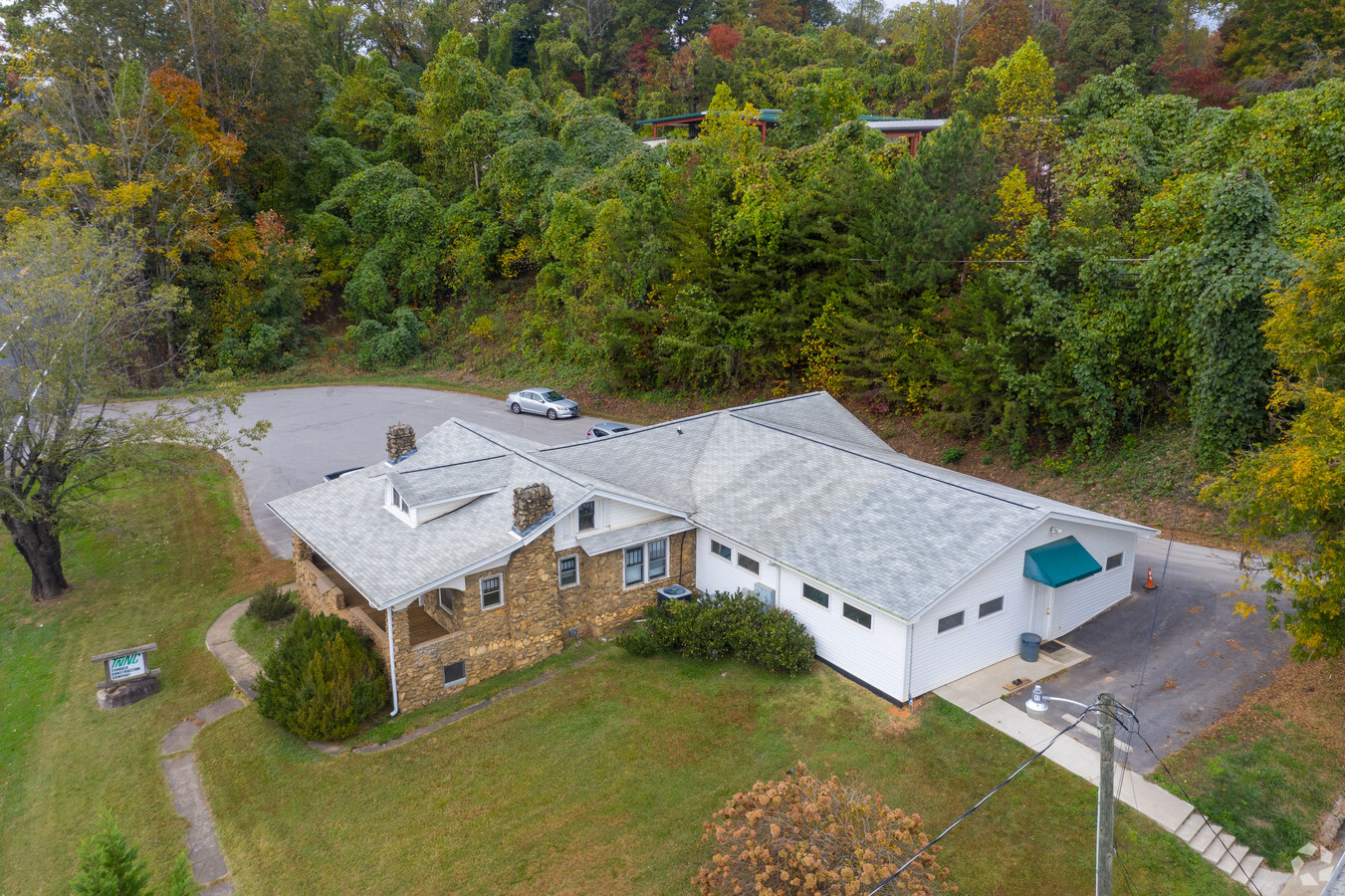
Property Record
1575 Smokey Park Hwy, Candler, NC 28715
NEARBY LISTINGS FOR SALE OR LEASE
Property Detail
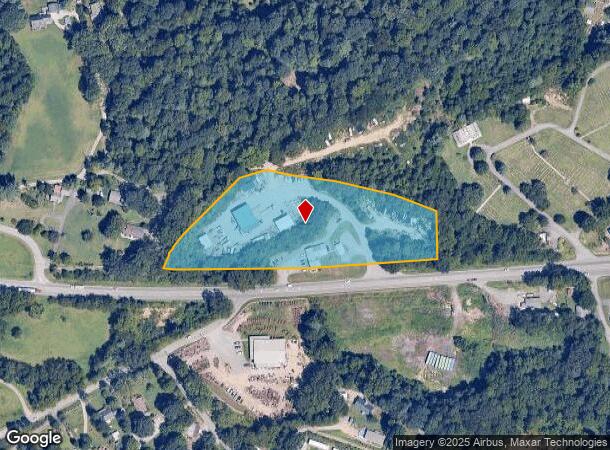
1575 Smokey Park Hwy
Asheville, NC
Williams Estate
9607-23-9553-00000
SUBDIV: WILLIAMS ESTATE LOT: C - 5-12, D - 1-10 14-25 & ST BLOCK: C & D PLAT: 0007-0077
Warehouse
Buncombe
X
North Carolina
3700960700J
c
2024
4.61 AC
2023
Buncombe County
002503
Asheville
8,726 SF
DEMOGRAPHICS near 1575 Smokey Park Hwy
1 Mile
3 Mile
5 Mile
2024 Total Population
3,161
21,486
42,921
2029 Population
3,268
22,169
44,392
Pop Growth 2024-2029
+ 3.39%
+ 3.18%
+ 3.43%
Average Age
40
42
41
2024 Total Households
1,300
8,713
17,736
HH Growth 2024-2029
+ 2.85%
+ 2.66%
+ 2.89%
Median Household Inc
$67,559
$67,899
$62,366
Avg Household Size
2.40
2.40
2.30
2024 Avg HH Vehicles
2.00
2.00
2.00
Median Home Value
$273,318
$297,263
$287,015
Median Year Built
1992
1991
1989
Nearby Places
- Restaurants
- Banks
- Shops
- Fitness
- Groceries
PUBLIC TRANSPORTATION
AIRPORT
Asheville Regional
DRIVE
WALK
Distance
Asheville Regional
20 min
14.4 mi
Freight Ports
North Charleston Terminal
DRIVE
WALK
Distance
North Charleston Terminal
292 min
258.2 mi
Nearby Properties
Address
Land Use
TOTAL SIZE
Lot Size
Zoning
Address
Land Use
TOTAL SIZE
Lot Size
Zoning
104,138 SF
33.25 AC
R-2
Address
Land Use
TOTAL SIZE
Lot Size
Zoning
134,180 SF
60.94 AC
PS
Address
Land Use
TOTAL SIZE
Lot Size
Zoning
164,080 SF
140.05 AC
PS
Address
Land Use
TOTAL SIZE
Lot Size
Zoning
151,884 SF
129.72 AC
Address
Land Use
TOTAL SIZE
Lot Size
Zoning
111,000 SF
21.97 AC
EMP
Address
Land Use
TOTAL SIZE
Lot Size
Zoning
79,908 SF
60 AC
PS
Address
Land Use
TOTAL SIZE
Lot Size
Zoning
131,946 SF
13.28 AC
EMP
Address
Land Use
TOTAL SIZE
Lot Size
Zoning
75,988 SF
12.90 AC
PS
Address
Land Use
TOTAL SIZE
Lot Size
Zoning
70,824 SF
12 AC
INST
Address
Land Use
TOTAL SIZE
Lot Size
Zoning
126,508 SF
14.90 AC
EMP
Address
Land Use
TOTAL SIZE
Lot Size
Zoning
196,498 SF
14.61 AC
EMP
Address
Land Use
TOTAL SIZE
Lot Size
Zoning
61,548 SF
8.95 AC
OU
Address
Land Use
TOTAL SIZE
Lot Size
Zoning
88,306 SF
10.29 AC
CS
Address
Land Use
TOTAL SIZE
Lot Size
Zoning
43,285 SF
7.88 AC
R-2
Address
Land Use
TOTAL SIZE
Lot Size
Zoning
94,560 SF
13.52 AC
PS
Address
Land Use
TOTAL SIZE
Lot Size
Zoning
4,492 SF
44.52 AC
PS
Address
Land Use
TOTAL SIZE
Lot Size
Zoning
56,400 SF
7.46 AC
OU
Address
Land Use
TOTAL SIZE
Lot Size
Zoning
33,321 SF
3.09 AC
HB
Address
Land Use
TOTAL SIZE
Lot Size
Zoning
316,009 SF
20 AC
EMP
Address
Land Use
TOTAL SIZE
Lot Size
Zoning
107,500 SF
17.89 AC
HB
Address
Land Use
TOTAL SIZE
Lot Size
Zoning
33,621 SF
12.19 AC
R-1
Address
Land Use
TOTAL SIZE
Lot Size
Zoning
9,469 SF
2.78 AC
HB
Address
Land Use
TOTAL SIZE
Lot Size
Zoning
34,752 SF
9.33 AC
R-1
Address
Land Use
TOTAL SIZE
Lot Size
Zoning
1,236,136 SF
52.82 AC
IND
Address
Land Use
TOTAL SIZE
Lot Size
Zoning
76,939 SF
6.48 AC
EMP
Address
Land Use
TOTAL SIZE
Lot Size
Zoning
54,142 SF
7.65 AC
HB
Address
Land Use
TOTAL SIZE
Lot Size
Zoning
19,812 SF
8.24 AC
R-1
Address
Land Use
TOTAL SIZE
Lot Size
Zoning
11,452 SF
6.83 AC
R-LD
Address
Land Use
TOTAL SIZE
Lot Size
Zoning
70,076 SF
5.47 AC
EMP
Address
Land Use
TOTAL SIZE
Lot Size
Zoning
30,878 SF
22.96 AC
IND
The World's #1 Commercial Real Estate Marketplace
Connect with us
© 2025 CoStar Group
The information above has been obtained from sources believed reliable. While we do not doubt its accuracy we have not verified it and make no guarantee, warranty or representation about it. It is your responsibility to independently confirm its accuracy and completeness. Any projections, opinions, assumptions, or estimates used are for example only and do not represent the current or future performance of the property. The value of this transaction to you depends on tax and other factors which should be evaluated by your tax, financial, and legal advisors. You and your advisors should conduct a careful, independent investigation of the property to determine to your satisfaction the suitability of the property for your needs.