Property Record
1580 Fairview Rd, Zanesville, OH 43701
NEARBY LISTINGS FOR SALE OR LEASE
-
-
View all Zanesville listings for sale on LoopNet.com
Property Detail
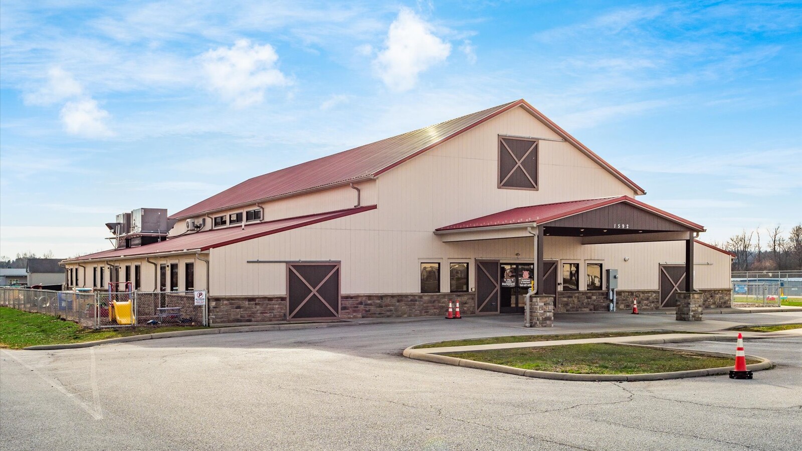
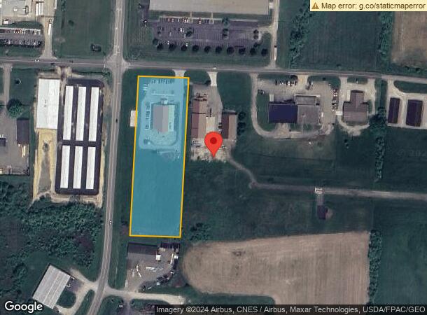
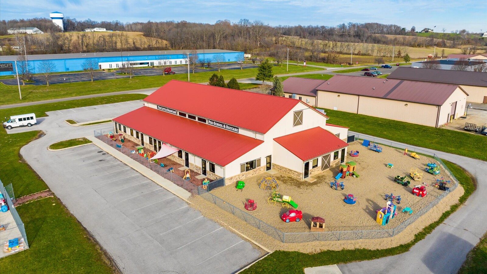
1580 Fairview Rd
Zanesville, OH
Sibleys Subdivision
86-34-01-01-018
R 8 TP 1 QR TP 1 LOT 5 3.36A
Privateschool
Muskingum
X
Ohio
39119C0170G
5
2023
3.36 AC
2023
Ohio South Area
911602
Other Market Areas
DEMOGRAPHICS near 1580 Fairview Rd
1 Mile
3 Mile
5 Mile
2024 Total Population
1,845
15,167
29,887
2029 Population
1,796
15,006
29,785
Pop Growth 2024-2029
(2.66%)
(1.06%)
(0.34%)
Average Age
49
44
42
2024 Total Households
946
7,034
12,955
HH Growth 2024-2029
(2.96%)
(1.08%)
(0.40%)
Median Household Inc
$58,764
$56,598
$52,299
Avg Household Size
1.90
2.10
2.20
2024 Avg HH Vehicles
2.00
2.00
2.00
Median Home Value
$187,272
$173,681
$157,478
Median Year Built
2000
1975
1967
Nearby Places
- Restaurants
- Banks
- Shops
- Fitness
- Groceries
Nearby Properties
Address
Land Use
TOTAL SIZE
Lot Size
Zoning
Address
Land Use
TOTAL SIZE
Lot Size
Zoning
219,630 SF
9.80 AC
O2
Address
Land Use
TOTAL SIZE
Lot Size
Zoning
0.81 AC
Address
Land Use
TOTAL SIZE
Lot Size
Zoning
119,150 SF
9.13 AC
C2
Address
Land Use
TOTAL SIZE
Lot Size
Zoning
121,905 SF
10.21 AC
Address
Land Use
TOTAL SIZE
Lot Size
Zoning
14,968 SF
15.87 AC
C2
Address
Land Use
TOTAL SIZE
Lot Size
Zoning
224,851 SF
28.78 AC
I1
Address
Land Use
TOTAL SIZE
Lot Size
Zoning
4,896 SF
21.31 AC
RM2
Address
Land Use
TOTAL SIZE
Lot Size
Zoning
317,584 SF
49.15 AC
C2
Address
Land Use
TOTAL SIZE
Lot Size
Zoning
42,000 SF
10.08 AC
O2
Address
Land Use
TOTAL SIZE
Lot Size
Zoning
197,951 SF
22.46 AC
C2
Address
Land Use
TOTAL SIZE
Lot Size
Zoning
125,135 SF
13.85 AC
C2
Address
Land Use
TOTAL SIZE
Lot Size
Zoning
64,732 SF
6.36 AC
RM1
Address
Land Use
TOTAL SIZE
Lot Size
Zoning
104,280 SF
9.77 AC
C4
Address
Land Use
TOTAL SIZE
Lot Size
Zoning
135,726 SF
16.84 AC
C4
Address
Land Use
TOTAL SIZE
Lot Size
Zoning
58,396 SF
9.83 AC
Address
Land Use
TOTAL SIZE
Lot Size
Zoning
93,676 SF
11.07 AC
O-2
Address
Land Use
TOTAL SIZE
Lot Size
Zoning
54,131 SF
10.55 AC
O2
Address
Land Use
TOTAL SIZE
Lot Size
Zoning
6,320 SF
13.49 AC
PUD
Address
Land Use
TOTAL SIZE
Lot Size
Zoning
10,469 SF
8.63 AC
RM1
Address
Land Use
TOTAL SIZE
Lot Size
Zoning
48,002 SF
7.13 AC
Address
Land Use
TOTAL SIZE
Lot Size
Zoning
87,834 SF
7.21 AC
C4
Address
Land Use
TOTAL SIZE
Lot Size
Zoning
17,180 SF
5.28 AC
PUD
Address
Land Use
TOTAL SIZE
Lot Size
Zoning
31,261 SF
74.04 AC
AE
Address
Land Use
TOTAL SIZE
Lot Size
Zoning
40,361 SF
2 AC
O2
Address
Land Use
TOTAL SIZE
Lot Size
Zoning
73,080 SF
3.75 AC
C4
Address
Land Use
TOTAL SIZE
Lot Size
Zoning
32,592 SF
8.22 AC
RES
Address
Land Use
TOTAL SIZE
Lot Size
Zoning
55,846 SF
5.92 AC
PUD
Address
Land Use
TOTAL SIZE
Lot Size
Zoning
21,796 SF
2.44 AC
O2
Address
Land Use
TOTAL SIZE
Lot Size
Zoning
6,305 SF
7.87 AC
PUD
Address
Land Use
TOTAL SIZE
Lot Size
Zoning
87,263 SF
2.93 AC
C2
The World's #1 Commercial Real Estate Marketplace
Connect with us
© 2025 CoStar Group
The information above has been obtained from sources believed reliable. While we do not doubt its accuracy we have not verified it and make no guarantee, warranty or representation about it. It is your responsibility to independently confirm its accuracy and completeness. Any projections, opinions, assumptions, or estimates used are for example only and do not represent the current or future performance of the property. The value of this transaction to you depends on tax and other factors which should be evaluated by your tax, financial, and legal advisors. You and your advisors should conduct a careful, independent investigation of the property to determine to your satisfaction the suitability of the property for your needs.