Property Record
15875 Fm 529 Rd, Houston, TX 77095


NEARBY LISTINGS FOR SALE OR LEASE
Property Detail
15875 Fm 529 Rd
1184890010003
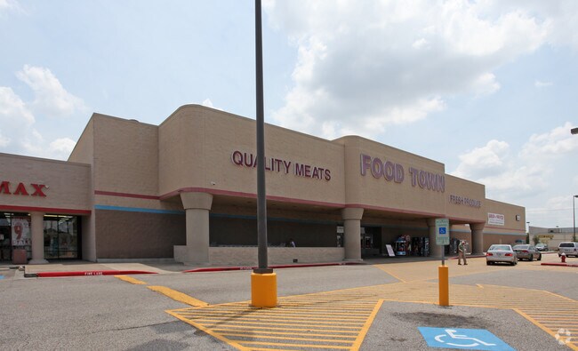
Center Sec 1 Copperwood Regional Shoppin
Supermarket
RES C BLK 1 CENTER SEC 1 COPPERWOOD REGIONAL SHOPPING
X
Harris
48201C0420P
Texas
2024
4.86 AC
2025
Far Katy North
541301
Houston
58,970 SF
Houston-The Woodlands-Sugar Land, TX
DEMOGRAPHICS near 15875 Fm 529 Rd
1 Mile
3 Mile
5 Mile
2024 Total Population
17,804
141,957
309,800
2029 Population
18,109
143,321
313,377
Pop Growth 2024-2029
+ 1.71%
+ 0.96%
+ 1.15%
Average Age
36
37
36
2024 Total Households
6,115
47,298
101,425
HH Growth 2024-2029
+ 1.67%
+ 0.94%
+ 1.09%
Median Household Inc
$77,707
$74,405
$82,492
Avg Household Size
2.90
2.90
3.00
2024 Avg HH Vehicles
2.00
2.00
2.00
Median Home Value
$211,906
$212,721
$231,879
Median Year Built
1988
1991
1998
Nearby Places
Map Layers
Map Styles
 Street
 Aerial
- Restaurants
- Banks
- Shops
- Fitness
- Groceries
PUBLIC TRANSPORTATION
AIRPORT
George Bush Intcntl/Houston
DRIVE
WALK
Distance
George Bush Intcntl/Houston
35 min
24.4 mi
William P Hobby
DRIVE
WALK
Distance
William P Hobby
54 min
35.0 mi
Freight Ports
Port of Houston
DRIVE
WALK
Distance
Port of Houston
45 min
30.6 mi
Nearby Properties
Address
Land Use
TOTAL SIZE
Lot Size
Zoning
Address
Land Use
TOTAL SIZE
Lot Size
Zoning
697,158 SF
Address
Land Use
TOTAL SIZE
Lot Size
Zoning
386,642 SF
14.45 AC
Address
Land Use
TOTAL SIZE
Lot Size
Zoning
466,299 SF
23.82 AC
Address
Land Use
TOTAL SIZE
Lot Size
Zoning
120.78 AC
Address
Land Use
TOTAL SIZE
Lot Size
Zoning
358,713 SF
19.91 AC
Address
Land Use
TOTAL SIZE
Lot Size
Zoning
320,084 SF
8.01 AC
Address
Land Use
TOTAL SIZE
Lot Size
Zoning
307,698 SF
13.12 AC
Address
Land Use
TOTAL SIZE
Lot Size
Zoning
387,245 SF
18.18 AC
Address
Land Use
TOTAL SIZE
Lot Size
Zoning
408,144 SF
26.13 AC
Address
Land Use
TOTAL SIZE
Lot Size
Zoning
418,572 SF
24.76 AC
Address
Land Use
TOTAL SIZE
Lot Size
Zoning
392,185 SF
30.73 AC
Address
Land Use
TOTAL SIZE
Lot Size
Zoning
491,051 SF
50 AC
Address
Land Use
TOTAL SIZE
Lot Size
Zoning
388,223 SF
14.99 AC
Address
Land Use
TOTAL SIZE
Lot Size
Zoning
384,280 SF
27.19 AC
Address
Land Use
TOTAL SIZE
Lot Size
Zoning
363,896 SF
21.69 AC
Address
Land Use
TOTAL SIZE
Lot Size
Zoning
412,250 SF
45.79 AC
Address
Land Use
TOTAL SIZE
Lot Size
Zoning
364,057 SF
22.03 AC
Address
Land Use
TOTAL SIZE
Lot Size
Zoning
112,440 SF
8.02 AC
Address
Land Use
TOTAL SIZE
Lot Size
Zoning
301,102 SF
12.58 AC
Address
Land Use
TOTAL SIZE
Lot Size
Zoning
342,196 SF
15.13 AC
Address
Land Use
TOTAL SIZE
Lot Size
Zoning
493,233 SF
25.82 AC
Address
Land Use
TOTAL SIZE
Lot Size
Zoning
232,717 SF
10.21 AC
Address
Land Use
TOTAL SIZE
Lot Size
Zoning
292,466 SF
12.18 AC
Address
Land Use
TOTAL SIZE
Lot Size
Zoning
351,468 SF
16.05 AC
Address
Land Use
TOTAL SIZE
Lot Size
Zoning
324,733 SF
19.26 AC
Address
Land Use
TOTAL SIZE
Lot Size
Zoning
300,000 SF
20.07 AC
Address
Land Use
TOTAL SIZE
Lot Size
Zoning
250,178 SF
Address
Land Use
TOTAL SIZE
Lot Size
Zoning
277,900 SF
18.43 AC
Address
Land Use
TOTAL SIZE
Lot Size
Zoning
268,114 SF
14.80 AC
Address
Land Use
TOTAL SIZE
Lot Size
Zoning
203,303 SF
6.41 AC
The World's #1 Commercial Real Estate Marketplace
Connect with us
© 2025 CoStar Group
The information above has been obtained from sources believed reliable. While we do not doubt its accuracy we have not verified it and make no guarantee, warranty or representation about it. It is your responsibility to independently confirm its accuracy and completeness. Any projections, opinions, assumptions, or estimates used are for example only and do not represent the current or future performance of the property. The value of this transaction to you depends on tax and other factors which should be evaluated by your tax, financial, and legal advisors. You and your advisors should conduct a careful, independent investigation of the property to determine to your satisfaction the suitability of the property for your needs.