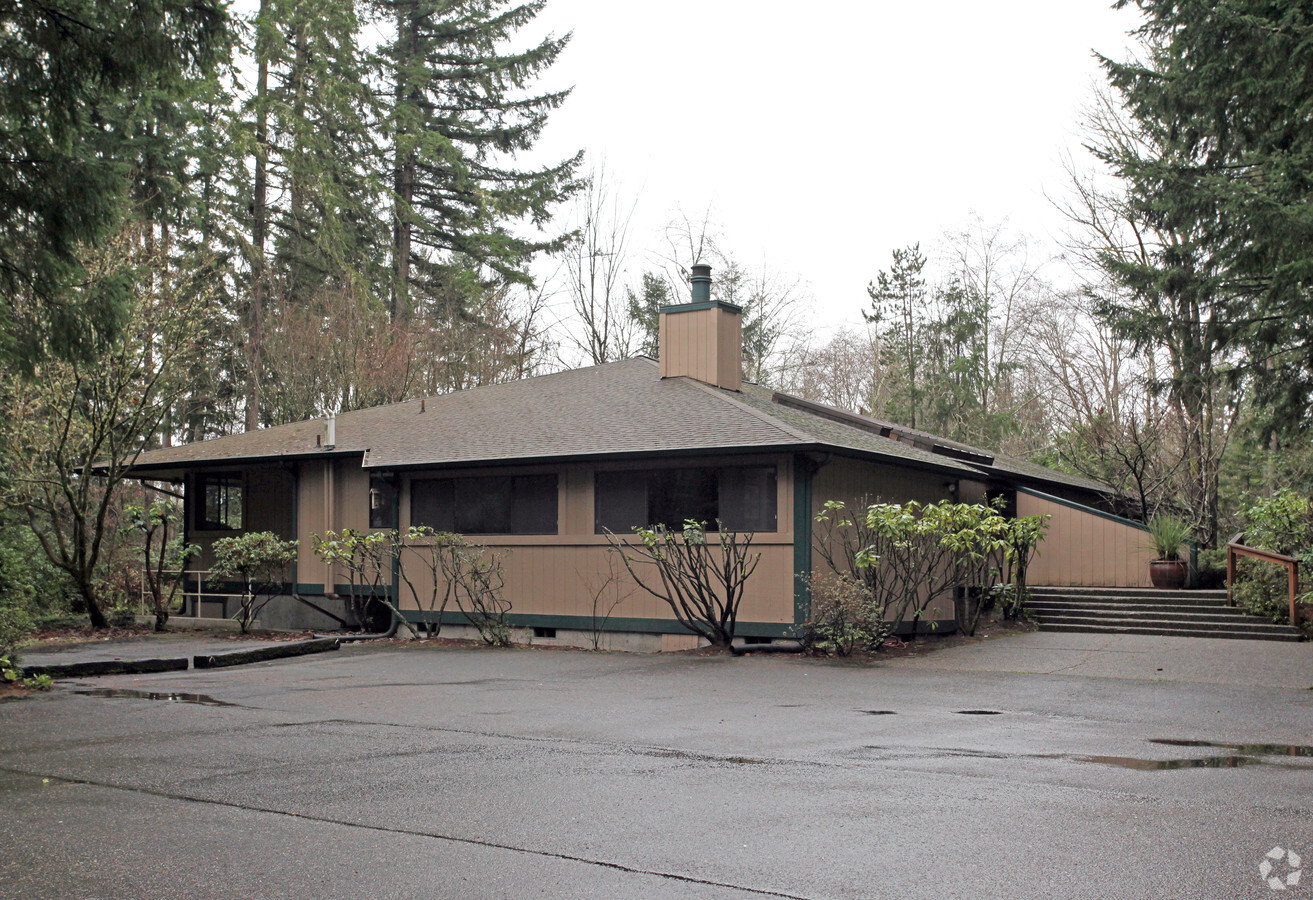
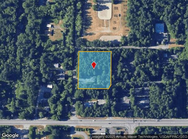
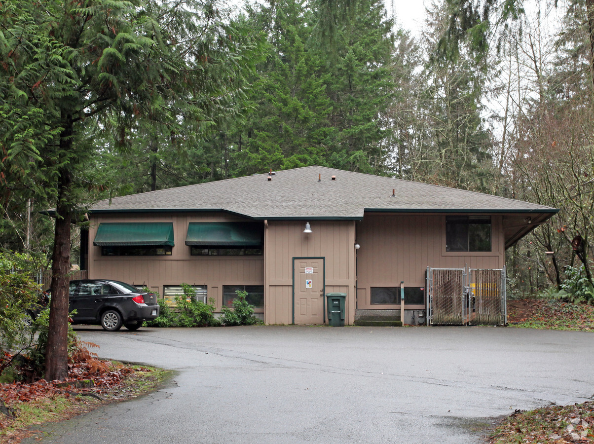
Property Record
1590 Woodridge Dr Se, Port Orchard, WA 98366
NEARBY LISTINGS FOR SALE OR LEASE
Property Detail
1590 Woodridge Dr Se
Bremerton-Silverdale, WA
Colby Garden Tracts Division Number One
4514-000-009-01-01
LOT B OF SHORT PLAT NO. 1888, AS RECORDED UNDER AUDITOR'S FILE NO. 7905030165, RECORDS OF KITSAP COUNTY, WASHINGTON, BEING A PORTION OF TRACT 9, PLAT OF COLBY GARDEN TRACTS, DIVISION 1, AS RECORDED IN VOLUME 3 OF PLATS, PAGE 62, IN KITSAP COUNTY, WAS
Medicalbuilding
Kitsap
X
Washington
53035C0390F
9,b
2025
2.02 AC
2025
South Kitsap County
092500
Bremerton/Silverdale
1,810 SF
DEMOGRAPHICS near 1590 Woodridge Dr Se
1 Mile
3 Mile
5 Mile
2024 Total Population
4,511
33,791
98,403
2029 Population
4,508
33,945
99,596
Pop Growth 2024-2029
(0.07%)
+ 0.46%
+ 1.21%
Average Age
40
41
40
2024 Total Households
1,752
13,132
37,662
HH Growth 2024-2029
(0.17%)
+ 0.38%
+ 1.35%
Median Household Inc
$80,954
$80,503
$72,000
Avg Household Size
2.50
2.50
2.40
2024 Avg HH Vehicles
2.00
2.00
2.00
Median Home Value
$421,409
$420,342
$415,087
Median Year Built
1979
1981
1978
Nearby Places
- Restaurants
- Banks
- Shops
- Fitness
- Groceries
PUBLIC TRANSPORTATION
AIRPORT
Seattle-Tacoma International
DRIVE
WALK
Distance
Seattle-Tacoma International
72 min
49.6 mi
Freight Ports
Port of Seattle
DRIVE
WALK
Distance
Port of Seattle
82 min
59.9 mi
Nearby Properties
Address
Land Use
TOTAL SIZE
Lot Size
Zoning
Address
Land Use
TOTAL SIZE
Lot Size
Zoning
25,973 SF
8.20 AC
CC
Address
Land Use
TOTAL SIZE
Lot Size
Zoning
17,592 SF
11.61 AC
UM
Address
Land Use
TOTAL SIZE
Lot Size
Zoning
125,582 SF
4.02 AC
NC
Address
Land Use
TOTAL SIZE
Lot Size
Zoning
110,778 SF
9.24 AC
CC
Address
Land Use
TOTAL SIZE
Lot Size
Zoning
185,893 SF
17.89 AC
CC
Address
Land Use
TOTAL SIZE
Lot Size
Zoning
77,580 SF
8.62 AC
UM
Address
Land Use
TOTAL SIZE
Lot Size
Zoning
14,660 SF
6.14 AC
UM
Address
Land Use
TOTAL SIZE
Lot Size
Zoning
14,660 SF
6.07 AC
UM
Address
Land Use
TOTAL SIZE
Lot Size
Zoning
49,604 SF
5.49 AC
UM
Address
Land Use
TOTAL SIZE
Lot Size
Zoning
62,642 SF
4.91 AC
UM
Address
Land Use
TOTAL SIZE
Lot Size
Zoning
56,006 SF
4.72 AC
UM
Address
Land Use
TOTAL SIZE
Lot Size
Zoning
45,379 SF
6.74 AC
UM
Address
Land Use
TOTAL SIZE
Lot Size
Zoning
69,192 SF
3.36 AC
UM
Address
Land Use
TOTAL SIZE
Lot Size
Zoning
2.33 AC
CITY
Address
Land Use
TOTAL SIZE
Lot Size
Zoning
60,977 SF
0.47 AC
DSAP
Address
Land Use
TOTAL SIZE
Lot Size
Zoning
24,930 SF
0.33 AC
DSAP
Address
Land Use
TOTAL SIZE
Lot Size
Zoning
45,904 SF
0.87 AC
NB
Address
Land Use
TOTAL SIZE
Lot Size
Zoning
39,800 SF
4.69 AC
CC
Address
Land Use
TOTAL SIZE
Lot Size
Zoning
45,288 SF
1.88 AC
CITY
Address
Land Use
TOTAL SIZE
Lot Size
Zoning
67,000 SF
4.19 AC
C
Address
Land Use
TOTAL SIZE
Lot Size
Zoning
31,130 SF
2.42 AC
UM
Address
Land Use
TOTAL SIZE
Lot Size
Zoning
65,956 SF
5.32 AC
CC
Address
Land Use
TOTAL SIZE
Lot Size
Zoning
85,187 SF
4.30 AC
CC
Address
Land Use
TOTAL SIZE
Lot Size
Zoning
55,460 SF
8.24 AC
CC
Address
Land Use
TOTAL SIZE
Lot Size
Zoning
28,652 SF
1.69 AC
UM
Address
Land Use
TOTAL SIZE
Lot Size
Zoning
55,647 SF
4.71 AC
CC
Address
Land Use
TOTAL SIZE
Lot Size
Zoning
1.06 AC
C
Address
Land Use
TOTAL SIZE
Lot Size
Zoning
43,914 SF
4.40 AC
CC
Address
Land Use
TOTAL SIZE
Lot Size
Zoning
70,528 SF
0.72 AC
DSAP
Address
Land Use
TOTAL SIZE
Lot Size
Zoning
52,180 SF
2.97 AC
CC
The World's #1 Commercial Real Estate Marketplace
Connect with us
© 2025 CoStar Group
The information above has been obtained from sources believed reliable. While we do not doubt its accuracy we have not verified it and make no guarantee, warranty or representation about it. It is your responsibility to independently confirm its accuracy and completeness. Any projections, opinions, assumptions, or estimates used are for example only and do not represent the current or future performance of the property. The value of this transaction to you depends on tax and other factors which should be evaluated by your tax, financial, and legal advisors. You and your advisors should conduct a careful, independent investigation of the property to determine to your satisfaction the suitability of the property for your needs.