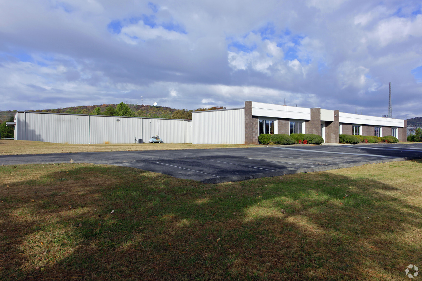
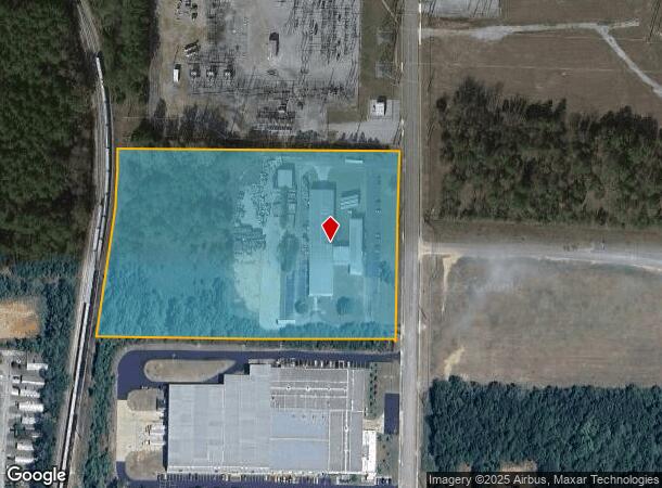
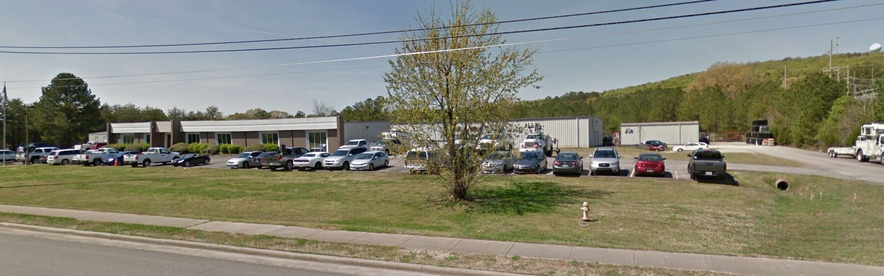
Property Record
15980 Chaney Thompson Rd Se, Huntsville, AL 35803

NEARBY LISTINGS FOR SALE OR LEASE
Property Detail
15980 Chaney Thompson Rd Se
23-04-17-3-000-002.000
ALL THAT PART OF THE SW 1/4 OF SEC 17 BEG N 00 DEG 17 MIN 14 SEC E 1483.52 FT & N 89 DEG 08 MIN 56 SEC W 25.0 FT FR THE CEN O
Officebuilding
Madison
X
Alabama
01089C0456G
11 AC
2024
South Madison County
2024
Huntsville
002924
Huntsville, AL
7,250 SF
DEMOGRAPHICS near 15980 Chaney Thompson Rd Se
1 Mile
3 Mile
5 Mile
2024 Total Population
4,733
26,766
52,280
2029 Population
5,242
29,418
57,444
Pop Growth 2024-2029
+ 10.75%
+ 9.91%
+ 9.88%
Average Age
43
43
42
2024 Total Households
1,930
10,955
21,461
HH Growth 2024-2029
+ 11.19%
+ 10.31%
+ 10.27%
Median Household Inc
$105,817
$93,808
$95,834
Avg Household Size
2.30
2.40
2.40
2024 Avg HH Vehicles
2.00
2.00
2.00
Median Home Value
$271,052
$247,007
$268,316
Median Year Built
1993
1986
1985
Nearby Places
- Restaurants
- Banks
- Shops
- Fitness
- Groceries
PUBLIC TRANSPORTATION
AIRPORT
Huntsville International-Carl T Jones Field
DRIVE
WALK
Distance
Huntsville International-Carl T Jones Field
36 min
23.6 mi
Freight Ports
Port of Mobile
DRIVE
WALK
Distance
Port of Mobile
396 min
350.9 mi
SALE & LEASE HISTORY
LISTING DATE
SALE/LEASE

Sep 23, 2016
For Sale
May 08, 2017
For Lease
Jul 17, 2020
For Lease
Jul 17, 2020
For Sale
Nearby Properties
Address
Land Use
TOTAL SIZE
Lot Size
Zoning
Address
Land Use
TOTAL SIZE
Lot Size
Zoning
63,237 SF
10.99 AC
Address
Land Use
TOTAL SIZE
Lot Size
Zoning
83,720 SF
109 AC
Address
Land Use
TOTAL SIZE
Lot Size
Zoning
9,908 SF
14 AC
Address
Land Use
TOTAL SIZE
Lot Size
Zoning
1,351 SF
9.50 AC
Address
Land Use
TOTAL SIZE
Lot Size
Zoning
3,130 SF
11.18 AC
Address
Land Use
TOTAL SIZE
Lot Size
Zoning
198,119 SF
21.01 AC
Address
Land Use
TOTAL SIZE
Lot Size
Zoning
43,168 SF
23 AC
Address
Land Use
TOTAL SIZE
Lot Size
Zoning
84,320 SF
7.73 AC
Address
Land Use
TOTAL SIZE
Lot Size
Zoning
8,317 SF
1.17 AC
Address
Land Use
TOTAL SIZE
Lot Size
Zoning
32,400 SF
5.34 AC
Address
Land Use
TOTAL SIZE
Lot Size
Zoning
10,836 SF
10 AC
Address
Land Use
TOTAL SIZE
Lot Size
Zoning
14,400 SF
4.90 AC
Address
Land Use
TOTAL SIZE
Lot Size
Zoning
45,369 SF
6.03 AC
Address
Land Use
TOTAL SIZE
Lot Size
Zoning
87,406 SF
7.71 AC
Address
Land Use
TOTAL SIZE
Lot Size
Zoning
8,030 SF
0.91 AC
Address
Land Use
TOTAL SIZE
Lot Size
Zoning
27,400 SF
4.78 AC
Address
Land Use
TOTAL SIZE
Lot Size
Zoning
8,190 SF
18.58 AC
Address
Land Use
TOTAL SIZE
Lot Size
Zoning
5,184 SF
5 AC
Address
Land Use
TOTAL SIZE
Lot Size
Zoning
68,069 SF
6.98 AC
Address
Land Use
TOTAL SIZE
Lot Size
Zoning
2,100 SF
2.72 AC
Address
Land Use
TOTAL SIZE
Lot Size
Zoning
55,875 SF
4.50 AC
Address
Land Use
TOTAL SIZE
Lot Size
Zoning
Address
Land Use
TOTAL SIZE
Lot Size
Zoning
16,260 SF
4.10 AC
Address
Land Use
TOTAL SIZE
Lot Size
Zoning
8,625 SF
2.26 AC
Address
Land Use
TOTAL SIZE
Lot Size
Zoning
35.22 AC
Address
Land Use
TOTAL SIZE
Lot Size
Zoning
Address
Land Use
TOTAL SIZE
Lot Size
Zoning
Address
Land Use
TOTAL SIZE
Lot Size
Zoning
Address
Land Use
TOTAL SIZE
Lot Size
Zoning
6,168 SF
2.30 AC
Address
Land Use
TOTAL SIZE
Lot Size
Zoning
The World's #1 Commercial Real Estate Marketplace
Connect with us
© 2025 CoStar Group
The information above has been obtained from sources believed reliable. While we do not doubt its accuracy we have not verified it and make no guarantee, warranty or representation about it. It is your responsibility to independently confirm its accuracy and completeness. Any projections, opinions, assumptions, or estimates used are for example only and do not represent the current or future performance of the property. The value of this transaction to you depends on tax and other factors which should be evaluated by your tax, financial, and legal advisors. You and your advisors should conduct a careful, independent investigation of the property to determine to your satisfaction the suitability of the property for your needs.