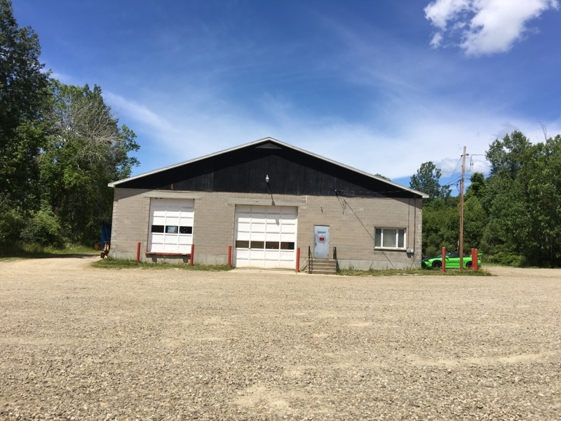
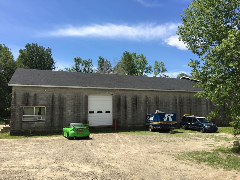
Property Record
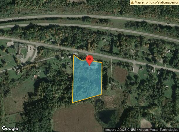
1599 Route 394, Falconer, NY 14733
NEARBY LISTINGS FOR SALE OR LEASE
Property Detail
1599 Route 394
Jamestown-Dunkirk-Fredonia, NY
OLD APN: 065600 4-1-36
065600-355-000-0002-015-000
Chautauqua
Warehouse
New York
2023
15.000
2023
11.20 AC
037400
Other Market Areas
14,176 SF
DEMOGRAPHICS near 1599 Route 394
1 Mile
3 Mile
5 Mile
2024 Total Population
239
4,662
24,537
2029 Population
236
4,573
24,023
Pop Growth 2024-2029
(1.26%)
(1.91%)
(2.09%)
Average Age
43
43
41
2024 Total Households
94
1,999
10,578
HH Growth 2024-2029
(1.06%)
(2.00%)
(2.17%)
Median Household Inc
$70,672
$49,358
$33,805
Avg Household Size
2.40
2.20
2.20
2024 Avg HH Vehicles
2.00
2.00
1.00
Median Home Value
$144,444
$78,664
$69,002
Median Year Built
1961
1951
1948
Nearby Places
- Restaurants
- Banks
- Shops
- Fitness
- Groceries
SALE & LEASE HISTORY
LISTING DATE
SALE/LEASE

Sep 24, 2016
For Sale
Nearby Properties
Address
Land Use
TOTAL SIZE
Lot Size
Zoning
Address
Land Use
TOTAL SIZE
Lot Size
Zoning
38.50 AC
401
Address
Land Use
TOTAL SIZE
Lot Size
Zoning
395,580 SF
61.80 AC
06 - INDUS
Address
Land Use
TOTAL SIZE
Lot Size
Zoning
0.27 AC
06 - INDUS
Address
Land Use
TOTAL SIZE
Lot Size
Zoning
66,500 SF
1.10 AC
06 - INDUS
Address
Land Use
TOTAL SIZE
Lot Size
Zoning
134,858 SF
31.10 AC
06 - INDUS
Address
Land Use
TOTAL SIZE
Lot Size
Zoning
107,016 SF
4.70 AC
03 - MULTI
Address
Land Use
TOTAL SIZE
Lot Size
Zoning
190,436 SF
34.70 AC
06 - INDUS
Address
Land Use
TOTAL SIZE
Lot Size
Zoning
122,500 SF
10.30 AC
06 - INDUS
Address
Land Use
TOTAL SIZE
Lot Size
Zoning
2.80 AC
Address
Land Use
TOTAL SIZE
Lot Size
Zoning
33,663 SF
1 AC
Address
Land Use
TOTAL SIZE
Lot Size
Zoning
318,800 SF
18.10 AC
06 - INDUS
Address
Land Use
TOTAL SIZE
Lot Size
Zoning
194,301 SF
4.10 AC
06 - INDUS
Address
Land Use
TOTAL SIZE
Lot Size
Zoning
209,985 SF
8.10 AC
06 - INDUS
Address
Land Use
TOTAL SIZE
Lot Size
Zoning
4.60 AC
06 - INDUS
Address
Land Use
TOTAL SIZE
Lot Size
Zoning
33,500 SF
11.30 AC
Address
Land Use
TOTAL SIZE
Lot Size
Zoning
7,896 SF
6.70 AC
Address
Land Use
TOTAL SIZE
Lot Size
Zoning
12,384 SF
9.75 AC
06 - INDUS
Address
Land Use
TOTAL SIZE
Lot Size
Zoning
132,554 SF
7.20 AC
06 - INDUS
Address
Land Use
TOTAL SIZE
Lot Size
Zoning
3,768 SF
6.90 AC
05 - COMME
Address
Land Use
TOTAL SIZE
Lot Size
Zoning
134,874 SF
12.70 AC
06 - INDUS
Address
Land Use
TOTAL SIZE
Lot Size
Zoning
119,904 SF
27.10 AC
06 - INDUS
Address
Land Use
TOTAL SIZE
Lot Size
Zoning
34,946 SF
1.88 AC
Address
Land Use
TOTAL SIZE
Lot Size
Zoning
10,315 SF
0.18 AC
Address
Land Use
TOTAL SIZE
Lot Size
Zoning
136,114 SF
8.20 AC
06 - INDUS
Address
Land Use
TOTAL SIZE
Lot Size
Zoning
26,013 SF
5.10 AC
05 - COMME
Address
Land Use
TOTAL SIZE
Lot Size
Zoning
30,696 SF
28.50 AC
05 - COMME
Address
Land Use
TOTAL SIZE
Lot Size
Zoning
9,854 SF
4.20 AC
412
Address
Land Use
TOTAL SIZE
Lot Size
Zoning
16,000 SF
0.36 AC
06 - INDUS
Address
Land Use
TOTAL SIZE
Lot Size
Zoning
88,600 SF
2.80 AC
06 - INDUS
Address
Land Use
TOTAL SIZE
Lot Size
Zoning
57,600 SF
3 AC
06 - INDUS
The World's #1 Commercial Real Estate Marketplace
Connect with us
© 2025 CoStar Group
The information above has been obtained from sources believed reliable. While we do not doubt its accuracy we have not verified it and make no guarantee, warranty or representation about it. It is your responsibility to independently confirm its accuracy and completeness. Any projections, opinions, assumptions, or estimates used are for example only and do not represent the current or future performance of the property. The value of this transaction to you depends on tax and other factors which should be evaluated by your tax, financial, and legal advisors. You and your advisors should conduct a careful, independent investigation of the property to determine to your satisfaction the suitability of the property for your needs.