Property Record
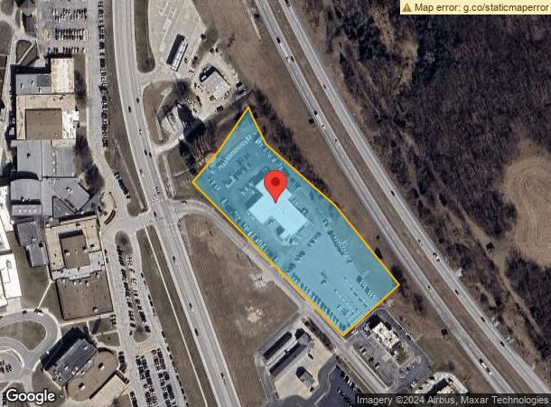
1600 Prairie View Rd, Platte City, MO 64079

NEARBY LISTINGS FOR SALE OR LEASE
-
-
View all Platte City listings for sale on LoopNet.com
Property Detail
1600 Prairie View Rd
Kansas City, MO-KS
Water Tower Plaza
12-90-31-000-000-011-001
WATER TOWER PLAZA REPLAT LOT 1
Vehiclerentalsvehiclesales
Platte
X
Missouri
29095C0010G
1
2023
4.68 AC
2023
I-29 Corridor
030502
Kansas City
19,000 SF
DEMOGRAPHICS near 1600 Prairie View Rd
1 Mile
3 Mile
5 Mile
2024 Total Population
4,043
12,901
14,381
2029 Population
4,422
14,119
15,746
Pop Growth 2024-2029
+ 9.37%
+ 9.44%
+ 9.49%
Average Age
39
39
40
2024 Total Households
1,660
4,853
5,393
HH Growth 2024-2029
+ 9.40%
+ 9.42%
+ 9.48%
Median Household Inc
$63,684
$91,943
$92,323
Avg Household Size
2.40
2.60
2.60
2024 Avg HH Vehicles
2.00
2.00
2.00
Median Home Value
$198,921
$266,558
$271,287
Median Year Built
1987
1996
1995
Nearby Places
- Restaurants
- Banks
- Shops
- Fitness
- Groceries
PUBLIC TRANSPORTATION
AIRPORT
Kansas City International
Drive
Walk
Distance
Kansas City International
11 min
6.7 mi
Freight Ports
Tulsa Port Of Catoosa
Drive
Walk
Distance
Tulsa Port Of Catoosa
288 min
258.2 mi
Nearby Properties
Address
Land Use
TOTAL SIZE
Lot Size
Zoning
Address
Land Use
TOTAL SIZE
Lot Size
Zoning
210314
4.68 AC
Address
Land Use
TOTAL SIZE
Lot Size
Zoning
113825
6.39 AC
Address
Land Use
TOTAL SIZE
Lot Size
Zoning
176804
5.77 AC
Address
Land Use
TOTAL SIZE
Lot Size
Zoning
25596
3.90 AC
Address
Land Use
TOTAL SIZE
Lot Size
Zoning
26144
5.93 AC
Address
Land Use
TOTAL SIZE
Lot Size
Zoning
176408
14.36 AC
Address
Land Use
TOTAL SIZE
Lot Size
Zoning
Address
Land Use
TOTAL SIZE
Lot Size
Zoning
Address
Land Use
TOTAL SIZE
Lot Size
Zoning
19100
1.54 AC
Address
Land Use
TOTAL SIZE
Lot Size
Zoning
8745
1.50 AC
Address
Land Use
TOTAL SIZE
Lot Size
Zoning
15141
14.69 AC
Address
Land Use
TOTAL SIZE
Lot Size
Zoning
6006
5.07 AC
Address
Land Use
TOTAL SIZE
Lot Size
Zoning
Address
Land Use
TOTAL SIZE
Lot Size
Zoning
26678
7.13 AC
Address
Land Use
TOTAL SIZE
Lot Size
Zoning
53291
6.93 AC
Address
Land Use
TOTAL SIZE
Lot Size
Zoning
70560
7.04 AC
Address
Land Use
TOTAL SIZE
Lot Size
Zoning
91016
5.62 AC
Address
Land Use
TOTAL SIZE
Lot Size
Zoning
30181
1.99 AC
Address
Land Use
TOTAL SIZE
Lot Size
Zoning
Address
Land Use
TOTAL SIZE
Lot Size
Zoning
18777
5.78 AC
Address
Land Use
TOTAL SIZE
Lot Size
Zoning
77579
6.39 AC
Address
Land Use
TOTAL SIZE
Lot Size
Zoning
31612
2.43 AC
Address
Land Use
TOTAL SIZE
Lot Size
Zoning
2888
5.37 AC
Address
Land Use
TOTAL SIZE
Lot Size
Zoning
80529
2.30 AC
Address
Land Use
TOTAL SIZE
Lot Size
Zoning
78947
3.92 AC
Address
Land Use
TOTAL SIZE
Lot Size
Zoning
14548
2.02 AC
Address
Land Use
TOTAL SIZE
Lot Size
Zoning
7138
7.28 AC
Address
Land Use
TOTAL SIZE
Lot Size
Zoning
39371
3.22 AC
Address
Land Use
TOTAL SIZE
Lot Size
Zoning
7464
2.19 AC
Address
Land Use
TOTAL SIZE
Lot Size
Zoning
4988
2.25 AC
Start a new search to find other properties for sale or lease
Connect with us
© 2024 CoStar Group
The information above has been obtained from sources believed reliable. While we do not doubt its accuracy we have not verified it and make no guarantee, warranty or representation about it. It is your responsibility to independently confirm its accuracy and completeness. Any projections, opinions, assumptions, or estimates used are for example only and do not represent the current or future performance of the property. The value of this transaction to you depends on tax and other factors which should be evaluated by your tax, financial, and legal advisors. You and your advisors should conduct a careful, independent investigation of the property to determine to your satisfaction the suitability of the property for your needs.