Property Record
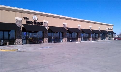
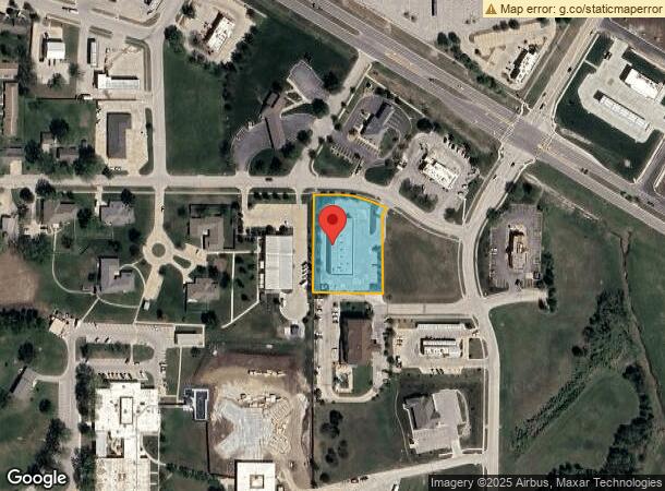
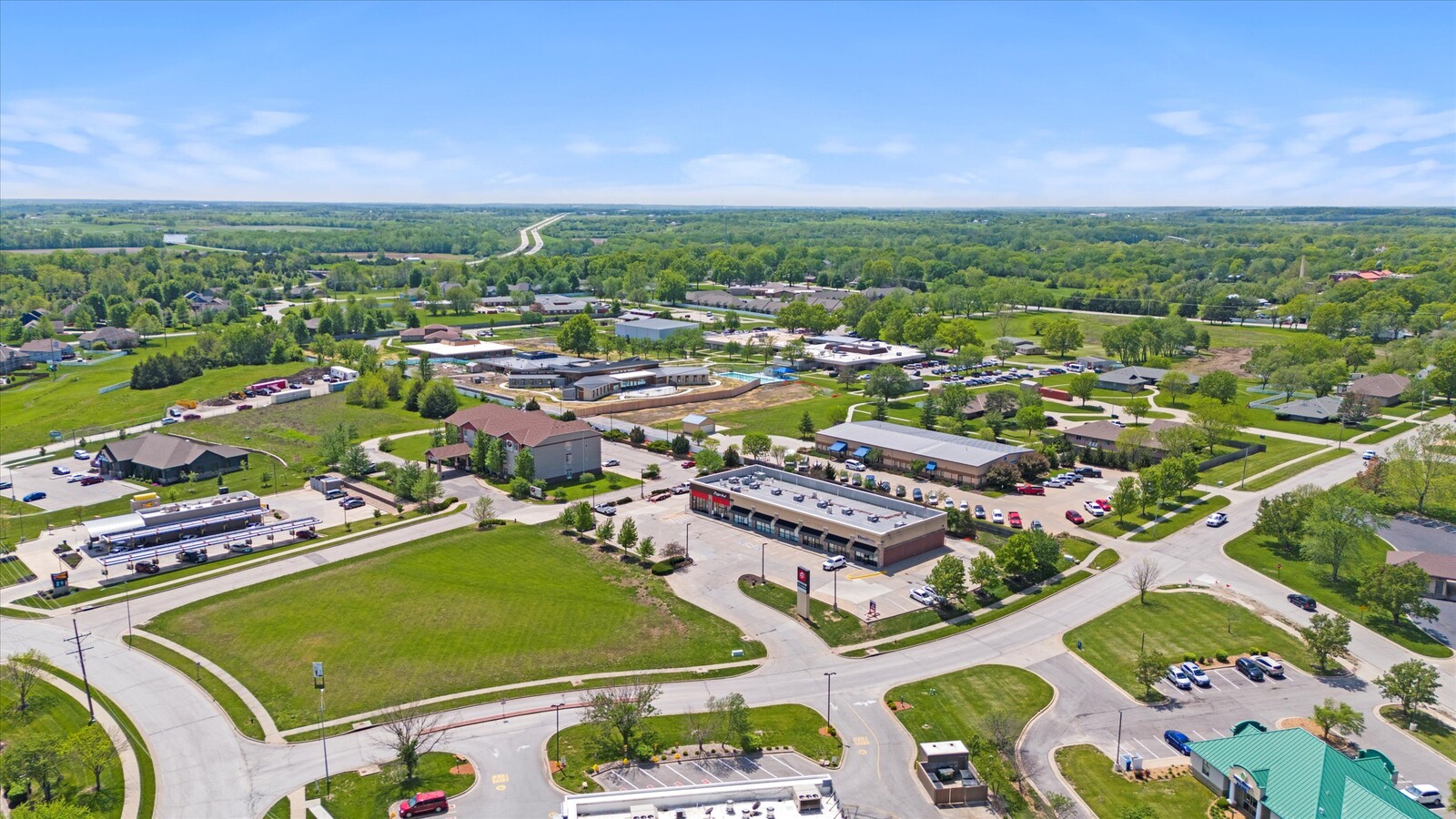
1601 E Peoria St, Paola, KS 66071
NEARBY LISTINGS FOR SALE OR LEASE
Property Detail
1601 E Peoria St
135-15-0-30-01-002.01-0
Paola Business Park #2 Lots 7,8,9
Stripcommercialcenter
PAOLA BUSINESS PARK #2, ACRES 1.2, TR BEG NW/C PARCEL 9 PAOLA BUSINESS PARK #2 TH E67.5 SELY141 SWLY25 S223.4 W192.8 N278.7
X
Miami
20121C0178D
Kansas
2023
1.20 AC
2024
Outer South Kansas City
100601
Kansas City
9,600 SF
Kansas City, MO-KS
DEMOGRAPHICS near 1601 E Peoria St
1 Mile
3 Mile
5 Mile
2024 Total Population
3,217
7,033
8,603
2029 Population
3,346
7,334
8,961
Pop Growth 2024-2029
+ 4.01%
+ 4.28%
+ 4.16%
Average Age
41
41
42
2024 Total Households
1,321
2,881
3,500
HH Growth 2024-2029
+ 4.01%
+ 4.30%
+ 4.23%
Median Household Inc
$60,820
$71,165
$73,789
Avg Household Size
2.30
2.30
2.30
2024 Avg HH Vehicles
2.00
2.00
2.00
Median Home Value
$174,441
$198,140
$221,890
Median Year Built
1965
1969
1972
Nearby Places
- Restaurants
- Banks
- Shops
- Fitness
- Groceries
SALE & LEASE HISTORY
LISTING DATE
SALE/LEASE

Sep 24, 2016
For Sale
Mar 31, 2017
For Sale
Mar 23, 2018
For Lease
Jun 09, 2020
For Sale
Jan 26, 2023
For Sale
Aug 30, 2022
For Sale
Nearby Properties
Address
Land Use
TOTAL SIZE
Lot Size
Zoning
Address
Land Use
TOTAL SIZE
Lot Size
Zoning
45,759 SF
63.69 AC
Address
Land Use
TOTAL SIZE
Lot Size
Zoning
29,348 SF
0.81 AC
Address
Land Use
TOTAL SIZE
Lot Size
Zoning
52,836 SF
7.26 AC
Address
Land Use
TOTAL SIZE
Lot Size
Zoning
11,250 SF
30.50 AC
Address
Land Use
TOTAL SIZE
Lot Size
Zoning
64,224 SF
37.95 AC
Address
Land Use
TOTAL SIZE
Lot Size
Zoning
27,400 SF
0.77 AC
Address
Land Use
TOTAL SIZE
Lot Size
Zoning
29,054 SF
18.25 AC
Address
Land Use
TOTAL SIZE
Lot Size
Zoning
26,316 SF
6.15 AC
Address
Land Use
TOTAL SIZE
Lot Size
Zoning
8,424 SF
1.86 AC
Address
Land Use
TOTAL SIZE
Lot Size
Zoning
37,296 SF
1.74 AC
Address
Land Use
TOTAL SIZE
Lot Size
Zoning
7,200 SF
15.23 AC
PGA
Address
Land Use
TOTAL SIZE
Lot Size
Zoning
17,264 SF
2.25 AC
Address
Land Use
TOTAL SIZE
Lot Size
Zoning
2,248 SF
0.27 AC
Address
Land Use
TOTAL SIZE
Lot Size
Zoning
145,188 SF
18.23 AC
Address
Land Use
TOTAL SIZE
Lot Size
Zoning
23,563 SF
5.25 AC
Address
Land Use
TOTAL SIZE
Lot Size
Zoning
8,791 SF
0.13 AC
Address
Land Use
TOTAL SIZE
Lot Size
Zoning
25,784 SF
1.73 AC
Address
Land Use
TOTAL SIZE
Lot Size
Zoning
16,780 SF
8.17 AC
Address
Land Use
TOTAL SIZE
Lot Size
Zoning
25,048 SF
4.88 AC
Address
Land Use
TOTAL SIZE
Lot Size
Zoning
684 SF
18.52 AC
PGA
Address
Land Use
TOTAL SIZE
Lot Size
Zoning
3,532 SF
2.96 AC
Address
Land Use
TOTAL SIZE
Lot Size
Zoning
2,400 SF
2.91 AC
Address
Land Use
TOTAL SIZE
Lot Size
Zoning
3,220 SF
0.64 AC
Address
Land Use
TOTAL SIZE
Lot Size
Zoning
89,440 SF
40.97 AC
PGA
Address
Land Use
TOTAL SIZE
Lot Size
Zoning
175.46 AC
Address
Land Use
TOTAL SIZE
Lot Size
Zoning
14,828 SF
8.93 AC
Address
Land Use
TOTAL SIZE
Lot Size
Zoning
13,552 SF
4.50 AC
PGA
Address
Land Use
TOTAL SIZE
Lot Size
Zoning
6,606 SF
9.80 AC
Address
Land Use
TOTAL SIZE
Lot Size
Zoning
15,000 SF
4.27 AC
Address
Land Use
TOTAL SIZE
Lot Size
Zoning
5,992 SF
0.70 AC
The World's #1 Commercial Real Estate Marketplace
Connect with us
© 2025 CoStar Group
The information above has been obtained from sources believed reliable. While we do not doubt its accuracy we have not verified it and make no guarantee, warranty or representation about it. It is your responsibility to independently confirm its accuracy and completeness. Any projections, opinions, assumptions, or estimates used are for example only and do not represent the current or future performance of the property. The value of this transaction to you depends on tax and other factors which should be evaluated by your tax, financial, and legal advisors. You and your advisors should conduct a careful, independent investigation of the property to determine to your satisfaction the suitability of the property for your needs.