Property Record
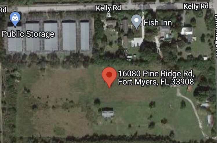
16080 Pine Ridge Rd, Fort Myers, FL 33908

NEARBY LISTINGS FOR SALE OR LEASE
Property Detail
16080 Pine Ridge Rd
Cape Coral-Fort Myers, FL
Bates Pine Ridge Trk Farms
06-46-24-01-00009.0010
BATES PINE RIDGE TRK FARMS BLK2 PB3PG68PT OF LT2+N1/2 LT 3 LES R/W+OR1888/1270
Pasture
Lee
AE
Florida
12071C0418G
2,3
2023
7.24 AC
2024
S Ft Myers/San Carlos
001916
Southwest Florida
3,312 SF
DEMOGRAPHICS near 16080 Pine Ridge Rd
1 Mile
3 Mile
5 Mile
2024 Total Population
8,774
49,415
110,165
2029 Population
10,601
59,172
131,872
Pop Growth 2024-2029
+ 20.82%
+ 19.75%
+ 19.70%
Average Age
52
56
55
2024 Total Households
4,428
24,681
55,449
HH Growth 2024-2029
+ 20.82%
+ 19.53%
+ 19.39%
Median Household Inc
$49,366
$62,464
$61,688
Avg Household Size
1.90
1.90
1.90
2024 Avg HH Vehicles
1.00
1.00
1.00
Median Home Value
$201,690
$286,422
$296,712
Median Year Built
1999
1995
1988
Nearby Places
- Restaurants
- Banks
- Shops
- Fitness
- Groceries
PUBLIC TRANSPORTATION
AIRPORT
Southwest Florida International
DRIVE
WALK
Distance
Southwest Florida International
25 min
14.0 mi
Punta Gorda
DRIVE
WALK
Distance
Punta Gorda
54 min
40.2 mi
Freight Ports
Port Manatee
DRIVE
WALK
Distance
Port Manatee
133 min
111.9 mi
SALE & LEASE HISTORY
LISTING DATE
SALE/LEASE

May 11, 2023
For Sale
Mar 14, 2022
For Sale
Nearby Properties
Address
Land Use
TOTAL SIZE
Lot Size
Zoning
Address
Land Use
TOTAL SIZE
Lot Size
Zoning
1,116,051 SF
35.44 AC
CPD
Address
Land Use
TOTAL SIZE
Lot Size
Zoning
Address
Land Use
TOTAL SIZE
Lot Size
Zoning
446,205 SF
28.90 AC
CC
Address
Land Use
TOTAL SIZE
Lot Size
Zoning
564,663 SF
33.53 AC
CPD
Address
Land Use
TOTAL SIZE
Lot Size
Zoning
334,148 SF
48.67 AC
RM-2
Address
Land Use
TOTAL SIZE
Lot Size
Zoning
335,660 SF
15.42 AC
MPD
Address
Land Use
TOTAL SIZE
Lot Size
Zoning
423,044 SF
37.11 AC
C-1
Address
Land Use
TOTAL SIZE
Lot Size
Zoning
209,483 SF
15.03 AC
CF-2
Address
Land Use
TOTAL SIZE
Lot Size
Zoning
153,907 SF
22.03 AC
TFC2
Address
Land Use
TOTAL SIZE
Lot Size
Zoning
96,448 SF
3.85 AC
CPD
Address
Land Use
TOTAL SIZE
Lot Size
Zoning
235,691 SF
30.01 AC
RM-6
Address
Land Use
TOTAL SIZE
Lot Size
Zoning
65,051 SF
4.89 AC
CFPD
Address
Land Use
TOTAL SIZE
Lot Size
Zoning
44.05 AC
RPD
Address
Land Use
TOTAL SIZE
Lot Size
Zoning
469,746 SF
89.44 AC
RPD
Address
Land Use
TOTAL SIZE
Lot Size
Zoning
301,212 SF
5.28 AC
Address
Land Use
TOTAL SIZE
Lot Size
Zoning
15.22 AC
CF-3
Address
Land Use
TOTAL SIZE
Lot Size
Zoning
89,321 SF
11.40 AC
CPD
Address
Land Use
TOTAL SIZE
Lot Size
Zoning
26,337 SF
11.54 AC
C-1
Address
Land Use
TOTAL SIZE
Lot Size
Zoning
120,368 SF
3.52 AC
CPD
Address
Land Use
TOTAL SIZE
Lot Size
Zoning
163,409 SF
15.13 AC
CG
Address
Land Use
TOTAL SIZE
Lot Size
Zoning
82,450 SF
4.11 AC
CPD
Address
Land Use
TOTAL SIZE
Lot Size
Zoning
87,275 SF
10.79 AC
CPD
Address
Land Use
TOTAL SIZE
Lot Size
Zoning
38,928 SF
4.88 AC
CT
Address
Land Use
TOTAL SIZE
Lot Size
Zoning
85,815 SF
3.48 AC
CT
Address
Land Use
TOTAL SIZE
Lot Size
Zoning
132,456 SF
7.86 AC
IPD
Address
Land Use
TOTAL SIZE
Lot Size
Zoning
6,910 SF
7.37 AC
AG-2
Address
Land Use
TOTAL SIZE
Lot Size
Zoning
84,147 SF
10.60 AC
CPD
Address
Land Use
TOTAL SIZE
Lot Size
Zoning
34,157 SF
2.54 AC
CPD
Address
Land Use
TOTAL SIZE
Lot Size
Zoning
102,031 SF
4.01 AC
MPD
Address
Land Use
TOTAL SIZE
Lot Size
Zoning
185,986 SF
13.40 AC
CPD
The World's #1 Commercial Real Estate Marketplace
Connect with us
© 2025 CoStar Group
The information above has been obtained from sources believed reliable. While we do not doubt its accuracy we have not verified it and make no guarantee, warranty or representation about it. It is your responsibility to independently confirm its accuracy and completeness. Any projections, opinions, assumptions, or estimates used are for example only and do not represent the current or future performance of the property. The value of this transaction to you depends on tax and other factors which should be evaluated by your tax, financial, and legal advisors. You and your advisors should conduct a careful, independent investigation of the property to determine to your satisfaction the suitability of the property for your needs.