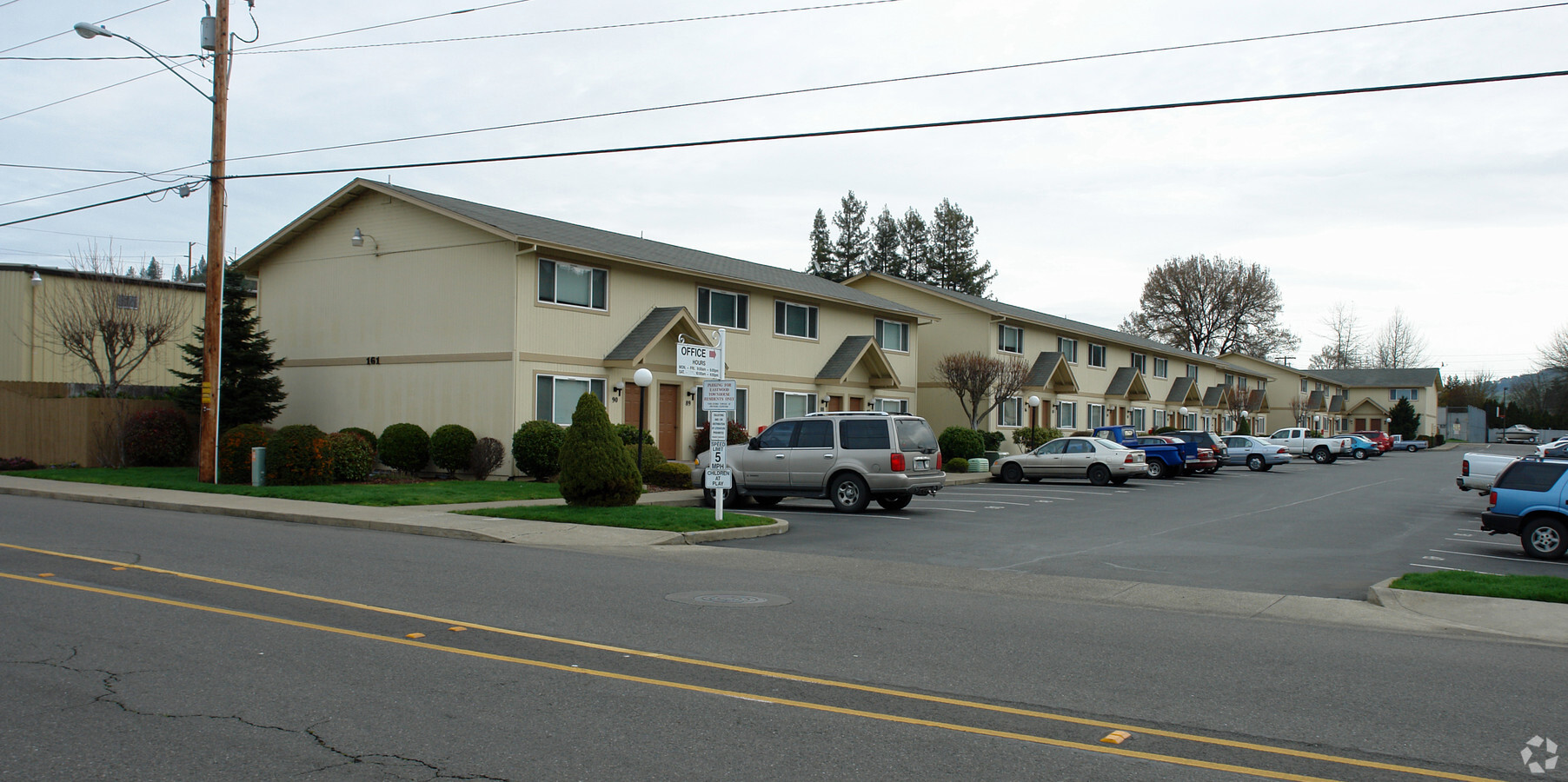
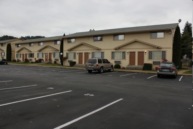
Property Record
161 Ne Rifle Range St, Roseburg, OR 97470
NEARBY LISTINGS FOR SALE OR LEASE
-
-
View all Roseburg listings for sale on LoopNet.com
Property Detail
161 Ne Rifle Range St
R40844
Land Partition 2005-0058
Multifamilydwelling
P.P. 2005-58, PARCEL 1, ACRES 1.73
X
Douglas
41019C1729F
Oregon
2024
22
2024
1.73 AC
120001
Other Market Areas
44,704 SF
Roseburg, OR
DEMOGRAPHICS near 161 Ne Rifle Range St
1 Mile
3 Mile
5 Mile
2024 Total Population
4,288
21,756
38,730
2029 Population
4,600
22,873
40,389
Pop Growth 2024-2029
+ 7.28%
+ 5.13%
+ 4.28%
Average Age
40
42
44
2024 Total Households
1,762
9,295
16,292
HH Growth 2024-2029
+ 7.49%
+ 5.21%
+ 4.35%
Median Household Inc
$39,958
$42,611
$47,328
Avg Household Size
2.30
2.20
2.30
2024 Avg HH Vehicles
2.00
2.00
2.00
Median Home Value
$234,069
$240,793
$258,415
Median Year Built
1975
1972
1978
Nearby Places
- Restaurants
- Banks
- Shops
- Fitness
- Groceries
Nearby Properties
Address
Land Use
TOTAL SIZE
Lot Size
Zoning
Address
Land Use
TOTAL SIZE
Lot Size
Zoning
149.62 AC
PR
Address
Land Use
TOTAL SIZE
Lot Size
Zoning
1,000 SF
18.99 AC
PR
Address
Land Use
TOTAL SIZE
Lot Size
Zoning
239,143 SF
6.29 AC
PR
Address
Land Use
TOTAL SIZE
Lot Size
Zoning
102.28 AC
AP
Address
Land Use
TOTAL SIZE
Lot Size
Zoning
63.52 AC
PR
Address
Land Use
TOTAL SIZE
Lot Size
Zoning
145,644 SF
9.08 AC
MU
Address
Land Use
TOTAL SIZE
Lot Size
Zoning
86,285 SF
4.91 AC
C3
Address
Land Use
TOTAL SIZE
Lot Size
Zoning
152,625 SF
20.21 AC
C3
Address
Land Use
TOTAL SIZE
Lot Size
Zoning
90,785 SF
2.76 AC
PR
Address
Land Use
TOTAL SIZE
Lot Size
Zoning
1,713 SF
7 AC
MU
Address
Land Use
TOTAL SIZE
Lot Size
Zoning
230,093 SF
17.80 AC
C3
Address
Land Use
TOTAL SIZE
Lot Size
Zoning
82,532 SF
2.43 AC
C3
Address
Land Use
TOTAL SIZE
Lot Size
Zoning
115,574 SF
4.32 AC
C3
Address
Land Use
TOTAL SIZE
Lot Size
Zoning
43,384 SF
9.16 AC
PR
Address
Land Use
TOTAL SIZE
Lot Size
Zoning
115,934 SF
3.48 AC
MR29
Address
Land Use
TOTAL SIZE
Lot Size
Zoning
2.11 AC
MU
Address
Land Use
TOTAL SIZE
Lot Size
Zoning
13.73 AC
M2
Address
Land Use
TOTAL SIZE
Lot Size
Zoning
4.76 AC
PR
Address
Land Use
TOTAL SIZE
Lot Size
Zoning
89,208 SF
5.01 AC
MU
Address
Land Use
TOTAL SIZE
Lot Size
Zoning
68,135 SF
8.13 AC
C3
Address
Land Use
TOTAL SIZE
Lot Size
Zoning
37,755 SF
2.80 AC
C3
Address
Land Use
TOTAL SIZE
Lot Size
Zoning
41,353 SF
4.18 AC
C3
Address
Land Use
TOTAL SIZE
Lot Size
Zoning
129,644 SF
4.85 AC
MU
Address
Land Use
TOTAL SIZE
Lot Size
Zoning
2.55 AC
M2
Address
Land Use
TOTAL SIZE
Lot Size
Zoning
57,685 SF
5.34 AC
C3
Address
Land Use
TOTAL SIZE
Lot Size
Zoning
21,852 SF
2.70 AC
C3
Address
Land Use
TOTAL SIZE
Lot Size
Zoning
42,900 SF
5.11 AC
MU
Address
Land Use
TOTAL SIZE
Lot Size
Zoning
23,996 SF
2.23 AC
C3
Address
Land Use
TOTAL SIZE
Lot Size
Zoning
1,000 SF
26.34 AC
PR
Address
Land Use
TOTAL SIZE
Lot Size
Zoning
70,897 SF
4.32 AC
C3
The World's #1 Commercial Real Estate Marketplace
Connect with us
© 2025 CoStar Group
The information above has been obtained from sources believed reliable. While we do not doubt its accuracy we have not verified it and make no guarantee, warranty or representation about it. It is your responsibility to independently confirm its accuracy and completeness. Any projections, opinions, assumptions, or estimates used are for example only and do not represent the current or future performance of the property. The value of this transaction to you depends on tax and other factors which should be evaluated by your tax, financial, and legal advisors. You and your advisors should conduct a careful, independent investigation of the property to determine to your satisfaction the suitability of the property for your needs.