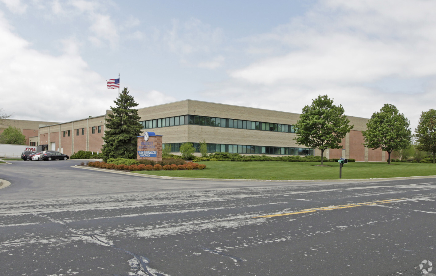
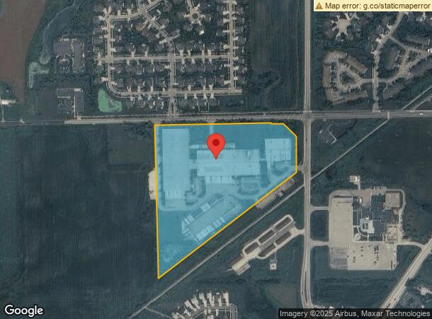
Property Record
1611 S Sunset Rd, Port Washington, WI 53074


NEARBY LISTINGS FOR SALE OR LEASE
-
-
View all Port Washington listings for sale on LoopNet.com
Property Detail
1611 S Sunset Rd
Milwaukee-Waukesha-West Allis, WI
0852154 PART NE SE 21.09 ACS COMM 243 FT W & 40 FT S OF NE COR BEING #3071 CSM LOT 1 VOL 21/389 SEC 31 T 11 R 22
160311300500
Ozaukee
Industrialgeneral
Wisconsin
X
1
55089C0182G
21.09 AC
2024
North Ozaukee
2024
Milwaukee/Madison
630202
DEMOGRAPHICS near 1611 S Sunset Rd
1 Mile
3 Mile
5 Mile
2024 Total Population
5,567
20,792
32,750
2029 Population
5,936
21,995
34,582
Pop Growth 2024-2029
+ 6.63%
+ 5.79%
+ 5.59%
Average Age
40
42
42
2024 Total Households
2,274
8,729
13,776
HH Growth 2024-2029
+ 6.73%
+ 5.80%
+ 5.59%
Median Household Inc
$65,083
$69,620
$73,778
Avg Household Size
2.30
2.30
2.30
2024 Avg HH Vehicles
2.00
2.00
2.00
Median Home Value
$286,339
$270,533
$283,343
Median Year Built
1985
1974
1975
Nearby Places
- Restaurants
- Banks
- Shops
- Fitness
- Groceries
PUBLIC TRANSPORTATION
AIRPORT
General Mitchell International
DRIVE
WALK
Distance
General Mitchell International
45 min
31.6 mi
Freight Ports
Port Milwaukee
DRIVE
WALK
Distance
Port Milwaukee
37 min
27.4 mi
Nearby Properties
Address
Land Use
TOTAL SIZE
Lot Size
Zoning
Address
Land Use
TOTAL SIZE
Lot Size
Zoning
23.51 AC
Address
Land Use
TOTAL SIZE
Lot Size
Zoning
Address
Land Use
TOTAL SIZE
Lot Size
Zoning
Address
Land Use
TOTAL SIZE
Lot Size
Zoning
8.08 AC
Address
Land Use
TOTAL SIZE
Lot Size
Zoning
Address
Land Use
TOTAL SIZE
Lot Size
Zoning
27.63 AC
Address
Land Use
TOTAL SIZE
Lot Size
Zoning
10.28 AC
Address
Land Use
TOTAL SIZE
Lot Size
Zoning
8.34 AC
Address
Land Use
TOTAL SIZE
Lot Size
Zoning
Address
Land Use
TOTAL SIZE
Lot Size
Zoning
Address
Land Use
TOTAL SIZE
Lot Size
Zoning
Address
Land Use
TOTAL SIZE
Lot Size
Zoning
Address
Land Use
TOTAL SIZE
Lot Size
Zoning
Address
Land Use
TOTAL SIZE
Lot Size
Zoning
10.26 AC
Address
Land Use
TOTAL SIZE
Lot Size
Zoning
Address
Land Use
TOTAL SIZE
Lot Size
Zoning
Address
Land Use
TOTAL SIZE
Lot Size
Zoning
Address
Land Use
TOTAL SIZE
Lot Size
Zoning
24.24 AC
Address
Land Use
TOTAL SIZE
Lot Size
Zoning
Address
Land Use
TOTAL SIZE
Lot Size
Zoning
Address
Land Use
TOTAL SIZE
Lot Size
Zoning
Address
Land Use
TOTAL SIZE
Lot Size
Zoning
Address
Land Use
TOTAL SIZE
Lot Size
Zoning
Address
Land Use
TOTAL SIZE
Lot Size
Zoning
15.24 AC
Address
Land Use
TOTAL SIZE
Lot Size
Zoning
Address
Land Use
TOTAL SIZE
Lot Size
Zoning
3.62 AC
Address
Land Use
TOTAL SIZE
Lot Size
Zoning
Address
Land Use
TOTAL SIZE
Lot Size
Zoning
Address
Land Use
TOTAL SIZE
Lot Size
Zoning
The World's #1 Commercial Real Estate Marketplace
Connect with us
© 2025 CoStar Group
The information above has been obtained from sources believed reliable. While we do not doubt its accuracy we have not verified it and make no guarantee, warranty or representation about it. It is your responsibility to independently confirm its accuracy and completeness. Any projections, opinions, assumptions, or estimates used are for example only and do not represent the current or future performance of the property. The value of this transaction to you depends on tax and other factors which should be evaluated by your tax, financial, and legal advisors. You and your advisors should conduct a careful, independent investigation of the property to determine to your satisfaction the suitability of the property for your needs.