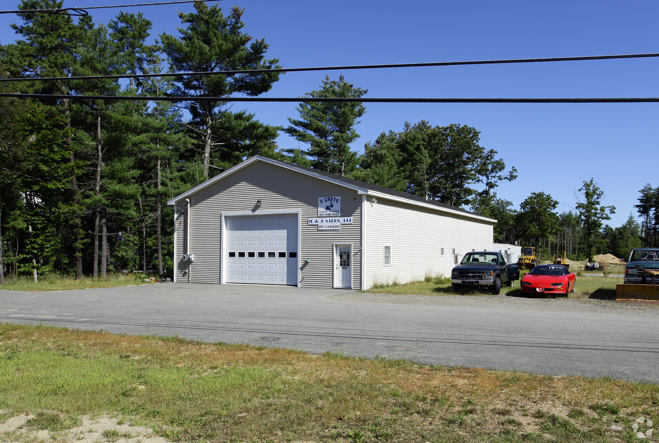
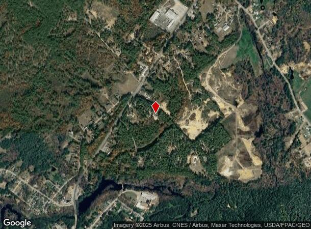
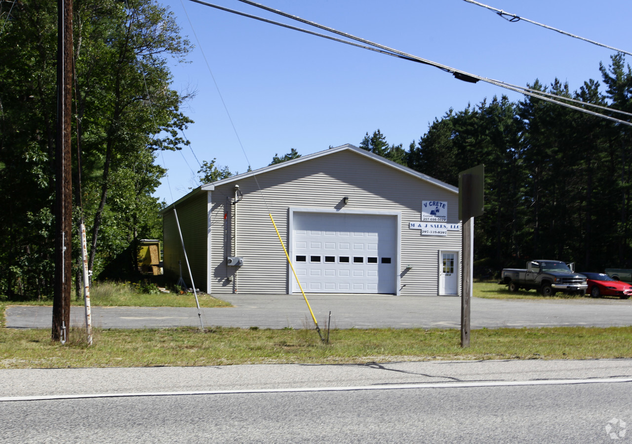
Property Record
1618 Carl Broggi Hwy, Lebanon, ME 04027
NEARBY LISTINGS FOR SALE OR LEASE
Property Detail
1618 Carl Broggi Hwy
Portland-South Portland, ME
York
LBNN-000002U-000000-000021-A000000
Maine
Commercialbuilding
21-a
2024
6.70 AC
2024
York County
031000
Portland/South Portland
DEMOGRAPHICS near 1618 Carl Broggi Hwy
1 Mile
3 Mile
5 Mile
2024 Total Population
1,768
11,817
32,569
2029 Population
1,830
12,344
34,006
Pop Growth 2024-2029
+ 3.51%
+ 4.46%
+ 4.41%
Average Age
40
43
43
2024 Total Households
705
4,934
13,526
HH Growth 2024-2029
+ 3.55%
+ 4.46%
+ 4.47%
Median Household Inc
$76,434
$80,184
$81,656
Avg Household Size
2.50
2.40
2.30
2024 Avg HH Vehicles
2.00
2.00
2.00
Median Home Value
$241,422
$226,603
$246,132
Median Year Built
1979
1981
1977
Nearby Places
- Restaurants
- Banks
- Shops
- Fitness
- Groceries
PUBLIC TRANSPORTATION
AIRPORT
Portsmouth International at Pease
DRIVE
WALK
Distance
Portsmouth International at Pease
39 min
23.1 mi
Freight Ports
Portland, ME
DRIVE
WALK
Distance
Portland, ME
63 min
46.5 mi
Nearby Properties
Address
Land Use
TOTAL SIZE
Lot Size
Zoning
Address
Land Use
TOTAL SIZE
Lot Size
Zoning
53,517 SF
30 AC
A
Address
Land Use
TOTAL SIZE
Lot Size
Zoning
111,807 SF
31.93 AC
HC
Address
Land Use
TOTAL SIZE
Lot Size
Zoning
221,995 SF
35.47 AC
IND
Address
Land Use
TOTAL SIZE
Lot Size
Zoning
44,272 SF
27 AC
A
Address
Land Use
TOTAL SIZE
Lot Size
Zoning
10,172 SF
92.55 AC
A
Address
Land Use
TOTAL SIZE
Lot Size
Zoning
236,340 SF
27.34 AC
HC
Address
Land Use
TOTAL SIZE
Lot Size
Zoning
30 AC
RA
Address
Land Use
TOTAL SIZE
Lot Size
Zoning
65,452 SF
8.87 AC
HC
Address
Land Use
TOTAL SIZE
Lot Size
Zoning
68,535 SF
7.10 AC
R2
Address
Land Use
TOTAL SIZE
Lot Size
Zoning
87.64 AC
A
Address
Land Use
TOTAL SIZE
Lot Size
Zoning
51,968 SF
5.40 AC
R2
Address
Land Use
TOTAL SIZE
Lot Size
Zoning
58,500 SF
11.55 AC
R2
Address
Land Use
TOTAL SIZE
Lot Size
Zoning
1,968 SF
53 AC
RA
Address
Land Use
TOTAL SIZE
Lot Size
Zoning
114,452 SF
5.81 AC
NMU
Address
Land Use
TOTAL SIZE
Lot Size
Zoning
19,000 SF
3.50 AC
R2
Address
Land Use
TOTAL SIZE
Lot Size
Zoning
1,288 SF
72 AC
A
Address
Land Use
TOTAL SIZE
Lot Size
Zoning
40,577 SF
5.40 AC
R1
Address
Land Use
TOTAL SIZE
Lot Size
Zoning
17,355 SF
2.60 AC
R2
Address
Land Use
TOTAL SIZE
Lot Size
Zoning
32 AC
RA
Address
Land Use
TOTAL SIZE
Lot Size
Zoning
74.59 AC
A
Address
Land Use
TOTAL SIZE
Lot Size
Zoning
34 AC
A
Address
Land Use
TOTAL SIZE
Lot Size
Zoning
37,884 SF
3.49 AC
R2
Address
Land Use
TOTAL SIZE
Lot Size
Zoning
23,344 SF
5.30 AC
NMU
Address
Land Use
TOTAL SIZE
Lot Size
Zoning
16,080 SF
6.41 AC
IND
Address
Land Use
TOTAL SIZE
Lot Size
Zoning
516 SF
23.09 AC
IND
Address
Land Use
TOTAL SIZE
Lot Size
Zoning
14,576 SF
1.96 AC
HC
Address
Land Use
TOTAL SIZE
Lot Size
Zoning
3,703 SF
15.60 AC
A
Address
Land Use
TOTAL SIZE
Lot Size
Zoning
14,690 SF
10.30 AC
IND
Address
Land Use
TOTAL SIZE
Lot Size
Zoning
9,058 SF
3.40 AC
R2
Address
Land Use
TOTAL SIZE
Lot Size
Zoning
15.40 AC
RA
The World's #1 Commercial Real Estate Marketplace
Connect with us
© 2025 CoStar Group
The information above has been obtained from sources believed reliable. While we do not doubt its accuracy we have not verified it and make no guarantee, warranty or representation about it. It is your responsibility to independently confirm its accuracy and completeness. Any projections, opinions, assumptions, or estimates used are for example only and do not represent the current or future performance of the property. The value of this transaction to you depends on tax and other factors which should be evaluated by your tax, financial, and legal advisors. You and your advisors should conduct a careful, independent investigation of the property to determine to your satisfaction the suitability of the property for your needs.