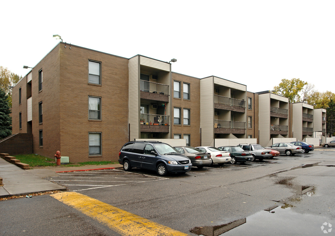
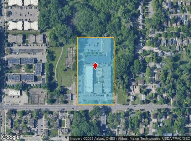
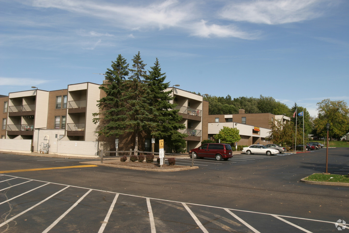
Property Record
1619 Maryland Ave E, Saint Paul, MN 55106
NEARBY LISTINGS FOR SALE OR LEASE
Property Detail
1619 Maryland Ave E
22-29-22-43-0047
Section 22 Town 29 Range 22
Apartment
SECTION 22 TOWN 29 RANGE 22 EX E 295 16/100 FT THE SE 1/4 OF SW 1/4 ...AND ST) IN SEC 22 TN 29 RN 22
X
Ramsey
27037C0050E
Minnesota
2024
4.42 AC
2023
Prosperity Heights
0307043004
Minneapolis/St Paul
4,759 SF
Minneapolis-St. Paul-Bloomington, MN-WI
DEMOGRAPHICS near 1619 Maryland Ave E
1 Mile
3 Mile
5 Mile
2024 Total Population
24,080
130,472
286,562
2029 Population
23,260
126,691
282,457
Pop Growth 2024-2029
(3.41%)
(2.90%)
(1.43%)
Average Age
33
35
37
2024 Total Households
7,628
44,302
107,629
HH Growth 2024-2029
(3.72%)
(2.97%)
(1.34%)
Median Household Inc
$60,542
$62,532
$64,915
Avg Household Size
3.00
2.80
2.50
2024 Avg HH Vehicles
2.00
2.00
2.00
Median Home Value
$193,081
$226,375
$251,023
Median Year Built
1958
1962
1969
Nearby Places
- Restaurants
- Banks
- Shops
- Fitness
- Groceries
PUBLIC TRANSPORTATION
COMMUTER RAIL
St. Paul-Minneapolis (Empire Builder - Amtrak)
DRIVE
WALK
Distance
St. Paul-Minneapolis (Empire Builder - Amtrak)
8 min
4.0 mi
AIRPORT
Minneapolis-St Paul International/Wold-Chamberlain
DRIVE
WALK
Distance
Minneapolis-St Paul International/Wold-Chamberlain
23 min
13.5 mi
Freight Ports
Port Milwaukee
DRIVE
WALK
Distance
Port Milwaukee
361 min
327.8 mi
Nearby Properties
Address
Land Use
TOTAL SIZE
Lot Size
Zoning
Address
Land Use
TOTAL SIZE
Lot Size
Zoning
267,948 SF
372.92 AC
Address
Land Use
TOTAL SIZE
Lot Size
Zoning
160,800 SF
5.05 AC
Address
Land Use
TOTAL SIZE
Lot Size
Zoning
460,439 SF
25.26 AC
Address
Land Use
TOTAL SIZE
Lot Size
Zoning
47,670 SF
179 AC
Address
Land Use
TOTAL SIZE
Lot Size
Zoning
273,937 SF
16.75 AC
Address
Land Use
TOTAL SIZE
Lot Size
Zoning
3,080 SF
9.37 AC
Address
Land Use
TOTAL SIZE
Lot Size
Zoning
53,851 SF
22.74 AC
Address
Land Use
TOTAL SIZE
Lot Size
Zoning
311,332 SF
36.34 AC
Address
Land Use
TOTAL SIZE
Lot Size
Zoning
13.10 AC
Address
Land Use
TOTAL SIZE
Lot Size
Zoning
246,000 SF
31.03 AC
Address
Land Use
TOTAL SIZE
Lot Size
Zoning
3.91 AC
Address
Land Use
TOTAL SIZE
Lot Size
Zoning
138,407 SF
15.67 AC
Address
Land Use
TOTAL SIZE
Lot Size
Zoning
256,440 SF
27.44 AC
Address
Land Use
TOTAL SIZE
Lot Size
Zoning
64,563 SF
1.05 AC
Address
Land Use
TOTAL SIZE
Lot Size
Zoning
96,587 SF
17.42 AC
Address
Land Use
TOTAL SIZE
Lot Size
Zoning
Address
Land Use
TOTAL SIZE
Lot Size
Zoning
222,374 SF
43.99 AC
Address
Land Use
TOTAL SIZE
Lot Size
Zoning
371,200 SF
8.99 AC
Address
Land Use
TOTAL SIZE
Lot Size
Zoning
129,854 SF
5.08 AC
Address
Land Use
TOTAL SIZE
Lot Size
Zoning
49,691 SF
10.94 AC
Address
Land Use
TOTAL SIZE
Lot Size
Zoning
190,062 SF
6.99 AC
Address
Land Use
TOTAL SIZE
Lot Size
Zoning
129,290 SF
5.13 AC
Address
Land Use
TOTAL SIZE
Lot Size
Zoning
297,750 SF
11.54 AC
Address
Land Use
TOTAL SIZE
Lot Size
Zoning
192,600 SF
11 AC
Address
Land Use
TOTAL SIZE
Lot Size
Zoning
63,354 SF
7.27 AC
Address
Land Use
TOTAL SIZE
Lot Size
Zoning
63,354 SF
10.37 AC
Address
Land Use
TOTAL SIZE
Lot Size
Zoning
221,625 SF
3.94 AC
Address
Land Use
TOTAL SIZE
Lot Size
Zoning
1,344 SF
14.08 AC
Address
Land Use
TOTAL SIZE
Lot Size
Zoning
118,442 SF
12.83 AC
Address
Land Use
TOTAL SIZE
Lot Size
Zoning
11,328 SF
6.86 AC
The World's #1 Commercial Real Estate Marketplace
Connect with us
© 2025 CoStar Group
The information above has been obtained from sources believed reliable. While we do not doubt its accuracy we have not verified it and make no guarantee, warranty or representation about it. It is your responsibility to independently confirm its accuracy and completeness. Any projections, opinions, assumptions, or estimates used are for example only and do not represent the current or future performance of the property. The value of this transaction to you depends on tax and other factors which should be evaluated by your tax, financial, and legal advisors. You and your advisors should conduct a careful, independent investigation of the property to determine to your satisfaction the suitability of the property for your needs.