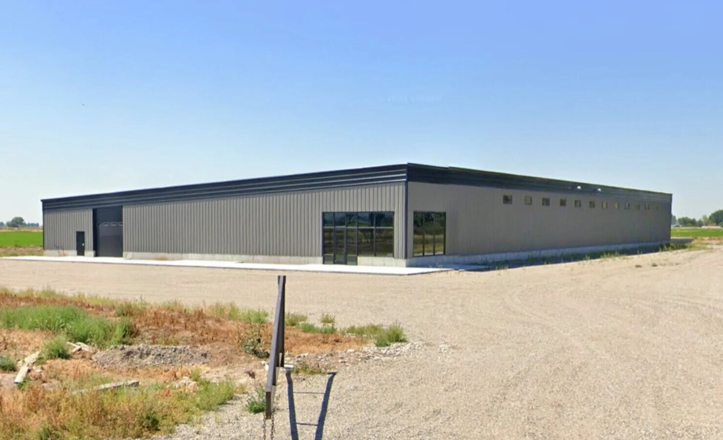
Property Record
162 N Yellowstone Hwy, Idaho Falls, ID 83401

NEARBY LISTINGS FOR SALE OR LEASE
Property Detail
162 N Yellowstone Hwy
Idaho Falls, ID
5.000 A NE1/4 NE1/4, SEC 22, T 3N, R 38
RP03N38E220050
Bonneville
Farms
Idaho
2024
5 AC
2024
Idaho South Area
970405
Other Market Areas
DEMOGRAPHICS near 162 N Yellowstone Hwy
1 Mile
3 Mile
5 Mile
2024 Total Population
1,557
4,836
27,786
2029 Population
1,736
5,404
31,539
Pop Growth 2024-2029
+ 11.50%
+ 11.75%
+ 13.51%
Average Age
35
35
33
2024 Total Households
465
1,465
8,269
HH Growth 2024-2029
+ 11.40%
+ 11.60%
+ 13.39%
Median Household Inc
$91,005
$94,339
$88,087
Avg Household Size
3.30
3.30
3.30
2024 Avg HH Vehicles
3.00
3.00
3.00
Median Home Value
$364,583
$373,482
$364,188
Median Year Built
1988
1980
2002
Nearby Places
- Restaurants
- Banks
- Shops
- Fitness
- Groceries
PUBLIC TRANSPORTATION
AIRPORT
Idaho Falls Regional
DRIVE
WALK
Distance
Idaho Falls Regional
13 min
6.0 mi
Freight Ports
Port of Portland
DRIVE
WALK
Distance
Port of Portland
746 min
713.9 mi
SALE & LEASE HISTORY
LISTING DATE
SALE/LEASE

Apr 24, 2024
For Lease
Apr 24, 2024
For Sale
Nearby Properties
Address
Land Use
TOTAL SIZE
Lot Size
Zoning
Address
Land Use
TOTAL SIZE
Lot Size
Zoning
267,740 SF
45.91 AC
Address
Land Use
TOTAL SIZE
Lot Size
Zoning
3,189 SF
34,651.77 AC
Address
Land Use
TOTAL SIZE
Lot Size
Zoning
4,363 SF
13.28 AC
Address
Land Use
TOTAL SIZE
Lot Size
Zoning
10,324 SF
8.73 AC
Address
Land Use
TOTAL SIZE
Lot Size
Zoning
210,995 SF
24.15 AC
R2
Address
Land Use
TOTAL SIZE
Lot Size
Zoning
27,084 SF
3.69 AC
Address
Land Use
TOTAL SIZE
Lot Size
Zoning
179,244 SF
16.56 AC
Address
Land Use
TOTAL SIZE
Lot Size
Zoning
93,971 SF
9.38 AC
R2
Address
Land Use
TOTAL SIZE
Lot Size
Zoning
122,067 SF
10.50 AC
Address
Land Use
TOTAL SIZE
Lot Size
Zoning
216 SF
3.58 AC
Address
Land Use
TOTAL SIZE
Lot Size
Zoning
Address
Land Use
TOTAL SIZE
Lot Size
Zoning
1,573 SF
10.46 AC
Address
Land Use
TOTAL SIZE
Lot Size
Zoning
76,649 SF
3.96 AC
Address
Land Use
TOTAL SIZE
Lot Size
Zoning
96,146 SF
7.53 AC
R2
Address
Land Use
TOTAL SIZE
Lot Size
Zoning
163,776 SF
9.56 AC
R2
Address
Land Use
TOTAL SIZE
Lot Size
Zoning
3,219 SF
5.14 AC
R2
Address
Land Use
TOTAL SIZE
Lot Size
Zoning
69,900 SF
7.15 AC
Address
Land Use
TOTAL SIZE
Lot Size
Zoning
133,191 SF
12.69 AC
R2
Address
Land Use
TOTAL SIZE
Lot Size
Zoning
91,889 SF
11.68 AC
R2
Address
Land Use
TOTAL SIZE
Lot Size
Zoning
2,992 SF
4.96 AC
R2
Address
Land Use
TOTAL SIZE
Lot Size
Zoning
67,657 SF
4.08 AC
R2
Address
Land Use
TOTAL SIZE
Lot Size
Zoning
Address
Land Use
TOTAL SIZE
Lot Size
Zoning
111,308 SF
32.53 AC
R2
Address
Land Use
TOTAL SIZE
Lot Size
Zoning
80,772 SF
10.41 AC
R2
Address
Land Use
TOTAL SIZE
Lot Size
Zoning
55,291 SF
11.84 AC
Address
Land Use
TOTAL SIZE
Lot Size
Zoning
800 SF
14.06 AC
Address
Land Use
TOTAL SIZE
Lot Size
Zoning
39,528 SF
6.47 AC
R2
Address
Land Use
TOTAL SIZE
Lot Size
Zoning
2,456 SF
5.43 AC
Address
Land Use
TOTAL SIZE
Lot Size
Zoning
27,500 SF
5.50 AC
R2
Address
Land Use
TOTAL SIZE
Lot Size
Zoning
63,594 SF
3.92 AC
R2
The World's #1 Commercial Real Estate Marketplace
Connect with us
© 2025 CoStar Group
The information above has been obtained from sources believed reliable. While we do not doubt its accuracy we have not verified it and make no guarantee, warranty or representation about it. It is your responsibility to independently confirm its accuracy and completeness. Any projections, opinions, assumptions, or estimates used are for example only and do not represent the current or future performance of the property. The value of this transaction to you depends on tax and other factors which should be evaluated by your tax, financial, and legal advisors. You and your advisors should conduct a careful, independent investigation of the property to determine to your satisfaction the suitability of the property for your needs.