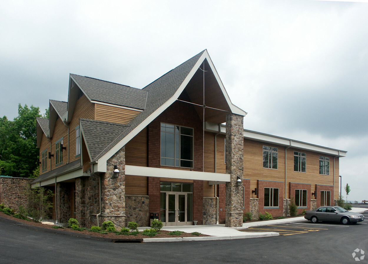
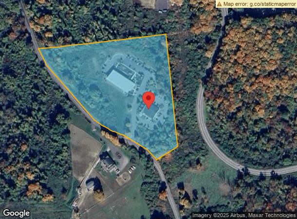
Property Record
162 Prospect Hill Rd, Brewster, NY 10509
NEARBY LISTINGS FOR SALE OR LEASE
Property Detail
162 Prospect Hill Rd
373089-056-000-0001-032-002-0000
Putnam
Officebuilding
New York
X
32.002
36079C0142E
8.80 AC
2023
Brewster
2023
Westchester/So Connecticut
011802
Dutchess County-Putnam County, NY
13,200 SF
DEMOGRAPHICS near 162 Prospect Hill Rd
1 Mile
3 Mile
5 Mile
2024 Total Population
1,687
21,549
42,801
2029 Population
1,693
21,617
42,915
Pop Growth 2024-2029
+ 0.36%
+ 0.32%
+ 0.27%
Average Age
42
43
43
2024 Total Households
603
8,125
15,853
HH Growth 2024-2029
+ 0.50%
+ 0.34%
+ 0.27%
Median Household Inc
$105,317
$89,545
$102,811
Avg Household Size
2.80
2.60
2.60
2024 Avg HH Vehicles
2.00
2.00
2.00
Median Home Value
$342,369
$377,756
$390,243
Median Year Built
1968
1975
1972
Nearby Places
- Restaurants
- Banks
- Shops
- Fitness
- Groceries
PUBLIC TRANSPORTATION
COMMUTER RAIL
Brewster Station (Harlem Line - Metro-North Commuter Railroad Company (Metro-North))
DRIVE
WALK
Distance
Brewster Station (Harlem Line - Metro-North Commuter Railroad Company (Metro-North))
4 min
1.9 mi
Southeast Station (Harlem Line - Metro-North Commuter Railroad Company (Metro-North))
DRIVE
WALK
Distance
Southeast Station (Harlem Line - Metro-North Commuter Railroad Company (Metro-North))
8 min
2.3 mi
AIRPORT
Westchester County
DRIVE
WALK
Distance
Westchester County
38 min
29.1 mi
New York Stewart International
DRIVE
WALK
Distance
New York Stewart International
48 min
34.9 mi
Freight Ports
Port of New Haven
DRIVE
WALK
Distance
Port of New Haven
71 min
48.8 mi
Nearby Properties
Address
Land Use
TOTAL SIZE
Lot Size
Zoning
Address
Land Use
TOTAL SIZE
Lot Size
Zoning
1,078.50 AC
SR 6
Address
Land Use
TOTAL SIZE
Lot Size
Zoning
670.72 AC
SP Z
Address
Land Use
TOTAL SIZE
Lot Size
Zoning
2,664 SF
808.45 AC
R60
Address
Land Use
TOTAL SIZE
Lot Size
Zoning
115,927 SF
50.83 AC
R160
Address
Land Use
TOTAL SIZE
Lot Size
Zoning
131,308 SF
43.18 AC
R
Address
Land Use
TOTAL SIZE
Lot Size
Zoning
306.87 AC
SP Z
Address
Land Use
TOTAL SIZE
Lot Size
Zoning
84,586 SF
0.01 AC
R
Address
Land Use
TOTAL SIZE
Lot Size
Zoning
102,496 SF
12.34 AC
R
Address
Land Use
TOTAL SIZE
Lot Size
Zoning
170,015 SF
70.32 AC
R160
Address
Land Use
TOTAL SIZE
Lot Size
Zoning
94,431 SF
0.01 AC
R
Address
Land Use
TOTAL SIZE
Lot Size
Zoning
146,484 SF
23.06 AC
SR 22
Address
Land Use
TOTAL SIZE
Lot Size
Zoning
223,335 SF
27.56 AC
OP2
Address
Land Use
TOTAL SIZE
Lot Size
Zoning
194,344 SF
17.77 AC
CBP
Address
Land Use
TOTAL SIZE
Lot Size
Zoning
81,450 SF
7.52 AC
C
Address
Land Use
TOTAL SIZE
Lot Size
Zoning
93,972 SF
25.97 AC
C
Address
Land Use
TOTAL SIZE
Lot Size
Zoning
Address
Land Use
TOTAL SIZE
Lot Size
Zoning
7,560 SF
2.37 AC
C
Address
Land Use
TOTAL SIZE
Lot Size
Zoning
6,424 SF
12 AC
CBP
Address
Land Use
TOTAL SIZE
Lot Size
Zoning
0.01 AC
OP3
Address
Land Use
TOTAL SIZE
Lot Size
Zoning
2,660 SF
2.47 AC
R40
Address
Land Use
TOTAL SIZE
Lot Size
Zoning
26,079 SF
1.61 AC
R
Address
Land Use
TOTAL SIZE
Lot Size
Zoning
34,540 SF
0.83 AC
C
Address
Land Use
TOTAL SIZE
Lot Size
Zoning
51,648 SF
40 AC
CBP
Address
Land Use
TOTAL SIZE
Lot Size
Zoning
28,525 SF
10 AC
SP Z
Address
Land Use
TOTAL SIZE
Lot Size
Zoning
101,492 SF
12.84 AC
SR 22
Address
Land Use
TOTAL SIZE
Lot Size
Zoning
Address
Land Use
TOTAL SIZE
Lot Size
Zoning
111,450 SF
25.75 AC
CBP
Address
Land Use
TOTAL SIZE
Lot Size
Zoning
3,077 SF
10.66 AC
RMF
Address
Land Use
TOTAL SIZE
Lot Size
Zoning
61,240 SF
24 AC
ED
Address
Land Use
TOTAL SIZE
Lot Size
Zoning
48,953 SF
7 AC
SP Z
The World's #1 Commercial Real Estate Marketplace
Connect with us
© 2025 CoStar Group
The information above has been obtained from sources believed reliable. While we do not doubt its accuracy we have not verified it and make no guarantee, warranty or representation about it. It is your responsibility to independently confirm its accuracy and completeness. Any projections, opinions, assumptions, or estimates used are for example only and do not represent the current or future performance of the property. The value of this transaction to you depends on tax and other factors which should be evaluated by your tax, financial, and legal advisors. You and your advisors should conduct a careful, independent investigation of the property to determine to your satisfaction the suitability of the property for your needs.