Property Record
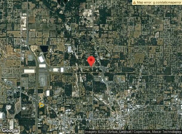
1624 Nw 35Th Avenue Rd, Ocala, FL 34475
NEARBY LISTINGS FOR SALE OR LEASE
Property Detail
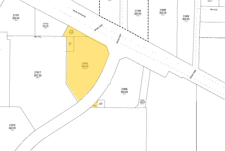
1624 Nw 35Th Avenue Rd
21842-000-00
U S Highway #27
Storemultistory
SEC 11 TWP 15 RGE 21 COM AT INTERSECTION OF S RWY LINE RD NO 500 WITH W LINE OF SE 1/4 OF NW 1/4 TH S 00-16-54 E 279.67 FT TH S 89-47-12 E 87.74 FT TH N 00-16-54 E 233.50 FT NWLY AL R/W 99.09 FT TO POB & COM NE COR OF SW 1/4 OF NW 1/4 TH W 210 FT TH
A
Marion
12083C0508E
Florida
2023
7.81 AC
2023
Greater Ocala
001500
Ocala
15,562 SF
Ocala, FL
DEMOGRAPHICS near 1624 Nw 35Th Avenue Rd
1 Mile
3 Mile
5 Mile
2024 Total Population
1,281
26,720
75,890
2029 Population
1,458
30,270
85,774
Pop Growth 2024-2029
+ 13.82%
+ 13.29%
+ 13.02%
Average Age
46
42
41
2024 Total Households
575
11,017
30,581
HH Growth 2024-2029
+ 13.91%
+ 13.40%
+ 13.06%
Median Household Inc
$39,999
$39,616
$49,436
Avg Household Size
2.10
2.20
2.30
2024 Avg HH Vehicles
2.00
1.00
2.00
Median Home Value
$167,741
$171,727
$193,446
Median Year Built
1993
1988
1986
Nearby Places
- Restaurants
- Banks
- Shops
- Fitness
- Groceries
Nearby Properties
Address
Land Use
TOTAL SIZE
Lot Size
Zoning
Address
Land Use
TOTAL SIZE
Lot Size
Zoning
704,765 SF
71.04 AC
GU
Address
Land Use
TOTAL SIZE
Lot Size
Zoning
195,992 SF
5.72 AC
FBC
Address
Land Use
TOTAL SIZE
Lot Size
Zoning
441,040 SF
150.01 AC
M1
Address
Land Use
TOTAL SIZE
Lot Size
Zoning
350,895 SF
27.85 AC
M1
Address
Land Use
TOTAL SIZE
Lot Size
Zoning
482,618 SF
34.54 AC
M2
Address
Land Use
TOTAL SIZE
Lot Size
Zoning
140,920 SF
28.09 AC
M2
Address
Land Use
TOTAL SIZE
Lot Size
Zoning
19,117 SF
0.98 AC
FBC
Address
Land Use
TOTAL SIZE
Lot Size
Zoning
9,854 SF
55.14 AC
B2
Address
Land Use
TOTAL SIZE
Lot Size
Zoning
79,199 SF
13.54 AC
B2
Address
Land Use
TOTAL SIZE
Lot Size
Zoning
112,663 SF
32.72 AC
INST
Address
Land Use
TOTAL SIZE
Lot Size
Zoning
26,801 SF
5.66 AC
FBC
Address
Land Use
TOTAL SIZE
Lot Size
Zoning
160,796 SF
25.59 AC
M2
Address
Land Use
TOTAL SIZE
Lot Size
Zoning
384,930 SF
17.76 AC
M1
Address
Land Use
TOTAL SIZE
Lot Size
Zoning
7,776 SF
19.09 AC
B2
Address
Land Use
TOTAL SIZE
Lot Size
Zoning
80,571 SF
13.72 AC
INST
Address
Land Use
TOTAL SIZE
Lot Size
Zoning
50,199 SF
4.74 AC
FBC
Address
Land Use
TOTAL SIZE
Lot Size
Zoning
94,360 SF
17.51 AC
B5
Address
Land Use
TOTAL SIZE
Lot Size
Zoning
116,876 SF
23.78 AC
M2
Address
Land Use
TOTAL SIZE
Lot Size
Zoning
73,361 SF
23.20 AC
GU
Address
Land Use
TOTAL SIZE
Lot Size
Zoning
47,567 SF
12 AC
INST
Address
Land Use
TOTAL SIZE
Lot Size
Zoning
55,809 SF
6.30 AC
M2
Address
Land Use
TOTAL SIZE
Lot Size
Zoning
64,438 SF
12.27 AC
B4
Address
Land Use
TOTAL SIZE
Lot Size
Zoning
79,311 SF
10.12 AC
INST
Address
Land Use
TOTAL SIZE
Lot Size
Zoning
11,351 SF
3.51 AC
B2
Address
Land Use
TOTAL SIZE
Lot Size
Zoning
15,800 SF
1.15 AC
FBC
Address
Land Use
TOTAL SIZE
Lot Size
Zoning
1,085,670 SF
89.70 AC
M1
Address
Land Use
TOTAL SIZE
Lot Size
Zoning
66,531 SF
26.96 AC
B2
Address
Land Use
TOTAL SIZE
Lot Size
Zoning
35,518 SF
9.98 AC
B2
Address
Land Use
TOTAL SIZE
Lot Size
Zoning
126,369 SF
10.47 AC
FBC
Address
Land Use
TOTAL SIZE
Lot Size
Zoning
63,200 SF
6.30 AC
B4
The World's #1 Commercial Real Estate Marketplace
Connect with us
© 2025 CoStar Group
The information above has been obtained from sources believed reliable. While we do not doubt its accuracy we have not verified it and make no guarantee, warranty or representation about it. It is your responsibility to independently confirm its accuracy and completeness. Any projections, opinions, assumptions, or estimates used are for example only and do not represent the current or future performance of the property. The value of this transaction to you depends on tax and other factors which should be evaluated by your tax, financial, and legal advisors. You and your advisors should conduct a careful, independent investigation of the property to determine to your satisfaction the suitability of the property for your needs.