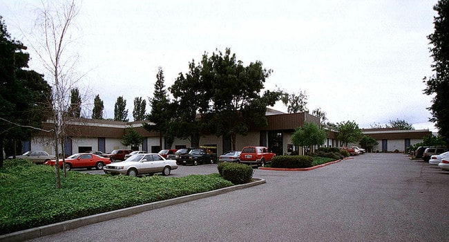
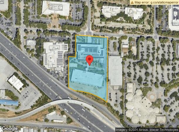
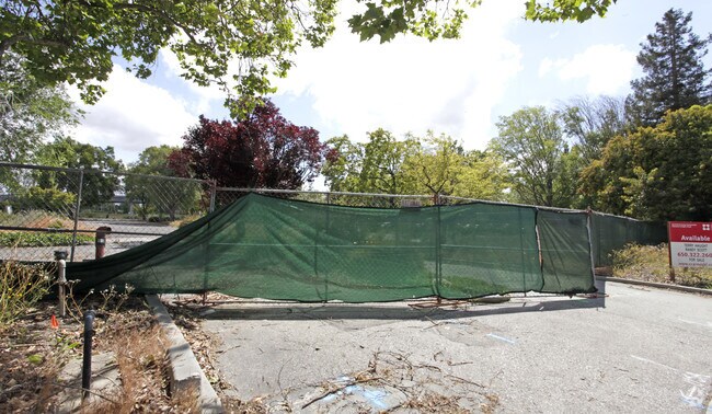
Property Record
1625 Plymouth St, Mountain View, CA 94043

NEARBY LISTINGS FOR SALE OR LEASE
Property Detail
1625 Plymouth St
Financialbuilding
Santa Clara
X
California
06085C0037H
5.15 AC
2024
Mountain View
2025
South Bay/San Jose
504601
San Jose-Sunnyvale-Santa Clara, CA
224,505 SF
116-13-035
DEMOGRAPHICS near 1625 Plymouth St
1 Mile
3 Mile
5 Mile
2024 Total Population
13,485
135,828
320,064
2029 Population
13,247
132,754
310,507
Pop Growth 2024-2029
(1.76%)
(2.26%)
(2.99%)
Average Age
40
39
39
2024 Total Households
5,501
54,541
119,798
HH Growth 2024-2029
(1.82%)
(2.39%)
(3.03%)
Median Household Inc
$164,827
$181,420
$174,084
Avg Household Size
2.30
2.40
2.50
2024 Avg HH Vehicles
2.00
2.00
2.00
Median Home Value
$1,111,870
$1,130,772
$1,127,879
Median Year Built
1976
1973
1972
Nearby Places
Map Layers
Map Styles
 Street
 Aerial
- Restaurants
- Banks
- Shops
- Fitness
- Groceries
PUBLIC TRANSPORTATION
COMMUTER RAIL
DRIVE
WALK
Distance
7 min
2.4 mi
Mountain View (Caltrain - Caltrain (Caltrain))
DRIVE
WALK
Distance
Mountain View (Caltrain - Caltrain (Caltrain))
8 min
2.6 mi
AIRPORT
Norman Y Mineta San Jose International
DRIVE
WALK
Distance
Norman Y Mineta San Jose International
16 min
10.2 mi
San Francisco International
DRIVE
WALK
Distance
San Francisco International
32 min
23.7 mi
Metro Oakland International
DRIVE
WALK
Distance
Metro Oakland International
45 min
32.5 mi
Freight Ports
Port of Redwood City
DRIVE
WALK
Distance
Port of Redwood City
17 min
10.6 mi
Nearby Properties
Address
Land Use
TOTAL SIZE
Lot Size
Zoning
Address
Land Use
TOTAL SIZE
Lot Size
Zoning
42.28 AC
PF
Address
Land Use
TOTAL SIZE
Lot Size
Zoning
499,360 SF
31.95 AC
MM40
Address
Land Use
TOTAL SIZE
Lot Size
Zoning
0.33 AC
PF
Address
Land Use
TOTAL SIZE
Lot Size
Zoning
1,640,399 SF
101.23 AC
MP-I
Address
Land Use
TOTAL SIZE
Lot Size
Zoning
450,575 SF
3.73 AC
P(9)
Address
Land Use
TOTAL SIZE
Lot Size
Zoning
318,172 SF
60.47 AC
MP-TO
Address
Land Use
TOTAL SIZE
Lot Size
Zoning
355,490 SF
26.49 AC
P39
Address
Land Use
TOTAL SIZE
Lot Size
Zoning
440,173 SF
25.33 AC
P39
Address
Land Use
TOTAL SIZE
Lot Size
Zoning
584,389 SF
5.25 AC
P(40)
Address
Land Use
TOTAL SIZE
Lot Size
Zoning
431,256 SF
12.43 AC
PPSP
Address
Land Use
TOTAL SIZE
Lot Size
Zoning
595,000 SF
7.42 AC
P(34)
Address
Land Use
TOTAL SIZE
Lot Size
Zoning
350,633 SF
1.08 AC
MPTOD
Address
Land Use
TOTAL SIZE
Lot Size
Zoning
350,633 SF
1.27 AC
MPTOD
Address
Land Use
TOTAL SIZE
Lot Size
Zoning
350,633 SF
1.08 AC
MPTOD
Address
Land Use
TOTAL SIZE
Lot Size
Zoning
353,745 SF
14.82 AC
PPSP
Address
Land Use
TOTAL SIZE
Lot Size
Zoning
233,124 SF
9.18 AC
P(7)
Address
Land Use
TOTAL SIZE
Lot Size
Zoning
4.13 AC
P39
Address
Land Use
TOTAL SIZE
Lot Size
Zoning
350,633 SF
1.27 AC
MPTOD
Address
Land Use
TOTAL SIZE
Lot Size
Zoning
350,633 SF
1.27 AC
MPTOD
Address
Land Use
TOTAL SIZE
Lot Size
Zoning
312,510 SF
23.46 AC
P41
Address
Land Use
TOTAL SIZE
Lot Size
Zoning
372,859 SF
4.71 AC
P
Address
Land Use
TOTAL SIZE
Lot Size
Zoning
298,463 SF
7 AC
P(19)
Address
Land Use
TOTAL SIZE
Lot Size
Zoning
63,131 SF
4.73 AC
P41
Address
Land Use
TOTAL SIZE
Lot Size
Zoning
287,644 SF
10.04 AC
PPSP
Address
Land Use
TOTAL SIZE
Lot Size
Zoning
203,098 SF
7.90 AC
PPSP
Address
Land Use
TOTAL SIZE
Lot Size
Zoning
640,105 SF
7.90 AC
R3-2*
Address
Land Use
TOTAL SIZE
Lot Size
Zoning
340,913 SF
15.64 AC
ML
Address
Land Use
TOTAL SIZE
Lot Size
Zoning
20,160.50 AC
P
Address
Land Use
TOTAL SIZE
Lot Size
Zoning
322,264 SF
3.92 AC
P
The World's #1 Commercial Real Estate Marketplace
Connect with us
© 2025 CoStar Group
The information above has been obtained from sources believed reliable. While we do not doubt its accuracy we have not verified it and make no guarantee, warranty or representation about it. It is your responsibility to independently confirm its accuracy and completeness. Any projections, opinions, assumptions, or estimates used are for example only and do not represent the current or future performance of the property. The value of this transaction to you depends on tax and other factors which should be evaluated by your tax, financial, and legal advisors. You and your advisors should conduct a careful, independent investigation of the property to determine to your satisfaction the suitability of the property for your needs.