
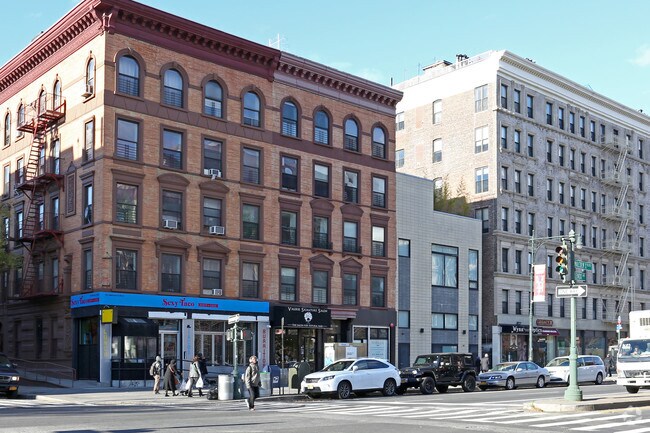
Property Record
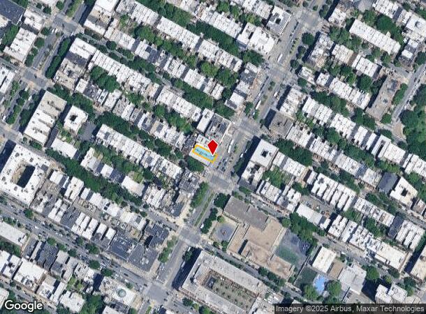
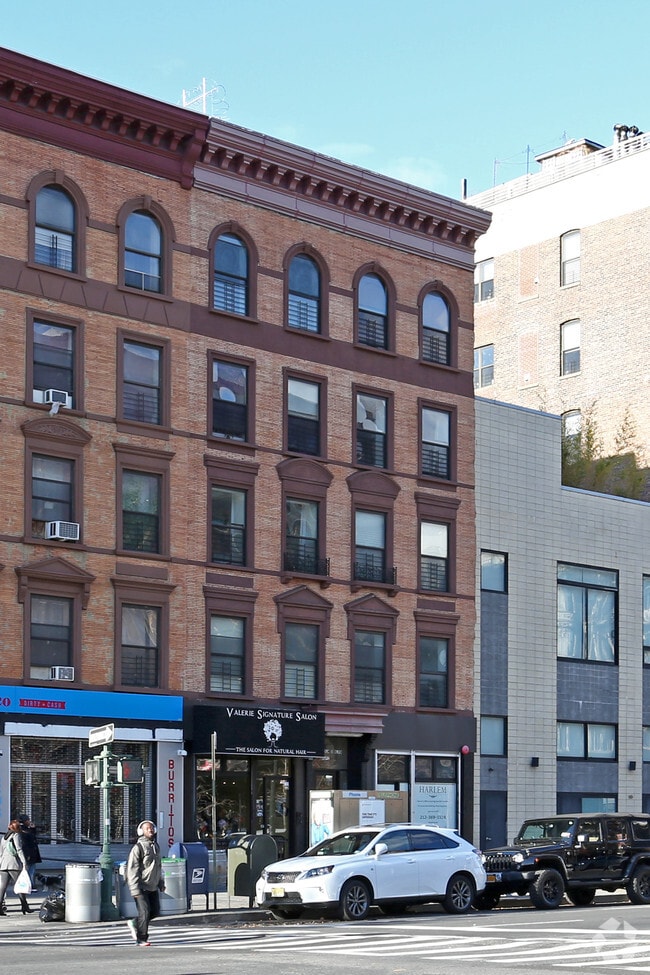
163 Malcolm X Blvd, New York, NY 10026
NEARBY LISTINGS FOR SALE OR LEASE
Property Detail
163 Malcolm X Blvd
1903-0031
Manhattan
Apartment
New York
X
31
3604970087F
0.08 AC
2024
Central Harlem
2025
New York City
022000
New York-Jersey City-White Plains, NY-NJ
14,570 SF
DEMOGRAPHICS near 163 Malcolm X Blvd
1 Mile
3 Mile
5 Mile
2024 Total Population
215,656
1,203,062
2,637,448
2029 Population
198,473
1,118,884
2,469,296
Pop Growth 2024-2029
(7.97%)
(7.00%)
(6.38%)
Average Age
40
41
40
2024 Total Households
89,669
520,706
1,112,194
HH Growth 2024-2029
(8.19%)
(7.34%)
(6.72%)
Median Household Inc
$46,925
$66,624
$67,240
Avg Household Size
2.20
2.20
2.20
2024 Avg HH Vehicles
.00
.00
.00
Median Home Value
$855,057
$887,372
$779,164
Median Year Built
1953
1954
1956
Nearby Places
- Restaurants
- Banks
- Shops
- Fitness
- Groceries
PUBLIC TRANSPORTATION
TRANSIT/SUBWAY
116 Street (2,3 Line) (2 - New York MTA Subway (The Subway), 3 - New York MTA Subway (The Subway))
DRIVE
WALK
Distance
116 Street (2,3 Line) (2 - New York MTA Subway (The Subway), 3 - New York MTA Subway (The Subway))
0 min
2 min
0.1 mi
125 Street (2,3 Line) (2 - New York MTA Subway (The Subway), 3 - New York MTA Subway (The Subway))
DRIVE
WALK
Distance
125 Street (2,3 Line) (2 - New York MTA Subway (The Subway), 3 - New York MTA Subway (The Subway))
2 min
6 min
0.3 mi
Central Park North (110 Street) (2,3 Line) (2 - New York MTA Subway (The Subway), 3 - New York MTA Subway (The Subway))
DRIVE
WALK
Distance
Central Park North (110 Street) (2,3 Line) (2 - New York MTA Subway (The Subway), 3 - New York MTA Subway (The Subway))
0 min
7 min
0.4 mi
116 Street (A,B,C Line) (A - New York MTA Subway (The Subway), B - New York MTA Subway (The Subway), C - New York MTA Subway (The Subway))
DRIVE
WALK
Distance
116 Street (A,B,C Line) (A - New York MTA Subway (The Subway), B - New York MTA Subway (The Subway), C - New York MTA Subway (The Subway))
1 min
8 min
0.4 mi
116 Street (4,6 Line) (4 - New York MTA Subway (The Subway), 6 - New York MTA Subway (The Subway))
DRIVE
WALK
Distance
116 Street (4,6 Line) (4 - New York MTA Subway (The Subway), 6 - New York MTA Subway (The Subway))
2 min
11 min
0.6 mi
COMMUTER RAIL
Harlem-125Th Street Station (Harlem Line - Metro-North Commuter Railroad Company (Metro-North), Hudson Line - Metro-North Commuter Railroad Company (Metro-North), New Haven Line - Metro-North Commuter Railroad Company (Metro-North))
DRIVE
WALK
Distance
Harlem-125Th Street Station (Harlem Line - Metro-North Commuter Railroad Company (Metro-North), Hudson Line - Metro-North Commuter Railroad Company (Metro-North), New Haven Line - Metro-North Commuter Railroad Company (Metro-North))
2 min
13 min
0.7 mi
Yankees-E 153Rd Street Station (Hudson Line - Metro-North Commuter Railroad Company (Metro-North))
DRIVE
WALK
Distance
Yankees-E 153Rd Street Station (Hudson Line - Metro-North Commuter Railroad Company (Metro-North))
6 min
2.4 mi
AIRPORT
LaGuardia
DRIVE
WALK
Distance
LaGuardia
14 min
6.7 mi
John F Kennedy International
DRIVE
WALK
Distance
John F Kennedy International
27 min
17.9 mi
Newark Liberty International
DRIVE
WALK
Distance
Newark Liberty International
30 min
24.1 mi
Freight Ports
NY - Red Hook Container Terminal
DRIVE
WALK
Distance
NY - Red Hook Container Terminal
27 min
12.2 mi
Nearby Properties
Address
Land Use
TOTAL SIZE
Lot Size
Zoning
Address
Land Use
TOTAL SIZE
Lot Size
Zoning
1,233,684 SF
16.94 AC
PARK
Address
Land Use
TOTAL SIZE
Lot Size
Zoning
3,693,539 SF
8.37 AC
R8
Address
Land Use
TOTAL SIZE
Lot Size
Zoning
400,160 SF
10.96 AC
R7-2
Address
Land Use
TOTAL SIZE
Lot Size
Zoning
2,215,000 SF
6.43 AC
R9
Address
Land Use
TOTAL SIZE
Lot Size
Zoning
264,420 SF
7.26 AC
C4-7
Address
Land Use
TOTAL SIZE
Lot Size
Zoning
2,230,742 SF
6.33 AC
R9
Address
Land Use
TOTAL SIZE
Lot Size
Zoning
174 AC
P2
Address
Land Use
TOTAL SIZE
Lot Size
Zoning
26.93 AC
R8
Address
Land Use
TOTAL SIZE
Lot Size
Zoning
1,368,870 SF
16.86 AC
R8
Address
Land Use
TOTAL SIZE
Lot Size
Zoning
2,278,432 SF
5.99 AC
R7-2
Address
Land Use
TOTAL SIZE
Lot Size
Zoning
449,876 SF
0.81 AC
C5-3
Address
Land Use
TOTAL SIZE
Lot Size
Zoning
449,876 SF
0.81 AC
C5-3
Address
Land Use
TOTAL SIZE
Lot Size
Zoning
1,025,320 SF
4.47 AC
C4-7
Address
Land Use
TOTAL SIZE
Lot Size
Zoning
1,200,000 SF
10.24 AC
R9
Address
Land Use
TOTAL SIZE
Lot Size
Zoning
755,000 SF
1.85 AC
R7-2
Address
Land Use
TOTAL SIZE
Lot Size
Zoning
4,000 SF
57.37 AC
BPC
Address
Land Use
TOTAL SIZE
Lot Size
Zoning
873,000 SF
9.95 AC
R7-2
Address
Land Use
TOTAL SIZE
Lot Size
Zoning
0.06 AC
R8
Address
Land Use
TOTAL SIZE
Lot Size
Zoning
1,670,868 SF
9.14 AC
R8
Address
Land Use
TOTAL SIZE
Lot Size
Zoning
757,439 SF
0.91 AC
C1-9
Address
Land Use
TOTAL SIZE
Lot Size
Zoning
733,747 SF
0.98 AC
R10
Address
Land Use
TOTAL SIZE
Lot Size
Zoning
1,651,267 SF
1.23 AC
R8
Address
Land Use
TOTAL SIZE
Lot Size
Zoning
7.64 AC
Address
Land Use
TOTAL SIZE
Lot Size
Zoning
714,224 SF
0.70 AC
R8
Address
Land Use
TOTAL SIZE
Lot Size
Zoning
360,120 SF
2.26 AC
C4-7
Address
Land Use
TOTAL SIZE
Lot Size
Zoning
45.60 AC
Address
Land Use
TOTAL SIZE
Lot Size
Zoning
1,075,000 SF
6.74 AC
R7-2
Address
Land Use
TOTAL SIZE
Lot Size
Zoning
775,241 SF
1.87 AC
R8B
Address
Land Use
TOTAL SIZE
Lot Size
Zoning
478,842 SF
3.56 AC
C6-1
Address
Land Use
TOTAL SIZE
Lot Size
Zoning
407,259 SF
0.93 AC
C5-2
The World's #1 Commercial Real Estate Marketplace
Connect with us
© 2025 CoStar Group
The information above has been obtained from sources believed reliable. While we do not doubt its accuracy we have not verified it and make no guarantee, warranty or representation about it. It is your responsibility to independently confirm its accuracy and completeness. Any projections, opinions, assumptions, or estimates used are for example only and do not represent the current or future performance of the property. The value of this transaction to you depends on tax and other factors which should be evaluated by your tax, financial, and legal advisors. You and your advisors should conduct a careful, independent investigation of the property to determine to your satisfaction the suitability of the property for your needs.