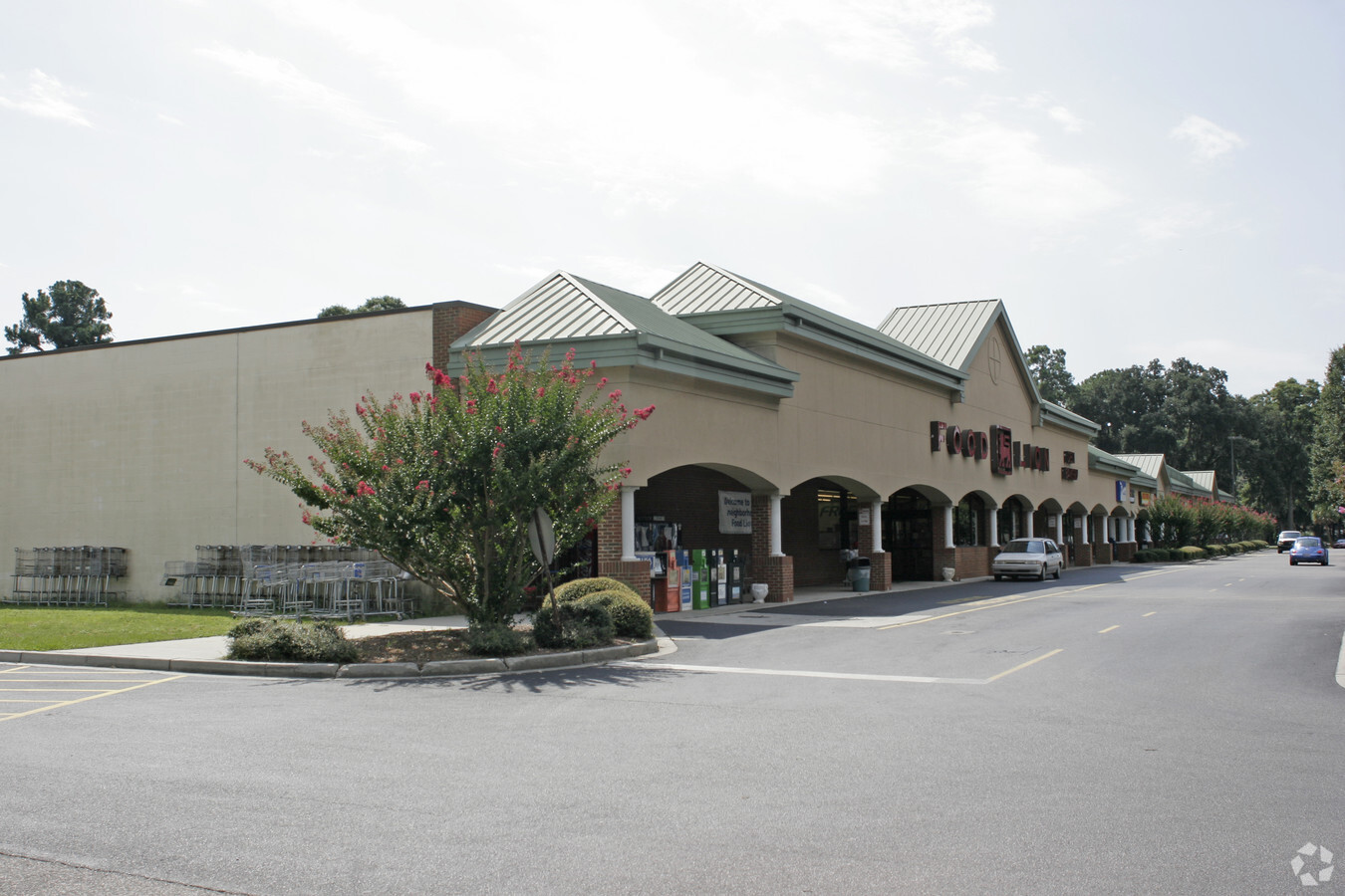
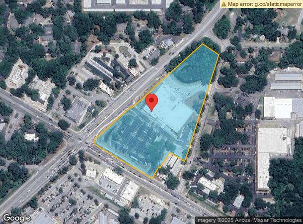
Property Record
163 Sea Island Pky, Beaufort, SC 29907
NEARBY LISTINGS FOR SALE OR LEASE
-
-
View all Beaufort listings for sale on LoopNet.com
Property Detail
163 Sea Island Pky
Other Market Areas
Ladys Is. Zoned Village Center
Hilton Head Island-Bluffton-Beaufort, SC
PAR A LTS 4 5 N J BROWN REVISED PLAT PB59 P158 ORDINANCE#2000/22 #O-49-00 MGFM:K
R123-015-000-0587-0000
Beaufort
Supermarket
South Carolina
2024
4-5
2024
7.32 AC
000902
Hilton Head/Beaufort
37,845 SF
DEMOGRAPHICS near 163 Sea Island Pky
1 Mile
3 Mile
5 Mile
2024 Total Population
1,774
14,158
32,406
2029 Population
1,956
15,653
35,749
Pop Growth 2024-2029
+ 10.26%
+ 10.56%
+ 10.32%
Average Age
42
43
42
2024 Total Households
691
6,021
13,389
HH Growth 2024-2029
+ 9.84%
+ 10.11%
+ 10.02%
Median Household Inc
$68,827
$60,506
$64,110
Avg Household Size
2.50
2.20
2.30
2024 Avg HH Vehicles
2.00
2.00
2.00
Median Home Value
$446,078
$345,473
$333,185
Median Year Built
1998
1987
1990
Nearby Places
- Restaurants
- Banks
- Shops
- Fitness
- Groceries
PUBLIC TRANSPORTATION
AIRPORT
Hilton Head
DRIVE
WALK
Distance
Hilton Head
56 min
40.3 mi
Freight Ports
Georgia Ports - Savannah
DRIVE
WALK
Distance
Georgia Ports - Savannah
65 min
49.7 mi
Nearby Properties
Address
Land Use
TOTAL SIZE
Lot Size
Zoning
Address
Land Use
TOTAL SIZE
Lot Size
Zoning
245,864 SF
19.36 AC
6601
Address
Land Use
TOTAL SIZE
Lot Size
Zoning
4.45 AC
6601
Address
Land Use
TOTAL SIZE
Lot Size
Zoning
19,232 SF
16.27 AC
6612
Address
Land Use
TOTAL SIZE
Lot Size
Zoning
144,673 SF
19.30 AC
4201
Address
Land Use
TOTAL SIZE
Lot Size
Zoning
101,304 SF
6.47 AC
6611
Address
Land Use
TOTAL SIZE
Lot Size
Zoning
34,200 SF
4.18 AC
6601
Address
Land Use
TOTAL SIZE
Lot Size
Zoning
144,226 SF
41.30 AC
6611
Address
Land Use
TOTAL SIZE
Lot Size
Zoning
116,067 SF
27 AC
6611
Address
Land Use
TOTAL SIZE
Lot Size
Zoning
4,928 SF
4.76 AC
6611
Address
Land Use
TOTAL SIZE
Lot Size
Zoning
37,624 SF
2.42 AC
6611
Address
Land Use
TOTAL SIZE
Lot Size
Zoning
6,024 SF
10.60 AC
6611
Address
Land Use
TOTAL SIZE
Lot Size
Zoning
16,197 SF
7.50 AC
6611
Address
Land Use
TOTAL SIZE
Lot Size
Zoning
6,784 SF
10.50 AC
6111
Address
Land Use
TOTAL SIZE
Lot Size
Zoning
52,322 SF
6.86 AC
6601
Address
Land Use
TOTAL SIZE
Lot Size
Zoning
75,233 SF
19.91 AC
6612
Address
Land Use
TOTAL SIZE
Lot Size
Zoning
53,862 SF
6.67 AC
9999
Address
Land Use
TOTAL SIZE
Lot Size
Zoning
36,020 SF
3.46 AC
6611
Address
Land Use
TOTAL SIZE
Lot Size
Zoning
58,085 SF
19.97 AC
6612
Address
Land Use
TOTAL SIZE
Lot Size
Zoning
35,734 SF
5.80 AC
6611
Address
Land Use
TOTAL SIZE
Lot Size
Zoning
105,705 SF
5.82 AC
4202
Address
Land Use
TOTAL SIZE
Lot Size
Zoning
60,696 SF
0.62 AC
6611
Address
Land Use
TOTAL SIZE
Lot Size
Zoning
41,760 SF
8.75 AC
6612
Address
Land Use
TOTAL SIZE
Lot Size
Zoning
119 AC
6601
Address
Land Use
TOTAL SIZE
Lot Size
Zoning
62,860 SF
6.26 AC
6611
Address
Land Use
TOTAL SIZE
Lot Size
Zoning
33,157 SF
1 AC
6611
Address
Land Use
TOTAL SIZE
Lot Size
Zoning
1.15 AC
Address
Land Use
TOTAL SIZE
Lot Size
Zoning
4,816 SF
7.92 AC
6611
Address
Land Use
TOTAL SIZE
Lot Size
Zoning
20,250 SF
2.25 AC
Address
Land Use
TOTAL SIZE
Lot Size
Zoning
38,260 SF
10 AC
6611
Address
Land Use
TOTAL SIZE
Lot Size
Zoning
34,800 SF
4.31 AC
6602
The World's #1 Commercial Real Estate Marketplace
Connect with us
© 2025 CoStar Group
The information above has been obtained from sources believed reliable. While we do not doubt its accuracy we have not verified it and make no guarantee, warranty or representation about it. It is your responsibility to independently confirm its accuracy and completeness. Any projections, opinions, assumptions, or estimates used are for example only and do not represent the current or future performance of the property. The value of this transaction to you depends on tax and other factors which should be evaluated by your tax, financial, and legal advisors. You and your advisors should conduct a careful, independent investigation of the property to determine to your satisfaction the suitability of the property for your needs.