Property Record
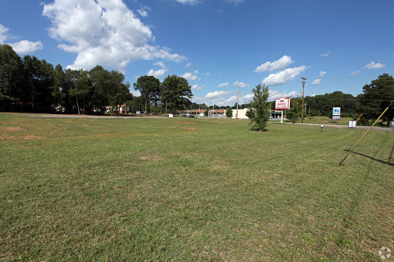
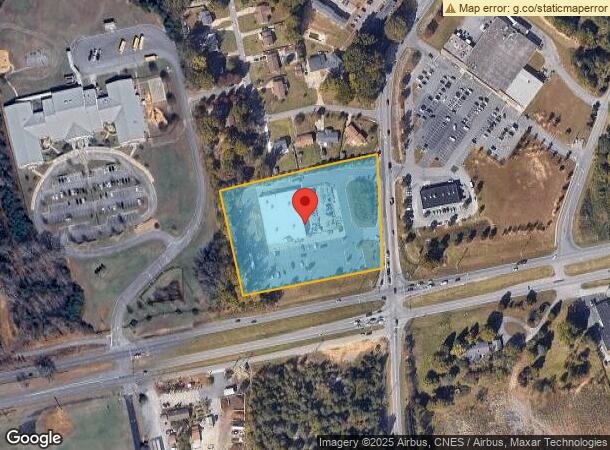
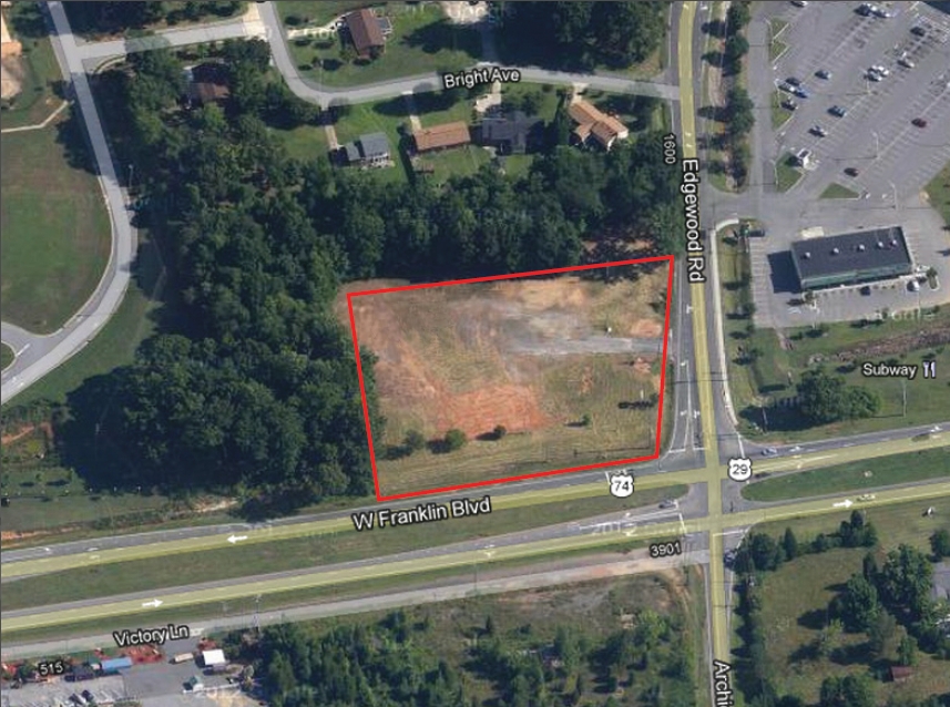
1630 Edgewood Rd, Bessemer City, NC 28016

NEARBY LISTINGS FOR SALE OR LEASE
Property Detail
1630 Edgewood Rd
153777
11 043 001 01 000
Departmentstoremultistory
Gaston
X
North Carolina
3710352500J
3.94 AC
2024
Gaston County
2024
Charlotte
0317031027
Charlotte-Concord-Gastonia, NC-SC
18,750 SF
DEMOGRAPHICS near 1630 Edgewood Rd
1 Mile
3 Mile
5 Mile
2024 Total Population
1,802
21,388
62,145
2029 Population
1,932
22,902
66,532
Pop Growth 2024-2029
+ 7.21%
+ 7.08%
+ 7.06%
Average Age
40
39
39
2024 Total Households
684
8,291
24,464
HH Growth 2024-2029
+ 7.31%
+ 7.22%
+ 7.18%
Median Household Inc
$42,694
$40,073
$39,495
Avg Household Size
2.60
2.50
2.40
2024 Avg HH Vehicles
2.00
2.00
2.00
Median Home Value
$154,926
$146,049
$143,039
Median Year Built
1975
1972
1971
Nearby Places
- Restaurants
- Banks
- Shops
- Fitness
- Groceries
PUBLIC TRANSPORTATION
COMMUTER RAIL
Gastonia Amtrak Station (Crescent - Amtrak)
DRIVE
WALK
Distance
Gastonia Amtrak Station (Crescent - Amtrak)
10 min
5.9 mi
AIRPORT
Charlotte/Douglas International
DRIVE
WALK
Distance
Charlotte/Douglas International
36 min
22.3 mi
Freight Ports
North Charleston Terminal
DRIVE
WALK
Distance
North Charleston Terminal
248 min
212.1 mi
Nearby Properties
Address
Land Use
TOTAL SIZE
Lot Size
Zoning
Address
Land Use
TOTAL SIZE
Lot Size
Zoning
68.71 AC
Address
Land Use
TOTAL SIZE
Lot Size
Zoning
268,563 SF
116.96 AC
MANU1
Address
Land Use
TOTAL SIZE
Lot Size
Zoning
29.89 AC
Address
Land Use
TOTAL SIZE
Lot Size
Zoning
Address
Land Use
TOTAL SIZE
Lot Size
Zoning
1,602 SF
14.02 AC
APT02
Address
Land Use
TOTAL SIZE
Lot Size
Zoning
2,250 SF
27.79 AC
OFF01
Address
Land Use
TOTAL SIZE
Lot Size
Zoning
539,988 SF
36.32 AC
STOR6
Address
Land Use
TOTAL SIZE
Lot Size
Zoning
192,978 SF
22.67 AC
RET05
Address
Land Use
TOTAL SIZE
Lot Size
Zoning
112,513 SF
13.09 AC
PUB01
Address
Land Use
TOTAL SIZE
Lot Size
Zoning
44,794 SF
46.96 AC
PUB01
Address
Land Use
TOTAL SIZE
Lot Size
Zoning
167,332 SF
19.92 AC
INDS1
Address
Land Use
TOTAL SIZE
Lot Size
Zoning
Address
Land Use
TOTAL SIZE
Lot Size
Zoning
105,285 SF
25.27 AC
INDS1
Address
Land Use
TOTAL SIZE
Lot Size
Zoning
514,404 SF
27.84 AC
INDS2
Address
Land Use
TOTAL SIZE
Lot Size
Zoning
780 SF
7.07 AC
APT01
Address
Land Use
TOTAL SIZE
Lot Size
Zoning
952 SF
22.68 AC
SHOP1
Address
Land Use
TOTAL SIZE
Lot Size
Zoning
60,685 SF
21.19 AC
PUB01
Address
Land Use
TOTAL SIZE
Lot Size
Zoning
110,840 SF
13.12 AC
INDS1
Address
Land Use
TOTAL SIZE
Lot Size
Zoning
163,106 SF
11.19 AC
STOR2
Address
Land Use
TOTAL SIZE
Lot Size
Zoning
60,916 SF
42.13 AC
Address
Land Use
TOTAL SIZE
Lot Size
Zoning
9,968 SF
18.38 AC
PUB01
Address
Land Use
TOTAL SIZE
Lot Size
Zoning
17.37 AC
Address
Land Use
TOTAL SIZE
Lot Size
Zoning
73,692 SF
5.12 AC
CHUR5
Address
Land Use
TOTAL SIZE
Lot Size
Zoning
81,000 SF
10.31 AC
INDS2
Address
Land Use
TOTAL SIZE
Lot Size
Zoning
902 SF
8.23 AC
APT01
Address
Land Use
TOTAL SIZE
Lot Size
Zoning
139,947 SF
22.96 AC
INDS1
Address
Land Use
TOTAL SIZE
Lot Size
Zoning
7,184 SF
4.73 AC
MOTL2
Address
Land Use
TOTAL SIZE
Lot Size
Zoning
408,172 SF
12.84 AC
INDS1
Address
Land Use
TOTAL SIZE
Lot Size
Zoning
20,000 SF
23.07 AC
INDS1
Address
Land Use
TOTAL SIZE
Lot Size
Zoning
1,440 SF
12.82 AC
The World's #1 Commercial Real Estate Marketplace
Connect with us
© 2025 CoStar Group
The information above has been obtained from sources believed reliable. While we do not doubt its accuracy we have not verified it and make no guarantee, warranty or representation about it. It is your responsibility to independently confirm its accuracy and completeness. Any projections, opinions, assumptions, or estimates used are for example only and do not represent the current or future performance of the property. The value of this transaction to you depends on tax and other factors which should be evaluated by your tax, financial, and legal advisors. You and your advisors should conduct a careful, independent investigation of the property to determine to your satisfaction the suitability of the property for your needs.