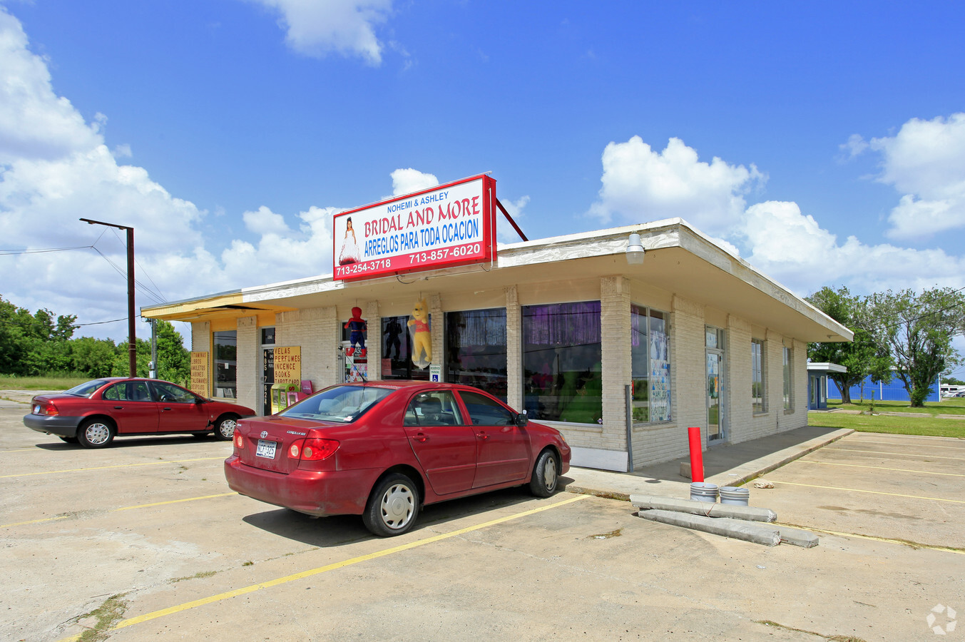
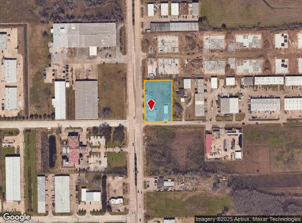
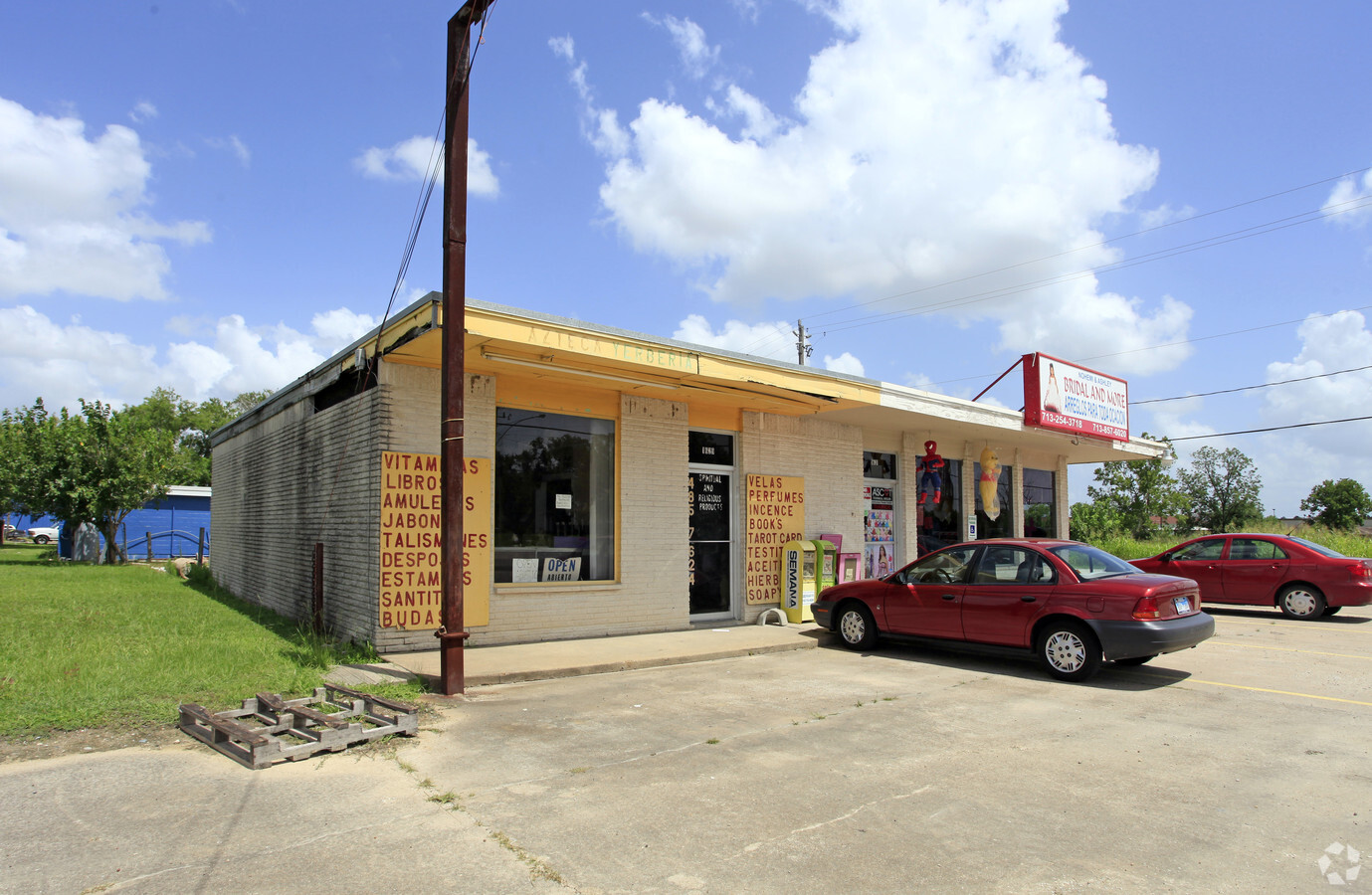
Property Record
1631 N Main St, Pearland, TX 77581
NEARBY LISTINGS FOR SALE OR LEASE
Property Detail
1631 N Main St
0542-0052-000
H T & B R R
Commercialnec
A0542 H T & B R R TRACT 43A1 (CALLED WAREHOUSE NO 1) ACRES 1.2646
X
Brazoria
48039C0035K
Texas
2023
1.26 AC
2023
Southeast Outlier
660401
Houston
3,630 SF
Houston-The Woodlands-Sugar Land, TX
DEMOGRAPHICS near 1631 N Main St
1 Mile
3 Mile
5 Mile
2024 Total Population
5,000
71,029
195,172
2029 Population
5,507
75,831
206,156
Pop Growth 2024-2029
+ 10.14%
+ 6.76%
+ 5.63%
Average Age
36
36
36
2024 Total Households
1,696
23,049
64,405
HH Growth 2024-2029
+ 10.32%
+ 7.02%
+ 5.76%
Median Household Inc
$85,866
$93,029
$80,368
Avg Household Size
2.90
3.00
3.00
2024 Avg HH Vehicles
2.00
2.00
2.00
Median Home Value
$314,122
$256,893
$245,031
Median Year Built
2000
2000
1995
Nearby Places
- Restaurants
- Banks
- Shops
- Fitness
- Groceries
PUBLIC TRANSPORTATION
AIRPORT
William P Hobby
DRIVE
WALK
Distance
William P Hobby
12 min
5.0 mi
George Bush Intcntl/Houston
DRIVE
WALK
Distance
George Bush Intcntl/Houston
47 min
35.8 mi
Freight Ports
Port of Houston
DRIVE
WALK
Distance
Port of Houston
24 min
13.2 mi
Nearby Properties
Address
Land Use
TOTAL SIZE
Lot Size
Zoning
Address
Land Use
TOTAL SIZE
Lot Size
Zoning
1,214,720 SF
92.85 AC
Address
Land Use
TOTAL SIZE
Lot Size
Zoning
83.37 AC
0004
Address
Land Use
TOTAL SIZE
Lot Size
Zoning
359,985 SF
12.56 AC
Address
Land Use
TOTAL SIZE
Lot Size
Zoning
252,472 SF
13.28 AC
Address
Land Use
TOTAL SIZE
Lot Size
Zoning
309,102 SF
16.81 AC
Address
Land Use
TOTAL SIZE
Lot Size
Zoning
236,642 SF
11.48 AC
Address
Land Use
TOTAL SIZE
Lot Size
Zoning
285,328 SF
40.75 AC
Address
Land Use
TOTAL SIZE
Lot Size
Zoning
128,754 SF
14.83 AC
Address
Land Use
TOTAL SIZE
Lot Size
Zoning
72,543 SF
22.64 AC
Address
Land Use
TOTAL SIZE
Lot Size
Zoning
14.93 AC
Address
Land Use
TOTAL SIZE
Lot Size
Zoning
144,879 SF
8.91 AC
Address
Land Use
TOTAL SIZE
Lot Size
Zoning
134,596 SF
7.21 AC
Address
Land Use
TOTAL SIZE
Lot Size
Zoning
89.23 AC
Address
Land Use
TOTAL SIZE
Lot Size
Zoning
100,549 SF
18.25 AC
Address
Land Use
TOTAL SIZE
Lot Size
Zoning
195,856 SF
20.81 AC
Address
Land Use
TOTAL SIZE
Lot Size
Zoning
157,128 SF
10 AC
0041
Address
Land Use
TOTAL SIZE
Lot Size
Zoning
148,902 SF
11.40 AC
Address
Land Use
TOTAL SIZE
Lot Size
Zoning
217,275 SF
26.83 AC
Address
Land Use
TOTAL SIZE
Lot Size
Zoning
114,828 SF
7.94 AC
Address
Land Use
TOTAL SIZE
Lot Size
Zoning
129,025 SF
7.02 AC
Address
Land Use
TOTAL SIZE
Lot Size
Zoning
67,218 SF
32.01 AC
Address
Land Use
TOTAL SIZE
Lot Size
Zoning
291,181 SF
11.07 AC
Address
Land Use
TOTAL SIZE
Lot Size
Zoning
106,341 SF
12.12 AC
0550
Address
Land Use
TOTAL SIZE
Lot Size
Zoning
81,609 SF
6.56 AC
Address
Land Use
TOTAL SIZE
Lot Size
Zoning
45,108 SF
3.74 AC
Address
Land Use
TOTAL SIZE
Lot Size
Zoning
112,800 SF
3.20 AC
Address
Land Use
TOTAL SIZE
Lot Size
Zoning
49.29 AC
0007
Address
Land Use
TOTAL SIZE
Lot Size
Zoning
86,550 SF
8.45 AC
Address
Land Use
TOTAL SIZE
Lot Size
Zoning
99,578 SF
11.62 AC
Address
Land Use
TOTAL SIZE
Lot Size
Zoning
63,615 SF
6.42 AC
0010
The World's #1 Commercial Real Estate Marketplace
Connect with us
© 2025 CoStar Group
The information above has been obtained from sources believed reliable. While we do not doubt its accuracy we have not verified it and make no guarantee, warranty or representation about it. It is your responsibility to independently confirm its accuracy and completeness. Any projections, opinions, assumptions, or estimates used are for example only and do not represent the current or future performance of the property. The value of this transaction to you depends on tax and other factors which should be evaluated by your tax, financial, and legal advisors. You and your advisors should conduct a careful, independent investigation of the property to determine to your satisfaction the suitability of the property for your needs.