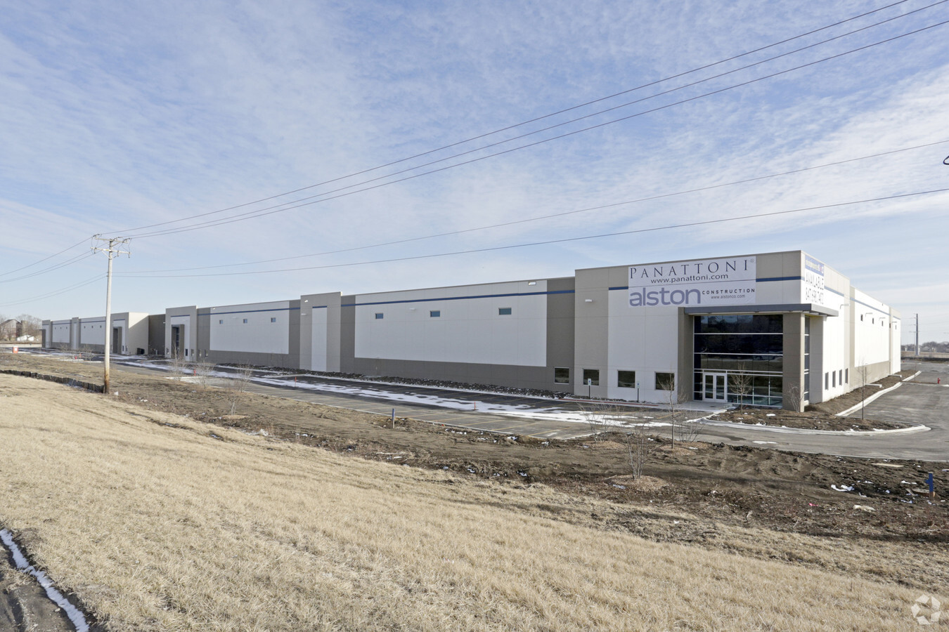
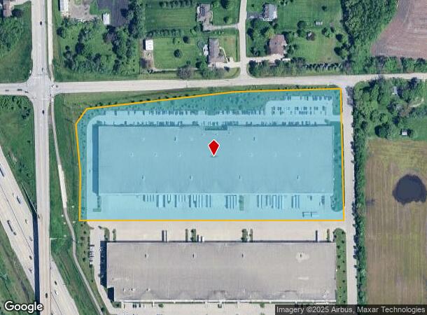
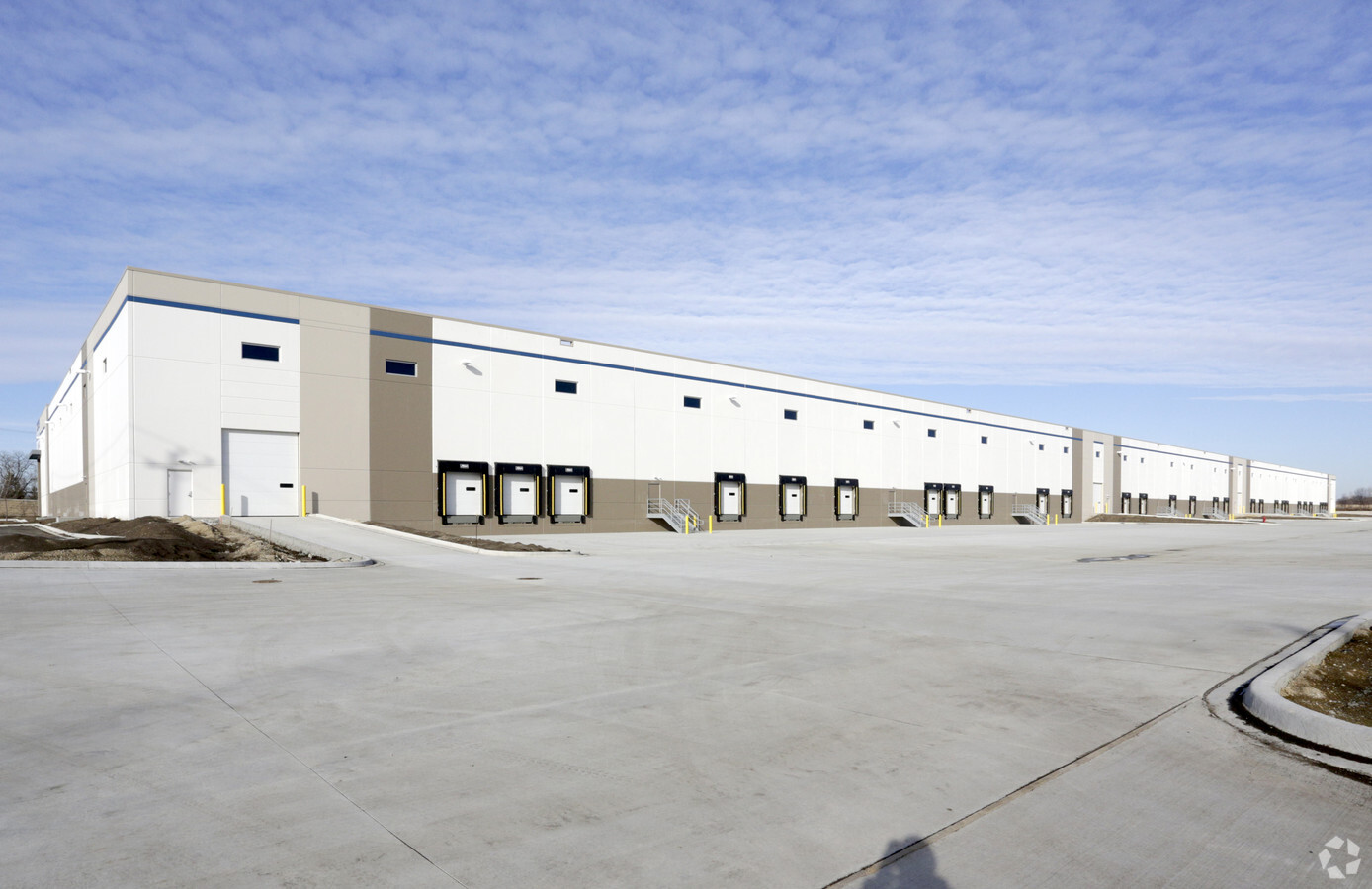
Property Record
16328 S John Lane Xing, Lockport, IL 60441
NEARBY LISTINGS FOR SALE OR LEASE
Property Detail
16328 S John Lane Xing
Chicago-Naperville-Elgin, IL-IN-WI
Corporate Center
05-20-301-001
LOT 1 IN 355 CORPORATE CENTER, BEING A SUB OF PRT OF THE W1/2 OF THE SW1/4 OF SEC 20, T36N-R11E.
Industrialgeneral
Will
X
Illinois
17197C0159G
1
2023
13.15 AC
2023
Joliet Area
8810101018
Chicago
228,690 SF
DEMOGRAPHICS near 16328 S John Lane Xing
1 Mile
3 Mile
5 Mile
2024 Total Population
3,791
35,318
92,055
2029 Population
3,797
35,298
91,808
Pop Growth 2024-2029
+ 0.16%
(0.06%)
(0.27%)
Average Age
37
40
40
2024 Total Households
1,262
13,118
31,220
HH Growth 2024-2029
+ 0.16%
(0.08%)
(0.31%)
Median Household Inc
$112,828
$94,159
$93,935
Avg Household Size
3.00
2.70
2.80
2024 Avg HH Vehicles
2.00
2.00
2.00
Median Home Value
$368,891
$296,439
$316,022
Median Year Built
2002
1994
1988
Nearby Places
- Restaurants
- Banks
- Shops
- Fitness
- Groceries
PUBLIC TRANSPORTATION
COMMUTER RAIL
Lockport Station (Heritage Corridor Line - Northeast Illinois Regional Commuter Railroad (Metra))
DRIVE
WALK
Distance
Lockport Station (Heritage Corridor Line - Northeast Illinois Regional Commuter Railroad (Metra))
9 min
3.5 mi
New Lenox Station (Rock Island District Line - Northeast Illinois Regional Commuter Railroad (Metra))
DRIVE
WALK
Distance
New Lenox Station (Rock Island District Line - Northeast Illinois Regional Commuter Railroad (Metra))
15 min
7.6 mi
AIRPORT
Chicago Midway International
DRIVE
WALK
Distance
Chicago Midway International
35 min
24.8 mi
Chicago O'Hare International
DRIVE
WALK
Distance
Chicago O'Hare International
43 min
36.3 mi
Nearby Properties
Address
Land Use
TOTAL SIZE
Lot Size
Zoning
Address
Land Use
TOTAL SIZE
Lot Size
Zoning
52.19 AC
Address
Land Use
TOTAL SIZE
Lot Size
Zoning
24.65 AC
Address
Land Use
TOTAL SIZE
Lot Size
Zoning
35.45 AC
Address
Land Use
TOTAL SIZE
Lot Size
Zoning
19.21 AC
Address
Land Use
TOTAL SIZE
Lot Size
Zoning
17.18 AC
Address
Land Use
TOTAL SIZE
Lot Size
Zoning
18.96 AC
Address
Land Use
TOTAL SIZE
Lot Size
Zoning
17.56 AC
Address
Land Use
TOTAL SIZE
Lot Size
Zoning
15.78 AC
Address
Land Use
TOTAL SIZE
Lot Size
Zoning
25.25 AC
Address
Land Use
TOTAL SIZE
Lot Size
Zoning
228,690 SF
17.80 AC
Address
Land Use
TOTAL SIZE
Lot Size
Zoning
219,969 SF
23.30 AC
Address
Land Use
TOTAL SIZE
Lot Size
Zoning
17.18 AC
Address
Land Use
TOTAL SIZE
Lot Size
Zoning
19.01 AC
Address
Land Use
TOTAL SIZE
Lot Size
Zoning
228,690 SF
10.54 AC
Address
Land Use
TOTAL SIZE
Lot Size
Zoning
143.93 AC
Address
Land Use
TOTAL SIZE
Lot Size
Zoning
25.79 AC
Address
Land Use
TOTAL SIZE
Lot Size
Zoning
14,376 SF
234.23 AC
Address
Land Use
TOTAL SIZE
Lot Size
Zoning
245,839 SF
29.90 AC
Address
Land Use
TOTAL SIZE
Lot Size
Zoning
9.15 AC
Address
Land Use
TOTAL SIZE
Lot Size
Zoning
2.45 AC
Address
Land Use
TOTAL SIZE
Lot Size
Zoning
3.19 AC
Address
Land Use
TOTAL SIZE
Lot Size
Zoning
65,591 SF
8.87 AC
Address
Land Use
TOTAL SIZE
Lot Size
Zoning
10.56 AC
Address
Land Use
TOTAL SIZE
Lot Size
Zoning
12.62 AC
Address
Land Use
TOTAL SIZE
Lot Size
Zoning
5.11 AC
Address
Land Use
TOTAL SIZE
Lot Size
Zoning
5.75 AC
Address
Land Use
TOTAL SIZE
Lot Size
Zoning
Address
Land Use
TOTAL SIZE
Lot Size
Zoning
8.20 AC
Address
Land Use
TOTAL SIZE
Lot Size
Zoning
31,991 SF
9.49 AC
The World's #1 Commercial Real Estate Marketplace
Connect with us
© 2025 CoStar Group
The information above has been obtained from sources believed reliable. While we do not doubt its accuracy we have not verified it and make no guarantee, warranty or representation about it. It is your responsibility to independently confirm its accuracy and completeness. Any projections, opinions, assumptions, or estimates used are for example only and do not represent the current or future performance of the property. The value of this transaction to you depends on tax and other factors which should be evaluated by your tax, financial, and legal advisors. You and your advisors should conduct a careful, independent investigation of the property to determine to your satisfaction the suitability of the property for your needs.