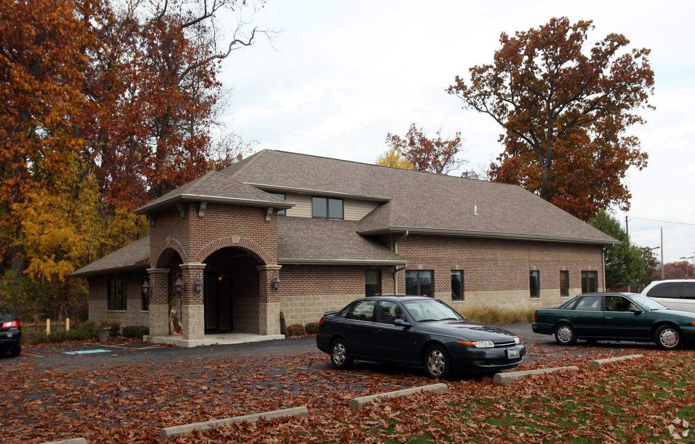
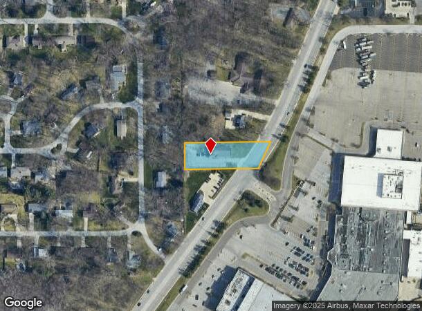
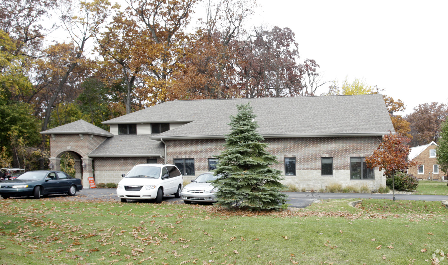
Property Record
16329 State Road 23, South Bend, IN 46635
NEARBY LISTINGS FOR SALE OR LEASE
Property Detail
16329 State Road 23
71-04-28-109-018.000-003
.833 AC TR BEG 776.13 S COR E 1/2 NW 1/4 SEC 28-38-3E (EX.037 AC STRIP END ADJ TO IN 23)
Medicalbuilding
St Joseph
X
Indiana
18141C0202D
0.65 AC
2023
Outlying St Joseph County
2023
South Bend/Mishawaka
011306
South Bend-Mishawaka, IN-MI
4,130 SF
DEMOGRAPHICS near 16329 State Road 23
1 Mile
3 Mile
5 Mile
2024 Total Population
5,241
57,807
148,566
2029 Population
5,197
57,479
148,550
Pop Growth 2024-2029
(0.84%)
(0.57%)
(0.01%)
Average Age
42
39
38
2024 Total Households
2,200
23,253
59,139
HH Growth 2024-2029
(0.86%)
(0.47%)
+ 0.04%
Median Household Inc
$81,688
$66,940
$58,707
Avg Household Size
2.30
2.20
2.30
2024 Avg HH Vehicles
2.00
2.00
2.00
Median Home Value
$205,844
$214,665
$169,812
Median Year Built
1980
1980
1968
Nearby Places
- Restaurants
- Banks
- Shops
- Fitness
- Groceries
PUBLIC TRANSPORTATION
COMMUTER RAIL
South Bend Amtrak Station (Capitol Limited - Amtrak, Lake Shore Limited - Amtrak)
DRIVE
WALK
Distance
South Bend Amtrak Station (Capitol Limited - Amtrak, Lake Shore Limited - Amtrak)
15 min
6.6 mi
South Bend Airport Station (South Shore Line - Northern Indiana Commuter Transportation District (South Shore Line))
DRIVE
WALK
Distance
South Bend Airport Station (South Shore Line - Northern Indiana Commuter Transportation District (South Shore Line))
17 min
8.2 mi
AIRPORT
South Bend International
DRIVE
WALK
Distance
South Bend International
26 min
10.4 mi
Freight Ports
Port Milwaukee
DRIVE
WALK
Distance
Port Milwaukee
222 min
181.8 mi
Nearby Properties
Address
Land Use
TOTAL SIZE
Lot Size
Zoning
Address
Land Use
TOTAL SIZE
Lot Size
Zoning
3,860,146 SF
436.76 AC
Address
Land Use
TOTAL SIZE
Lot Size
Zoning
24,392 SF
48.07 AC
Address
Land Use
TOTAL SIZE
Lot Size
Zoning
625,641 SF
89.04 AC
Address
Land Use
TOTAL SIZE
Lot Size
Zoning
808,463 SF
30.51 AC
Address
Land Use
TOTAL SIZE
Lot Size
Zoning
685,516 SF
62.26 AC
Address
Land Use
TOTAL SIZE
Lot Size
Zoning
294,502 SF
21.28 AC
Address
Land Use
TOTAL SIZE
Lot Size
Zoning
529,154 SF
30.30 AC
Address
Land Use
TOTAL SIZE
Lot Size
Zoning
276,540 SF
13.81 AC
Address
Land Use
TOTAL SIZE
Lot Size
Zoning
233,750 SF
19.80 AC
Address
Land Use
TOTAL SIZE
Lot Size
Zoning
426,478 SF
6 AC
Address
Land Use
TOTAL SIZE
Lot Size
Zoning
120,892 SF
114.29 AC
Address
Land Use
TOTAL SIZE
Lot Size
Zoning
160,546 SF
Address
Land Use
TOTAL SIZE
Lot Size
Zoning
276,683 SF
30.53 AC
Address
Land Use
TOTAL SIZE
Lot Size
Zoning
254,564 SF
Address
Land Use
TOTAL SIZE
Lot Size
Zoning
599,502 SF
39.10 AC
Address
Land Use
TOTAL SIZE
Lot Size
Zoning
239,363 SF
8.26 AC
Address
Land Use
TOTAL SIZE
Lot Size
Zoning
195,495 SF
17.90 AC
Address
Land Use
TOTAL SIZE
Lot Size
Zoning
410,568 SF
29.14 AC
Address
Land Use
TOTAL SIZE
Lot Size
Zoning
146,854 SF
11.57 AC
Address
Land Use
TOTAL SIZE
Lot Size
Zoning
18,028 SF
80.67 AC
Address
Land Use
TOTAL SIZE
Lot Size
Zoning
802,926 SF
49.31 AC
Address
Land Use
TOTAL SIZE
Lot Size
Zoning
140,994 SF
13.58 AC
Address
Land Use
TOTAL SIZE
Lot Size
Zoning
331,913 SF
30 AC
Address
Land Use
TOTAL SIZE
Lot Size
Zoning
158,214 SF
1.66 AC
Address
Land Use
TOTAL SIZE
Lot Size
Zoning
146,337 SF
20.82 AC
Address
Land Use
TOTAL SIZE
Lot Size
Zoning
174,997 SF
0.70 AC
Address
Land Use
TOTAL SIZE
Lot Size
Zoning
347,751 SF
32.52 AC
Address
Land Use
TOTAL SIZE
Lot Size
Zoning
192,770 SF
12.21 AC
Address
Land Use
TOTAL SIZE
Lot Size
Zoning
151,852 SF
0.86 AC
Address
Land Use
TOTAL SIZE
Lot Size
Zoning
360,056 SF
19.59 AC
The World's #1 Commercial Real Estate Marketplace
Connect with us
© 2025 CoStar Group
The information above has been obtained from sources believed reliable. While we do not doubt its accuracy we have not verified it and make no guarantee, warranty or representation about it. It is your responsibility to independently confirm its accuracy and completeness. Any projections, opinions, assumptions, or estimates used are for example only and do not represent the current or future performance of the property. The value of this transaction to you depends on tax and other factors which should be evaluated by your tax, financial, and legal advisors. You and your advisors should conduct a careful, independent investigation of the property to determine to your satisfaction the suitability of the property for your needs.