Property Record
2110 Dead Indian Memorial Rd, Ashland, OR 97520


NEARBY LISTINGS FOR SALE OR LEASE
-
-
View all Ashland listings for sale on LoopNet.com
Property Detail
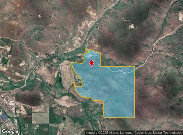
2110 Dead Indian Memorial Rd
10104111
Jackson
Farms
Oregon
A
154.16 AC
41029C2209G
Medford/Grants Pass
2023
Other Market Areas
2024
Medford, OR
002500
DEMOGRAPHICS near 2110 Dead Indian Memorial Rd
1 Mile
3 Mile
5 Mile
2024 Total Population
93
8,982
26,534
2029 Population
92
9,245
27,161
Pop Growth 2024-2029
(1.08%)
+ 2.93%
+ 2.36%
Average Age
48
45
44
2024 Total Households
38
4,279
12,212
HH Growth 2024-2029
(2.63%)
+ 2.97%
+ 2.53%
Median Household Inc
$80,357
$63,963
$64,564
Avg Household Size
2.50
2.00
2.00
2024 Avg HH Vehicles
3.00
2.00
2.00
Median Home Value
$694,444
$484,232
$553,660
Median Year Built
1977
1988
1985
Nearby Places
- Restaurants
- Banks
- Shops
- Fitness
- Groceries
PUBLIC TRANSPORTATION
AIRPORT
Rogue Valley International - Medford
DRIVE
WALK
Distance
Rogue Valley International - Medford
32 min
20.5 mi
Freight Ports
Port of Coos Bay, OR
DRIVE
WALK
Distance
Port of Coos Bay, OR
240 min
181.9 mi
SALE & LEASE HISTORY
LISTING DATE
SALE/LEASE

Jun 08, 2021
For Sale
Nearby Properties
Address
Land Use
TOTAL SIZE
Lot Size
Zoning
Address
Land Use
TOTAL SIZE
Lot Size
Zoning
25.14 AC
R-1-5
Address
Land Use
TOTAL SIZE
Lot Size
Zoning
9.73 AC
R-1-5
Address
Land Use
TOTAL SIZE
Lot Size
Zoning
80 AC
WR-20
Address
Land Use
TOTAL SIZE
Lot Size
Zoning
3.46 AC
R-2
Address
Land Use
TOTAL SIZE
Lot Size
Zoning
196,614 SF
10.05 AC
C-1
Address
Land Use
TOTAL SIZE
Lot Size
Zoning
320,862 SF
5.91 AC
C-1
Address
Land Use
TOTAL SIZE
Lot Size
Zoning
21,098 SF
56.38 AC
EFU
Address
Land Use
TOTAL SIZE
Lot Size
Zoning
5.71 AC
FR
Address
Land Use
TOTAL SIZE
Lot Size
Zoning
56,386 SF
2.98 AC
C-1
Address
Land Use
TOTAL SIZE
Lot Size
Zoning
40,673 SF
2.72 AC
C-1
Address
Land Use
TOTAL SIZE
Lot Size
Zoning
104,679 SF
3.59 AC
R-3
Address
Land Use
TOTAL SIZE
Lot Size
Zoning
0.53 AC
RR-5
Address
Land Use
TOTAL SIZE
Lot Size
Zoning
45,096 SF
2.57 AC
R-2
Address
Land Use
TOTAL SIZE
Lot Size
Zoning
43,456 SF
3.99 AC
C-1
Address
Land Use
TOTAL SIZE
Lot Size
Zoning
45,310 SF
1.78 AC
C-1
Address
Land Use
TOTAL SIZE
Lot Size
Zoning
12.12 AC
R-2
Address
Land Use
TOTAL SIZE
Lot Size
Zoning
38,784 SF
1.41 AC
E-1
Address
Land Use
TOTAL SIZE
Lot Size
Zoning
5,280 SF
20.05 AC
EFU
Address
Land Use
TOTAL SIZE
Lot Size
Zoning
75,078 SF
3.99 AC
M-1
Address
Land Use
TOTAL SIZE
Lot Size
Zoning
14,478 SF
19.82 AC
SO
Address
Land Use
TOTAL SIZE
Lot Size
Zoning
9.57 AC
WR
Address
Land Use
TOTAL SIZE
Lot Size
Zoning
26,146 SF
0.86 AC
C-1
Address
Land Use
TOTAL SIZE
Lot Size
Zoning
31,269 SF
2.90 AC
C-1
Address
Land Use
TOTAL SIZE
Lot Size
Zoning
25,847 SF
1.09 AC
C-1
Address
Land Use
TOTAL SIZE
Lot Size
Zoning
55,000 SF
4.48 AC
E-1
Address
Land Use
TOTAL SIZE
Lot Size
Zoning
79,213 SF
5.92 AC
E-1
Address
Land Use
TOTAL SIZE
Lot Size
Zoning
29.80 AC
E-1
Address
Land Use
TOTAL SIZE
Lot Size
Zoning
1.97 AC
E-1
Address
Land Use
TOTAL SIZE
Lot Size
Zoning
16.12 AC
R-1-5
Address
Land Use
TOTAL SIZE
Lot Size
Zoning
81,280 SF
1.81 AC
R-3
The World's #1 Commercial Real Estate Marketplace
Connect with us
© 2025 CoStar Group
The information above has been obtained from sources believed reliable. While we do not doubt its accuracy we have not verified it and make no guarantee, warranty or representation about it. It is your responsibility to independently confirm its accuracy and completeness. Any projections, opinions, assumptions, or estimates used are for example only and do not represent the current or future performance of the property. The value of this transaction to you depends on tax and other factors which should be evaluated by your tax, financial, and legal advisors. You and your advisors should conduct a careful, independent investigation of the property to determine to your satisfaction the suitability of the property for your needs.