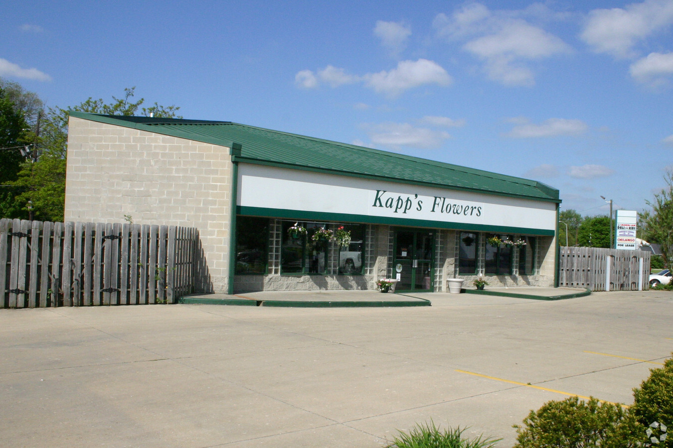
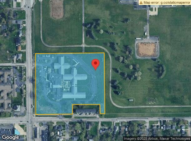
Property Record
1635 N Arlington Ave, Indianapolis, IN 46218
NEARBY LISTINGS FOR SALE OR LEASE
Property Detail
1635 N Arlington Ave
49-07-35-108-005.000-701
PT NW1/4 S35 T16 R4 BEG 2026.22 S OF NW CORE 730 S 650 W 51 N 150 W 265 S 150 W414.1 N 650 TO BEG 10.034 AC (8.355AC TAXABLE)
Hospitalprivate
Marion
X
Indiana
18097C0162F
8.36 AC
2023
Lawrence/East County
2023
Indianapolis
360800
Indianapolis-Carmel-Anderson, IN
63,997 SF
DEMOGRAPHICS near 1635 N Arlington Ave
1 Mile
3 Mile
5 Mile
2024 Total Population
12,909
94,779
259,852
2029 Population
12,817
94,844
260,115
Pop Growth 2024-2029
(0.71%)
+ 0.07%
+ 0.10%
Average Age
40
38
37
2024 Total Households
5,623
38,744
108,690
HH Growth 2024-2029
(0.75%)
(0.06%)
+ 0.06%
Median Household Inc
$38,866
$42,362
$47,420
Avg Household Size
2.20
2.30
2.30
2024 Avg HH Vehicles
1.00
1.00
1.00
Median Home Value
$143,839
$119,921
$152,312
Median Year Built
1956
1953
1959
Nearby Places
- Restaurants
- Banks
- Shops
- Fitness
- Groceries
PUBLIC TRANSPORTATION
COMMUTER RAIL
Indianapolis (Cardinal - Amtrak)
DRIVE
WALK
Distance
Indianapolis (Cardinal - Amtrak)
14 min
7.4 mi
AIRPORT
Indianapolis International
DRIVE
WALK
Distance
Indianapolis International
37 min
21.3 mi
Freight Ports
Port of Toledo
DRIVE
WALK
Distance
Port of Toledo
265 min
222.2 mi
Nearby Properties
Address
Land Use
TOTAL SIZE
Lot Size
Zoning
Address
Land Use
TOTAL SIZE
Lot Size
Zoning
25,146 SF
28.58 AC
ZO01
Address
Land Use
TOTAL SIZE
Lot Size
Zoning
1,202,700 SF
77.25 AC
ZO01
Address
Land Use
TOTAL SIZE
Lot Size
Zoning
6,000 SF
8.79 AC
ZO01
Address
Land Use
TOTAL SIZE
Lot Size
Zoning
768,000 SF
29.62 AC
ZO03
Address
Land Use
TOTAL SIZE
Lot Size
Zoning
713,497 SF
69.91 AC
ZO01
Address
Land Use
TOTAL SIZE
Lot Size
Zoning
536,804 SF
25.94 AC
ZO01
Address
Land Use
TOTAL SIZE
Lot Size
Zoning
4,588 SF
24.33 AC
ZO01
Address
Land Use
TOTAL SIZE
Lot Size
Zoning
2,451 SF
0.46 AC
ZO01
Address
Land Use
TOTAL SIZE
Lot Size
Zoning
925,384 SF
49.48 AC
ZO01
Address
Land Use
TOTAL SIZE
Lot Size
Zoning
268,930 SF
20.55 AC
ZO01
Address
Land Use
TOTAL SIZE
Lot Size
Zoning
1,768 SF
30.88 AC
ZO01
Address
Land Use
TOTAL SIZE
Lot Size
Zoning
278,338 SF
14.80 AC
Address
Land Use
TOTAL SIZE
Lot Size
Zoning
269,450 SF
5.85 AC
Address
Land Use
TOTAL SIZE
Lot Size
Zoning
150,929 SF
28.61 AC
ZO01
Address
Land Use
TOTAL SIZE
Lot Size
Zoning
8,054 SF
20.62 AC
Address
Land Use
TOTAL SIZE
Lot Size
Zoning
6,252 SF
17.02 AC
ZO01
Address
Land Use
TOTAL SIZE
Lot Size
Zoning
339,000 SF
9.59 AC
ZO01
Address
Land Use
TOTAL SIZE
Lot Size
Zoning
254,641 SF
29.53 AC
Address
Land Use
TOTAL SIZE
Lot Size
Zoning
77,518 SF
11.69 AC
ZO01
Address
Land Use
TOTAL SIZE
Lot Size
Zoning
616,065 SF
51.20 AC
ZO01
Address
Land Use
TOTAL SIZE
Lot Size
Zoning
1,538 SF
14.49 AC
ZO01
Address
Land Use
TOTAL SIZE
Lot Size
Zoning
1,282,569 SF
65.04 AC
ZO01
Address
Land Use
TOTAL SIZE
Lot Size
Zoning
129,209 SF
9.82 AC
ZO01
Address
Land Use
TOTAL SIZE
Lot Size
Zoning
593,228 SF
34.14 AC
ZO01
Address
Land Use
TOTAL SIZE
Lot Size
Zoning
53,988 SF
13.35 AC
ZO01
Address
Land Use
TOTAL SIZE
Lot Size
Zoning
76,663 SF
1.91 AC
Address
Land Use
TOTAL SIZE
Lot Size
Zoning
14,482 SF
8.89 AC
ZO01
Address
Land Use
TOTAL SIZE
Lot Size
Zoning
5,202 SF
26.63 AC
ZO01
Address
Land Use
TOTAL SIZE
Lot Size
Zoning
317,760 SF
15.56 AC
ZO01
Address
Land Use
TOTAL SIZE
Lot Size
Zoning
5.11 AC
ZO01
The World's #1 Commercial Real Estate Marketplace
Connect with us
© 2025 CoStar Group
The information above has been obtained from sources believed reliable. While we do not doubt its accuracy we have not verified it and make no guarantee, warranty or representation about it. It is your responsibility to independently confirm its accuracy and completeness. Any projections, opinions, assumptions, or estimates used are for example only and do not represent the current or future performance of the property. The value of this transaction to you depends on tax and other factors which should be evaluated by your tax, financial, and legal advisors. You and your advisors should conduct a careful, independent investigation of the property to determine to your satisfaction the suitability of the property for your needs.