Property Record
16441 S Harrells Ferry Rd, Baton Rouge, LA 70816

Property Detail
16441 S Harrells Ferry Rd
Baton Rouge, LA
WARD: 3-0, SUBDIVISION: RANNEY, PAUL E. ETAL TRACT, LOT: 2-B-1. CONT. 17.403 ACRES RESUB. OF TRACT 2-B OF THE PAUL E. RANNEY
01495577
East Baton Rouge
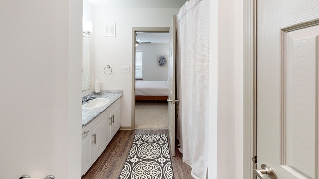
Apartment
Louisiana
AE The base floodplain where base flood elevations are provided. AE Zones are now used on new format FIRMs instead of A1-A30 Zones.
2-b-1
2025
17.40 AC
2025
Shenandoah
004511
Baton Rouge
742,463 SF
NEARBY LISTINGS FOR SALE OR LEASE
-
-
View all Baton Rouge listings for sale on LoopNet.com
DEMOGRAPHICS near 16441 S Harrells Ferry Rd
1 mile
3 mile
5 mile
2025 Total Population
6,607
59,392
132,271
2030 Population
6,614
58,737
132,153
Pop Growth 2025-2030
+ 0.11%
(1.10%)
(0.09%)
Average Age
36
39
38
2025 Total Households
2,489
23,373
52,382
HH Growth 2025-2030
(0.32%)
(1.27%)
(0.25%)
Median Household Inc
$81,484
$80,004
$73,551
Avg Household Size
2.60
2.50
2.40
2025 Avg HH Vehicles
2.00
2.00
2.00
Median Home Value
$275,670
$277,829
$258,348
Median Year Built
1994
1986
1986
Nearby Places
Map Layers
Map Styles
 Street
 Aerial
Layers
 Traffic
 Biking
Places
Listings with unknown addresses are not visible on the map
- Restaurants
- Banks
- Shops
- Fitness
- Groceries
PUBLIC TRANSPORTATION
AIRPORT
Baton Rouge Metro Ryan Field
Drive
Walk
Distance
Baton Rouge Metro Ryan Field
23 min
14.4 mi
Freight Ports
Port of Greater Baton Rouge
Drive
Walk
Distance
Port of Greater Baton Rouge
24 min
15.6 mi
Nearby Properties
Address
Land Use
TOTAL SIZE
Lot Size
Zoning
Address
Land Use
TOTAL SIZE
Lot Size
Zoning
375,748 SF
25.58 AC
Address
Land Use
TOTAL SIZE
Lot Size
Zoning
Address
Land Use
TOTAL SIZE
Lot Size
Zoning
481,760 SF
18.31 AC
Address
Land Use
TOTAL SIZE
Lot Size
Zoning
Address
Land Use
TOTAL SIZE
Lot Size
Zoning
13.07 AC
Address
Land Use
TOTAL SIZE
Lot Size
Zoning
145,622 SF
25.07 AC
Address
Land Use
TOTAL SIZE
Lot Size
Zoning
Address
Land Use
TOTAL SIZE
Lot Size
Zoning
Address
Land Use
TOTAL SIZE
Lot Size
Zoning
Address
Land Use
TOTAL SIZE
Lot Size
Zoning
257,282 SF
12.27 AC
Address
Land Use
TOTAL SIZE
Lot Size
Zoning
9.45 AC
Address
Land Use
TOTAL SIZE
Lot Size
Zoning
25.54 AC
Address
Land Use
TOTAL SIZE
Lot Size
Zoning
112,314 SF
10.16 AC
Address
Land Use
TOTAL SIZE
Lot Size
Zoning
15.16 AC
Address
Land Use
TOTAL SIZE
Lot Size
Zoning
199,026 SF
19.52 AC
Address
Land Use
TOTAL SIZE
Lot Size
Zoning
341,964 SF
18.67 AC
Address
Land Use
TOTAL SIZE
Lot Size
Zoning
14.11 AC
Address
Land Use
TOTAL SIZE
Lot Size
Zoning
Address
Land Use
TOTAL SIZE
Lot Size
Zoning
228,512 SF
9.77 AC
Address
Land Use
TOTAL SIZE
Lot Size
Zoning
14.31 AC
Address
Land Use
TOTAL SIZE
Lot Size
Zoning
Address
Land Use
TOTAL SIZE
Lot Size
Zoning
54,637 SF
40.37 AC
Address
Land Use
TOTAL SIZE
Lot Size
Zoning
119,533 SF
2 AC
Address
Land Use
TOTAL SIZE
Lot Size
Zoning
Address
Land Use
TOTAL SIZE
Lot Size
Zoning
Address
Land Use
TOTAL SIZE
Lot Size
Zoning
79,751 SF
33.73 AC
Address
Land Use
TOTAL SIZE
Lot Size
Zoning
10.50 AC
Address
Land Use
TOTAL SIZE
Lot Size
Zoning
71,818 SF
9.43 AC
Address
Land Use
TOTAL SIZE
Lot Size
Zoning
11.85 AC
The World's #1 Commercial Real Estate Marketplace
Connect with us
© 2026 CoStar Group
The information above has been obtained from sources believed reliable. While we do not doubt its accuracy we have not verified it and make no guarantee, warranty or representation about it. It is your responsibility to independently confirm its accuracy and completeness. Any projections, opinions, assumptions, or estimates used are for example only and do not represent the current or future performance of the property. The value of this transaction to you depends on tax and other factors which should be evaluated by your tax, financial, and legal advisors. You and your advisors should conduct a careful, independent investigation of the property to determine to your satisfaction the suitability of the property for your needs.