Property Record
165 Butler Rd, Kittanning, PA 16201


NEARBY LISTINGS FOR SALE OR LEASE
Property Detail
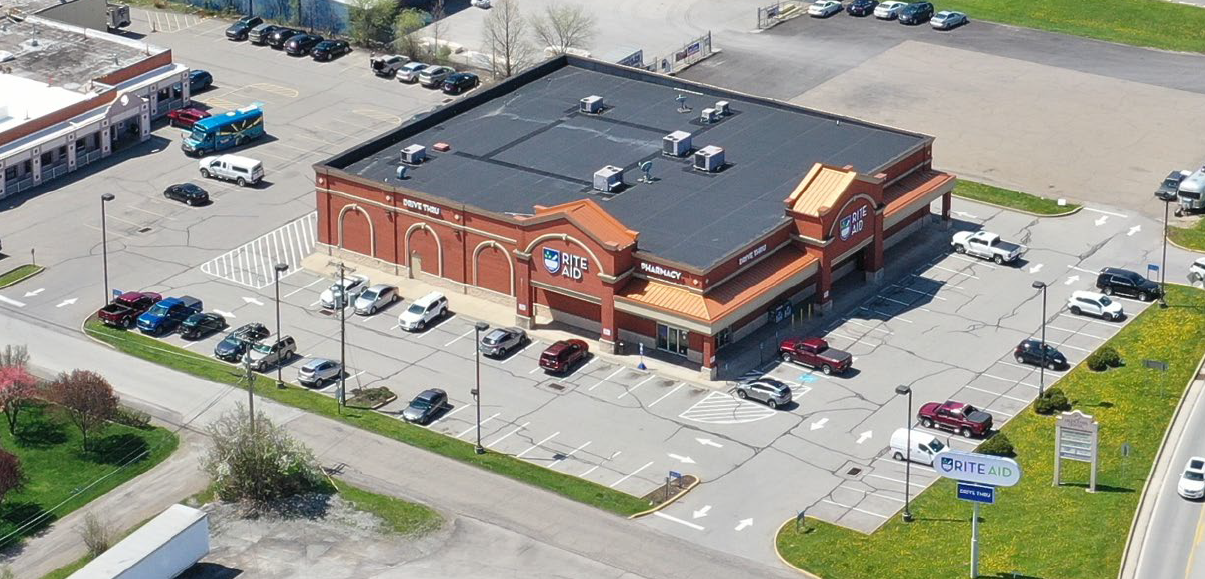
165 Butler Rd
50-0-035007
Highlands Center Plan Of Lots
Storebuilding
MAP NO:130.11-03-04; 0.613A - PAVED PARKING LOT
X
Armstrong
42005C0317D
Pennsylvania
2024
0.78 AC
2024
Armstrong County
951200
Pittsburgh
14,604 SF
Pittsburgh, PA
DEMOGRAPHICS near 165 Butler Rd
1 Mile
3 Mile
5 Mile
2024 Total Population
3,391
15,004
20,796
2029 Population
3,339
14,774
20,467
Pop Growth 2024-2029
(1.53%)
(1.53%)
(1.58%)
Average Age
47
44
45
2024 Total Households
1,657
6,761
9,228
HH Growth 2024-2029
(1.39%)
(1.48%)
(1.55%)
Median Household Inc
$42,554
$51,431
$55,051
Avg Household Size
2.00
2.20
2.20
2024 Avg HH Vehicles
1.00
2.00
2.00
Median Home Value
$133,333
$105,413
$127,988
Median Year Built
1954
1952
1955
Nearby Places
- Restaurants
- Banks
- Shops
- Fitness
- Groceries
SALE & LEASE HISTORY
LISTING DATE
SALE/LEASE

Oct 22, 2020
For Sale
Jul 05, 2017
For Sale
Apr 11, 2022
For Sale
Nearby Properties
Address
Land Use
TOTAL SIZE
Lot Size
Zoning
Address
Land Use
TOTAL SIZE
Lot Size
Zoning
233,203 SF
9.93 AC
Address
Land Use
TOTAL SIZE
Lot Size
Zoning
294,106 SF
68 AC
Address
Land Use
TOTAL SIZE
Lot Size
Zoning
145,792 SF
13.04 AC
COMMERCIAL
Address
Land Use
TOTAL SIZE
Lot Size
Zoning
112,395 SF
13 AC
Address
Land Use
TOTAL SIZE
Lot Size
Zoning
75,000 SF
121.87 AC
Address
Land Use
TOTAL SIZE
Lot Size
Zoning
37,066 SF
60.59 AC
Address
Land Use
TOTAL SIZE
Lot Size
Zoning
79,630 SF
109.35 AC
RESIDENTIA
Address
Land Use
TOTAL SIZE
Lot Size
Zoning
90,000 SF
49.36 AC
Address
Land Use
TOTAL SIZE
Lot Size
Zoning
31,984 SF
0.78 AC
BUSINESS
Address
Land Use
TOTAL SIZE
Lot Size
Zoning
27,200 SF
5.98 AC
INDUSTRIAL
Address
Land Use
TOTAL SIZE
Lot Size
Zoning
96,646 SF
7.90 AC
COMMERCIAL
Address
Land Use
TOTAL SIZE
Lot Size
Zoning
42,795 SF
7.89 AC
INDUSTRIAL
Address
Land Use
TOTAL SIZE
Lot Size
Zoning
113,651 SF
4.49 AC
Address
Land Use
TOTAL SIZE
Lot Size
Zoning
42,238 SF
1.50 AC
PUBLIC
Address
Land Use
TOTAL SIZE
Lot Size
Zoning
57,435 SF
7.11 AC
Address
Land Use
TOTAL SIZE
Lot Size
Zoning
31,290 SF
2.93 AC
COMMERCIAL
Address
Land Use
TOTAL SIZE
Lot Size
Zoning
89,326 SF
1.01 AC
PUBLIC
Address
Land Use
TOTAL SIZE
Lot Size
Zoning
72,840 SF
1.08 AC
RESIDENTIA
Address
Land Use
TOTAL SIZE
Lot Size
Zoning
36,441 SF
22.55 AC
COMMERCIAL
Address
Land Use
TOTAL SIZE
Lot Size
Zoning
83,216 SF
1.15 AC
PUBLIC
Address
Land Use
TOTAL SIZE
Lot Size
Zoning
28,431 SF
1.26 AC
Address
Land Use
TOTAL SIZE
Lot Size
Zoning
61,978 SF
0.91 AC
PUBLIC
Address
Land Use
TOTAL SIZE
Lot Size
Zoning
31,104 SF
7.22 AC
Address
Land Use
TOTAL SIZE
Lot Size
Zoning
35,940 SF
24.59 AC
COMMERCIAL
Address
Land Use
TOTAL SIZE
Lot Size
Zoning
22,792 SF
0.48 AC
COMMERCIAL
Address
Land Use
TOTAL SIZE
Lot Size
Zoning
29,456 SF
3.70 AC
Address
Land Use
TOTAL SIZE
Lot Size
Zoning
20,040 SF
0.72 AC
MEDIUM DEN
Address
Land Use
TOTAL SIZE
Lot Size
Zoning
54,048 SF
4 AC
COMMERCIAL
Address
Land Use
TOTAL SIZE
Lot Size
Zoning
12,146 SF
6.87 AC
The World's #1 Commercial Real Estate Marketplace
Connect with us
© 2025 CoStar Group
The information above has been obtained from sources believed reliable. While we do not doubt its accuracy we have not verified it and make no guarantee, warranty or representation about it. It is your responsibility to independently confirm its accuracy and completeness. Any projections, opinions, assumptions, or estimates used are for example only and do not represent the current or future performance of the property. The value of this transaction to you depends on tax and other factors which should be evaluated by your tax, financial, and legal advisors. You and your advisors should conduct a careful, independent investigation of the property to determine to your satisfaction the suitability of the property for your needs.