Property Record
165 Fort Pickens Rd, Gulf Breeze, FL 32561
NEARBY LISTINGS FOR SALE OR LEASE
-
-
View all Gulf Breeze listings for sale on LoopNet.com
Property Detail
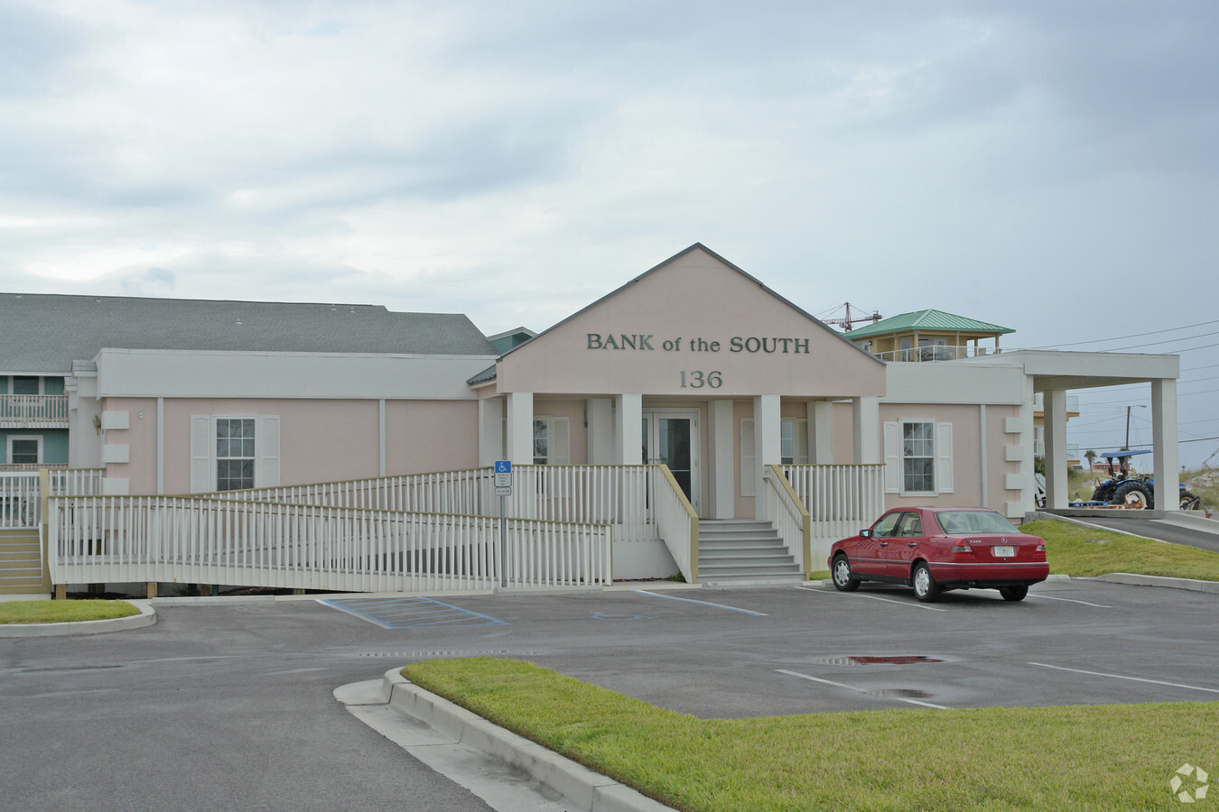
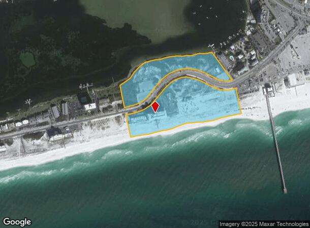
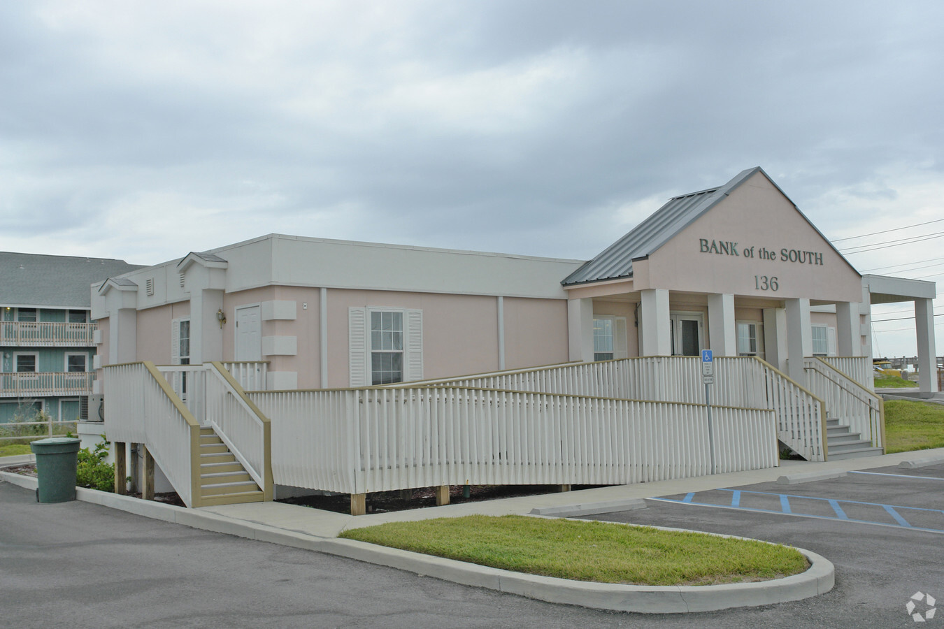
165 Fort Pickens Rd
Pensacola-Ferry Pass-Brent, FL
Villa Sabine 1St Addn
28-2S-26-2000-001-002
BLK B & BLK J 1ST ADDN VILLA SABINE PB 5 P 75 OR 1421 P 185 LESS RD R/W SHEET 6
Hotel
Escambia
VE
Florida
12033C0559G
1
2023
25.06 AC
2024
Pensacola Beach
002500
Pensacola
130,923 SF
DEMOGRAPHICS near 165 Fort Pickens Rd
1 Mile
3 Mile
5 Mile
2024 Total Population
1,463
8,986
20,475
2029 Population
1,634
10,142
23,264
Pop Growth 2024-2029
+ 11.69%
+ 12.86%
+ 13.62%
Average Age
51
48
46
2024 Total Households
700
4,054
8,724
HH Growth 2024-2029
+ 11.86%
+ 12.93%
+ 13.80%
Median Household Inc
$113,527
$113,317
$109,735
Avg Household Size
2.10
2.20
2.30
2024 Avg HH Vehicles
2.00
2.00
2.00
Median Home Value
$526,680
$532,656
$484,486
Median Year Built
1987
1980
1985
Nearby Places
- Restaurants
- Banks
- Shops
- Fitness
- Groceries
PUBLIC TRANSPORTATION
AIRPORT
Pensacola International
DRIVE
WALK
Distance
Pensacola International
28 min
13.9 mi
Freight Ports
Port of Mobile
DRIVE
WALK
Distance
Port of Mobile
85 min
67.7 mi
Nearby Properties
Address
Land Use
TOTAL SIZE
Lot Size
Zoning
Address
Land Use
TOTAL SIZE
Lot Size
Zoning
3,476 SF
540 AC
Address
Land Use
TOTAL SIZE
Lot Size
Zoning
10,134 SF
308 AC
Address
Land Use
TOTAL SIZE
Lot Size
Zoning
83,895 SF
149.82 AC
P
Address
Land Use
TOTAL SIZE
Lot Size
Zoning
341,192 SF
5.32 AC
CH-PB
Address
Land Use
TOTAL SIZE
Lot Size
Zoning
186,964 SF
21.30 AC
M
Address
Land Use
TOTAL SIZE
Lot Size
Zoning
5,410 SF
72 AC
P
Address
Land Use
TOTAL SIZE
Lot Size
Zoning
120,500 SF
11.11 AC
C1
Address
Land Use
TOTAL SIZE
Lot Size
Zoning
142,141 SF
3.92 AC
HDR/C-PB
Address
Land Use
TOTAL SIZE
Lot Size
Zoning
142,717 SF
5.24 AC
R1A
Address
Land Use
TOTAL SIZE
Lot Size
Zoning
132,772 SF
3.65 AC
CH-PB
Address
Land Use
TOTAL SIZE
Lot Size
Zoning
135,461 SF
9.54 AC
C1
Address
Land Use
TOTAL SIZE
Lot Size
Zoning
109,120 SF
4.65 AC
CH-PB
Address
Land Use
TOTAL SIZE
Lot Size
Zoning
77,250 SF
10 AC
G/C-PB
Address
Land Use
TOTAL SIZE
Lot Size
Zoning
116,896 SF
8.12 AC
C1
Address
Land Use
TOTAL SIZE
Lot Size
Zoning
73,354 SF
0.96 AC
C1
Address
Land Use
TOTAL SIZE
Lot Size
Zoning
106,998 SF
2.82 AC
MDR/C-PB
Address
Land Use
TOTAL SIZE
Lot Size
Zoning
56,031 SF
2.93 AC
C1
Address
Land Use
TOTAL SIZE
Lot Size
Zoning
84,933 SF
4.09 AC
C1
Address
Land Use
TOTAL SIZE
Lot Size
Zoning
1,566 SF
16.74 AC
CON/REC-PB
Address
Land Use
TOTAL SIZE
Lot Size
Zoning
38,717 SF
2.95 AC
C1
Address
Land Use
TOTAL SIZE
Lot Size
Zoning
57,128 SF
3.66 AC
CH-PB
Address
Land Use
TOTAL SIZE
Lot Size
Zoning
65,959 SF
5.28 AC
C1
Address
Land Use
TOTAL SIZE
Lot Size
Zoning
50,259 SF
3.52 AC
C1
Address
Land Use
TOTAL SIZE
Lot Size
Zoning
62,335 SF
8.76 AC
R1A
Address
Land Use
TOTAL SIZE
Lot Size
Zoning
70,426 SF
1.61 AC
C1
Address
Land Use
TOTAL SIZE
Lot Size
Zoning
8,702 SF
8.49 AC
PR-PB,REC/
Address
Land Use
TOTAL SIZE
Lot Size
Zoning
67,845 SF
3 AC
R1
Address
Land Use
TOTAL SIZE
Lot Size
Zoning
43,495 SF
2.89 AC
C1
Address
Land Use
TOTAL SIZE
Lot Size
Zoning
28,913 SF
2.41 AC
C1
The World's #1 Commercial Real Estate Marketplace
Connect with us
© 2025 CoStar Group
The information above has been obtained from sources believed reliable. While we do not doubt its accuracy we have not verified it and make no guarantee, warranty or representation about it. It is your responsibility to independently confirm its accuracy and completeness. Any projections, opinions, assumptions, or estimates used are for example only and do not represent the current or future performance of the property. The value of this transaction to you depends on tax and other factors which should be evaluated by your tax, financial, and legal advisors. You and your advisors should conduct a careful, independent investigation of the property to determine to your satisfaction the suitability of the property for your needs.