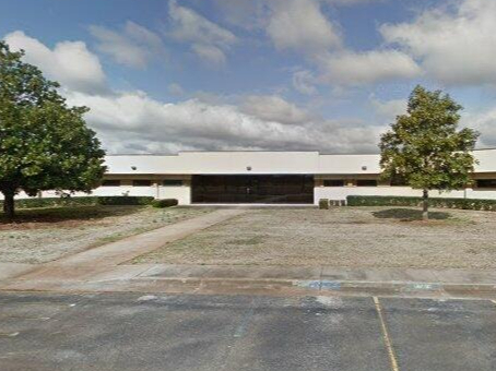
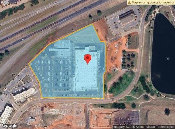
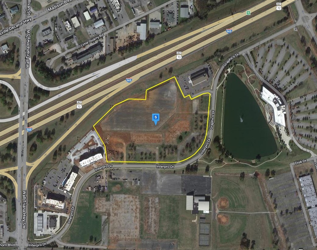
Property Record
165 Graphics Dr, Madison, AL 35758
NEARBY LISTINGS FOR SALE OR LEASE
Property Detail
165 Graphics Dr
Huntsville, AL
Intergraph North Campus Ph 5
16-05-21-0-000-080.004
LOT 4 INTERGRAPH NORTH CAMPUS PH 6 PB# 2022-315
Departmentstore
Madison
X
Alabama
01089C0311F
4
2024
12 AC
2024
Jetplex/Madison
011203
Huntsville
DEMOGRAPHICS near 165 Graphics Dr
1 Mile
3 Mile
5 Mile
2024 Total Population
1,993
31,040
69,702
2029 Population
2,194
34,548
78,040
Pop Growth 2024-2029
+ 10.09%
+ 11.30%
+ 11.96%
Average Age
38
38
38
2024 Total Households
1,123
13,505
27,469
HH Growth 2024-2029
+ 10.42%
+ 11.68%
+ 12.23%
Median Household Inc
$55,806
$91,276
$105,326
Avg Household Size
1.80
2.30
2.50
2024 Avg HH Vehicles
1.00
2.00
2.00
Median Home Value
$185,592
$319,664
$326,636
Median Year Built
1995
1998
2000
Nearby Places
- Restaurants
- Banks
- Shops
- Fitness
- Groceries
PUBLIC TRANSPORTATION
AIRPORT
Huntsville International-Carl T Jones Field
DRIVE
WALK
Distance
Huntsville International-Carl T Jones Field
10 min
4.5 mi
Freight Ports
Port of Mobile
DRIVE
WALK
Distance
Port of Mobile
377 min
345.7 mi
Nearby Properties
Address
Land Use
TOTAL SIZE
Lot Size
Zoning
Address
Land Use
TOTAL SIZE
Lot Size
Zoning
Address
Land Use
TOTAL SIZE
Lot Size
Zoning
31,506 SF
5.28 AC
Address
Land Use
TOTAL SIZE
Lot Size
Zoning
Address
Land Use
TOTAL SIZE
Lot Size
Zoning
Address
Land Use
TOTAL SIZE
Lot Size
Zoning
5,487 SF
30 AC
Address
Land Use
TOTAL SIZE
Lot Size
Zoning
Address
Land Use
TOTAL SIZE
Lot Size
Zoning
Address
Land Use
TOTAL SIZE
Lot Size
Zoning
4,431 SF
23.55 AC
Address
Land Use
TOTAL SIZE
Lot Size
Zoning
29,400 SF
80 AC
Address
Land Use
TOTAL SIZE
Lot Size
Zoning
6.40 AC
Address
Land Use
TOTAL SIZE
Lot Size
Zoning
Address
Land Use
TOTAL SIZE
Lot Size
Zoning
4,644 SF
20.70 AC
Address
Land Use
TOTAL SIZE
Lot Size
Zoning
4,798 SF
32.72 AC
Address
Land Use
TOTAL SIZE
Lot Size
Zoning
4,631 SF
41.41 AC
Address
Land Use
TOTAL SIZE
Lot Size
Zoning
4,410 SF
13 AC
Address
Land Use
TOTAL SIZE
Lot Size
Zoning
10,852 SF
29.12 AC
Address
Land Use
TOTAL SIZE
Lot Size
Zoning
13,720 SF
40 AC
Address
Land Use
TOTAL SIZE
Lot Size
Zoning
3,948 SF
22.35 AC
Address
Land Use
TOTAL SIZE
Lot Size
Zoning
6,337 SF
35 AC
Address
Land Use
TOTAL SIZE
Lot Size
Zoning
30,552 SF
22.24 AC
Address
Land Use
TOTAL SIZE
Lot Size
Zoning
4.40 AC
Address
Land Use
TOTAL SIZE
Lot Size
Zoning
11 AC
Address
Land Use
TOTAL SIZE
Lot Size
Zoning
20,648 SF
16.89 AC
Address
Land Use
TOTAL SIZE
Lot Size
Zoning
3,073 SF
16.80 AC
Address
Land Use
TOTAL SIZE
Lot Size
Zoning
3,637 SF
22.28 AC
Address
Land Use
TOTAL SIZE
Lot Size
Zoning
2,009 SF
20.06 AC
Address
Land Use
TOTAL SIZE
Lot Size
Zoning
553,868 SF
37 AC
Address
Land Use
TOTAL SIZE
Lot Size
Zoning
7,920 SF
49 AC
Address
Land Use
TOTAL SIZE
Lot Size
Zoning
11,255 SF
37 AC
Address
Land Use
TOTAL SIZE
Lot Size
Zoning
21,000 SF
49 AC
The World's #1 Commercial Real Estate Marketplace
Connect with us
© 2025 CoStar Group
The information above has been obtained from sources believed reliable. While we do not doubt its accuracy we have not verified it and make no guarantee, warranty or representation about it. It is your responsibility to independently confirm its accuracy and completeness. Any projections, opinions, assumptions, or estimates used are for example only and do not represent the current or future performance of the property. The value of this transaction to you depends on tax and other factors which should be evaluated by your tax, financial, and legal advisors. You and your advisors should conduct a careful, independent investigation of the property to determine to your satisfaction the suitability of the property for your needs.