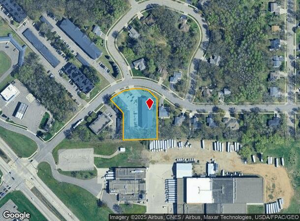
Property Record
1650 7Th St Se, Saint Cloud, MN 56304

NEARBY LISTINGS FOR SALE OR LEASE
Property Detail
1650 7Th St Se
St. Cloud, MN
Oakwood Heights
17.01512.00
SECT-31 TWP-036 RANGE-030 OAKWOOD HEIGHTS PLAT 4 LOT-001 BLOCK-001
Multifamilydwelling
Benton
X
Minnesota
27145C0645E
1
2024
1.28 AC
2024
Outlying Benton County
021201
Minneapolis/St Paul
DEMOGRAPHICS near 1650 7Th St Se
1 Mile
3 Mile
5 Mile
2024 Total Population
7,604
46,812
87,474
2029 Population
7,989
48,463
90,395
Pop Growth 2024-2029
+ 5.06%
+ 3.53%
+ 3.34%
Average Age
34
35
37
2024 Total Households
3,203
17,877
34,511
HH Growth 2024-2029
+ 4.87%
+ 3.54%
+ 3.36%
Median Household Inc
$44,704
$47,657
$53,771
Avg Household Size
2.30
2.30
2.30
2024 Avg HH Vehicles
2.00
2.00
2.00
Median Home Value
$161,836
$165,432
$190,572
Median Year Built
1976
1973
1981
Nearby Places
- Restaurants
- Banks
- Shops
- Fitness
- Groceries
PUBLIC TRANSPORTATION
COMMUTER RAIL
St. Cloud Amtrak Station (Empire Builder - Amtrak)
DRIVE
WALK
Distance
St. Cloud Amtrak Station (Empire Builder - Amtrak)
3 min
1.6 mi
Freight Ports
Port Milwaukee
DRIVE
WALK
Distance
Port Milwaukee
448 min
401.2 mi
Nearby Properties
Address
Land Use
TOTAL SIZE
Lot Size
Zoning
Address
Land Use
TOTAL SIZE
Lot Size
Zoning
16.60 AC
MD
Address
Land Use
TOTAL SIZE
Lot Size
Zoning
154.73 AC
I
Address
Land Use
TOTAL SIZE
Lot Size
Zoning
Address
Land Use
TOTAL SIZE
Lot Size
Zoning
281,127 SF
135,381 AC
PUD95
Address
Land Use
TOTAL SIZE
Lot Size
Zoning
15.77 AC
Address
Land Use
TOTAL SIZE
Lot Size
Zoning
252,469 SF
35 AC
Address
Land Use
TOTAL SIZE
Lot Size
Zoning
Address
Land Use
TOTAL SIZE
Lot Size
Zoning
Address
Land Use
TOTAL SIZE
Lot Size
Zoning
127,460 SF
5 AC
Address
Land Use
TOTAL SIZE
Lot Size
Zoning
183,627 SF
3 AC
R3
Address
Land Use
TOTAL SIZE
Lot Size
Zoning
6.61 AC
Address
Land Use
TOTAL SIZE
Lot Size
Zoning
25,608 SF
6.96 AC
R5
Address
Land Use
TOTAL SIZE
Lot Size
Zoning
100,024 SF
0.47 AC
Address
Land Use
TOTAL SIZE
Lot Size
Zoning
Address
Land Use
TOTAL SIZE
Lot Size
Zoning
112,300 SF
2.27 AC
R3
Address
Land Use
TOTAL SIZE
Lot Size
Zoning
29,349 SF
4.83 AC
Address
Land Use
TOTAL SIZE
Lot Size
Zoning
71,940 SF
1.99 AC
Address
Land Use
TOTAL SIZE
Lot Size
Zoning
13.37 AC
Address
Land Use
TOTAL SIZE
Lot Size
Zoning
136,500 SF
6.02 AC
R5
Address
Land Use
TOTAL SIZE
Lot Size
Zoning
24,642 SF
5.40 AC
R5
Address
Land Use
TOTAL SIZE
Lot Size
Zoning
4.57 AC
Address
Land Use
TOTAL SIZE
Lot Size
Zoning
80,100 SF
11.01 AC
Address
Land Use
TOTAL SIZE
Lot Size
Zoning
4.21 AC
Address
Land Use
TOTAL SIZE
Lot Size
Zoning
107,428 SF
2.67 AC
R3
Address
Land Use
TOTAL SIZE
Lot Size
Zoning
60,532 SF
1.38 AC
C4
Address
Land Use
TOTAL SIZE
Lot Size
Zoning
171,311 SF
1.77 AC
C3
Address
Land Use
TOTAL SIZE
Lot Size
Zoning
22,656 SF
4.81 AC
R5
Address
Land Use
TOTAL SIZE
Lot Size
Zoning
24,216 SF
3.37 AC
R5
Address
Land Use
TOTAL SIZE
Lot Size
Zoning
3.72 AC
The World's #1 Commercial Real Estate Marketplace
Connect with us
© 2025 CoStar Group
The information above has been obtained from sources believed reliable. While we do not doubt its accuracy we have not verified it and make no guarantee, warranty or representation about it. It is your responsibility to independently confirm its accuracy and completeness. Any projections, opinions, assumptions, or estimates used are for example only and do not represent the current or future performance of the property. The value of this transaction to you depends on tax and other factors which should be evaluated by your tax, financial, and legal advisors. You and your advisors should conduct a careful, independent investigation of the property to determine to your satisfaction the suitability of the property for your needs.