Property Record
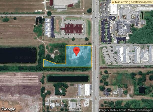
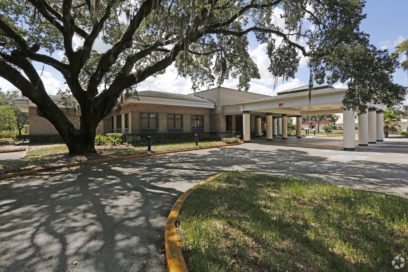
1655 Us Highway 441 N, Okeechobee, FL 34972

NEARBY LISTINGS FOR SALE OR LEASE
Property Detail
1655 Us Highway 441 N
Okeechobee, FL
Conners Highlands
R1-09-37-35-0020-00740-0010
CONNERS HIGHLANDS (PLAT BOOK 1 PAGE 21) LOTS 1 THROUGH 26, INCLUSIVE, BLOCK 74, CONNERS HIGHLANDS, ACCORDING TO THE PLAT THEREOF AS RECORDED IN PLAT BOOK 1, PAGE 21, INCLUDING ALL ALLEYS, OF THE PUBLIC RECORDS OF OKEECHOBEE COUNTY, FLORIDA. LESS AND
Officebuilding
Okeechobee
A
Florida
12093C0415C
1-26
2023
2.86 AC
2023
Florida Central South Area
910201
Other Market Areas
11,489 SF
DEMOGRAPHICS near 1655 Us Highway 441 N
1 Mile
3 Mile
5 Mile
2024 Total Population
1,627
16,361
27,078
2029 Population
1,712
17,325
28,784
Pop Growth 2024-2029
+ 5.22%
+ 5.89%
+ 6.30%
Average Age
39
38
42
2024 Total Households
588
5,588
10,141
HH Growth 2024-2029
+ 5.27%
+ 6.32%
+ 6.82%
Median Household Inc
$28,538
$49,060
$44,730
Avg Household Size
2.60
2.70
2.50
2024 Avg HH Vehicles
2.00
2.00
2.00
Median Home Value
$85,753
$142,167
$135,363
Median Year Built
1983
1983
1985
Nearby Places
- Restaurants
- Banks
- Shops
- Fitness
- Groceries
PUBLIC TRANSPORTATION
COMMUTER RAIL
Okeechobee Amtrak (Silver Star - Amtrak)
DRIVE
WALK
Distance
Okeechobee Amtrak (Silver Star - Amtrak)
1 min
9 min
0.5 mi
Freight Ports
Port of Palm Beach
DRIVE
WALK
Distance
Port of Palm Beach
87 min
60.4 mi
SALE & LEASE HISTORY
LISTING DATE
SALE/LEASE

Jan 11, 2018
For Sale
Nearby Properties
Address
Land Use
TOTAL SIZE
Lot Size
Zoning
Address
Land Use
TOTAL SIZE
Lot Size
Zoning
184,936 SF
49.13 AC
Address
Land Use
TOTAL SIZE
Lot Size
Zoning
156,293 SF
30.69 AC
Address
Land Use
TOTAL SIZE
Lot Size
Zoning
130,899 SF
11.02 AC
Address
Land Use
TOTAL SIZE
Lot Size
Zoning
74,541 SF
110.96 AC
Address
Land Use
TOTAL SIZE
Lot Size
Zoning
97,756 SF
4.13 AC
Address
Land Use
TOTAL SIZE
Lot Size
Zoning
160,231 SF
40 AC
Address
Land Use
TOTAL SIZE
Lot Size
Zoning
96,720 SF
14.79 AC
Address
Land Use
TOTAL SIZE
Lot Size
Zoning
103,221 SF
14.12 AC
Address
Land Use
TOTAL SIZE
Lot Size
Zoning
98,005 SF
30.43 AC
Address
Land Use
TOTAL SIZE
Lot Size
Zoning
86,964 SF
15.10 AC
Address
Land Use
TOTAL SIZE
Lot Size
Zoning
76,920 SF
14.89 AC
Address
Land Use
TOTAL SIZE
Lot Size
Zoning
91,700 SF
20.56 AC
Address
Land Use
TOTAL SIZE
Lot Size
Zoning
6,372 SF
21 AC
Address
Land Use
TOTAL SIZE
Lot Size
Zoning
86,516 SF
15.30 AC
Address
Land Use
TOTAL SIZE
Lot Size
Zoning
78,339 SF
10.74 AC
Address
Land Use
TOTAL SIZE
Lot Size
Zoning
46,330 SF
41 AC
Address
Land Use
TOTAL SIZE
Lot Size
Zoning
46,170 SF
4.22 AC
Address
Land Use
TOTAL SIZE
Lot Size
Zoning
19,768 SF
8 AC
Address
Land Use
TOTAL SIZE
Lot Size
Zoning
2,199 SF
258.06 AC
Address
Land Use
TOTAL SIZE
Lot Size
Zoning
47,304 SF
9.90 AC
Address
Land Use
TOTAL SIZE
Lot Size
Zoning
60,818 SF
7.76 AC
Address
Land Use
TOTAL SIZE
Lot Size
Zoning
775 SF
23.86 AC
Address
Land Use
TOTAL SIZE
Lot Size
Zoning
9,615 SF
7.38 AC
Address
Land Use
TOTAL SIZE
Lot Size
Zoning
9,803 SF
38.65 AC
Address
Land Use
TOTAL SIZE
Lot Size
Zoning
58,580 SF
10.82 AC
Address
Land Use
TOTAL SIZE
Lot Size
Zoning
39,771 SF
34.62 AC
Address
Land Use
TOTAL SIZE
Lot Size
Zoning
1,656 SF
176 AC
Address
Land Use
TOTAL SIZE
Lot Size
Zoning
50,675 SF
5.12 AC
Address
Land Use
TOTAL SIZE
Lot Size
Zoning
30,775 SF
2.48 AC
Address
Land Use
TOTAL SIZE
Lot Size
Zoning
25,746 SF
28.50 AC
The World's #1 Commercial Real Estate Marketplace
Connect with us
© 2025 CoStar Group
The information above has been obtained from sources believed reliable. While we do not doubt its accuracy we have not verified it and make no guarantee, warranty or representation about it. It is your responsibility to independently confirm its accuracy and completeness. Any projections, opinions, assumptions, or estimates used are for example only and do not represent the current or future performance of the property. The value of this transaction to you depends on tax and other factors which should be evaluated by your tax, financial, and legal advisors. You and your advisors should conduct a careful, independent investigation of the property to determine to your satisfaction the suitability of the property for your needs.