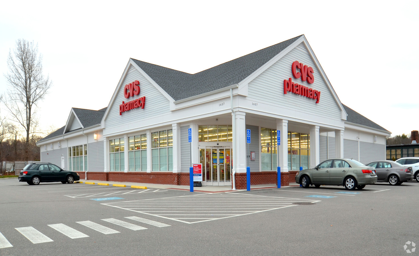
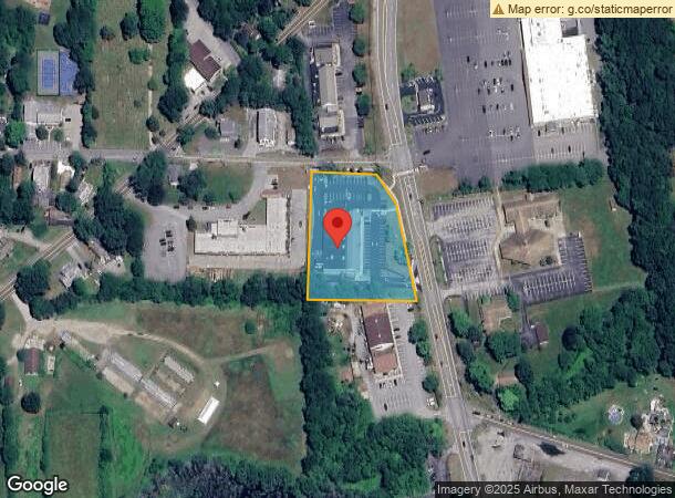
Property Record
1657 Route 12, Gales Ferry, CT 06335
NEARBY LISTINGS FOR SALE OR LEASE
Property Detail
1657 Route 12
LEDY-000091-001050-001657
New London
Commercialbuilding
Connecticut
X
1657
09011C0362J
1.90 AC
2024
New London
2024
Hartford
701200
Norwich-New London, CT
13,677 SF
DEMOGRAPHICS near 1657 Route 12
1 Mile
3 Mile
5 Mile
2024 Total Population
2,675
15,775
50,930
2029 Population
2,657
15,732
50,724
Pop Growth 2024-2029
(0.67%)
(0.27%)
(0.40%)
Average Age
40
41
39
2024 Total Households
1,024
5,776
18,541
HH Growth 2024-2029
(0.68%)
(0.61%)
(0.51%)
Median Household Inc
$94,196
$87,487
$77,415
Avg Household Size
2.60
2.40
2.40
2024 Avg HH Vehicles
2.00
2.00
2.00
Median Home Value
$253,228
$252,927
$251,919
Median Year Built
1966
1969
1970
Nearby Places
- Restaurants
- Banks
- Shops
- Fitness
- Groceries
PUBLIC TRANSPORTATION
COMMUTER RAIL
New London (Shore Line East - Shore Line East)
DRIVE
WALK
Distance
New London (Shore Line East - Shore Line East)
14 min
7.9 mi
Freight Ports
Port of Davisville, RI
DRIVE
WALK
Distance
Port of Davisville, RI
74 min
53.9 mi
SALE & LEASE HISTORY
LISTING DATE
SALE/LEASE

Dec 27, 2021
For Sale
Aug 07, 2019
For Sale
Nearby Properties
Address
Land Use
TOTAL SIZE
Lot Size
Zoning
Address
Land Use
TOTAL SIZE
Lot Size
Zoning
Address
Land Use
TOTAL SIZE
Lot Size
Zoning
251.73 AC
RM40
Address
Land Use
TOTAL SIZE
Lot Size
Zoning
60.63 AC
RU-20
Address
Land Use
TOTAL SIZE
Lot Size
Zoning
69,658 SF
16.31 AC
VR-10
Address
Land Use
TOTAL SIZE
Lot Size
Zoning
113.19 AC
C2/OZ
Address
Land Use
TOTAL SIZE
Lot Size
Zoning
38.30 AC
R40
Address
Land Use
TOTAL SIZE
Lot Size
Zoning
4,415 SF
128.73 AC
R40
Address
Land Use
TOTAL SIZE
Lot Size
Zoning
2.05 AC
RU-20
Address
Land Use
TOTAL SIZE
Lot Size
Zoning
6.54 AC
GOV
Address
Land Use
TOTAL SIZE
Lot Size
Zoning
34,436 SF
19.52 AC
IND
Address
Land Use
TOTAL SIZE
Lot Size
Zoning
18,015 SF
17.16 AC
GOV
Address
Land Use
TOTAL SIZE
Lot Size
Zoning
450,955 SF
157.97 AC
I
Address
Land Use
TOTAL SIZE
Lot Size
Zoning
46,011 SF
4.96 AC
C-2
Address
Land Use
TOTAL SIZE
Lot Size
Zoning
12.02 AC
R20-M
Address
Land Use
TOTAL SIZE
Lot Size
Zoning
26,956 SF
2.07 AC
C-1
Address
Land Use
TOTAL SIZE
Lot Size
Zoning
4.77 AC
R20
Address
Land Use
TOTAL SIZE
Lot Size
Zoning
11.89 AC
GFDD
Address
Land Use
TOTAL SIZE
Lot Size
Zoning
16.58 AC
GOV
Address
Land Use
TOTAL SIZE
Lot Size
Zoning
6.23 AC
CIP
Address
Land Use
TOTAL SIZE
Lot Size
Zoning
9.41 AC
LI
Address
Land Use
TOTAL SIZE
Lot Size
Zoning
8.30 AC
VR-75
Address
Land Use
TOTAL SIZE
Lot Size
Zoning
33.25 AC
R80
Address
Land Use
TOTAL SIZE
Lot Size
Zoning
18,400 SF
1.10 AC
R20
Address
Land Use
TOTAL SIZE
Lot Size
Zoning
4.90 AC
WD
Address
Land Use
TOTAL SIZE
Lot Size
Zoning
2,520 SF
79.35 AC
R20-M
Address
Land Use
TOTAL SIZE
Lot Size
Zoning
6.23 AC
C-1
Address
Land Use
TOTAL SIZE
Lot Size
Zoning
16,385 SF
1.72 AC
C-1
Address
Land Use
TOTAL SIZE
Lot Size
Zoning
11.77 AC
GOV
Address
Land Use
TOTAL SIZE
Lot Size
Zoning
12,267 SF
2.12 AC
R-20
The World's #1 Commercial Real Estate Marketplace
Connect with us
© 2025 CoStar Group
The information above has been obtained from sources believed reliable. While we do not doubt its accuracy we have not verified it and make no guarantee, warranty or representation about it. It is your responsibility to independently confirm its accuracy and completeness. Any projections, opinions, assumptions, or estimates used are for example only and do not represent the current or future performance of the property. The value of this transaction to you depends on tax and other factors which should be evaluated by your tax, financial, and legal advisors. You and your advisors should conduct a careful, independent investigation of the property to determine to your satisfaction the suitability of the property for your needs.