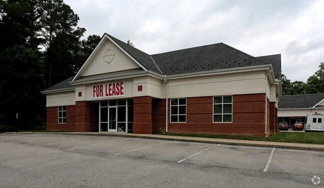
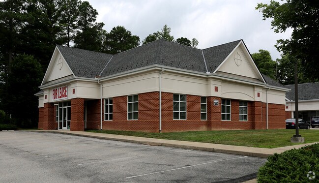
Property Record
1660 Anderson Hwy, Powhatan, VA 23139

Property Detail
1660 Anderson Hwy
042-73A
COLFIELD PCL A
Multipleuses
Powhatan
CC
Virginia
B and X Area of moderate flood hazard, usually the area between the limits of the 100-year and 500-year floods.
73a
2026
2.75 AC
2026
Powhatan
500101
Richmond VA
5,928 SF
Richmond, VA
NEARBY LISTINGS FOR SALE OR LEASE
-
-
View all Powhatan listings for lease on LoopNet.com
DEMOGRAPHICS near 1660 Anderson Hwy
1 mile
3 mile
5 mile
2025 Total Population
862
4,288
22,094
2030 Population
895
4,505
23,497
Pop Growth 2025-2030
+ 3.83%
+ 5.06%
+ 6.35%
Average Age
44
43
41
2025 Total Households
334
1,591
7,926
HH Growth 2025-2030
+ 3.89%
+ 5.03%
+ 6.25%
Median Household Inc
$111,298
$122,499
$138,131
Avg Household Size
2.50
2.70
2.80
2025 Avg HH Vehicles
3.00
3.00
2.00
Median Home Value
$474,999
$542,285
$559,884
Median Year Built
1987
1991
2003
Nearby Places
Map Layers
Map Styles
 Street
 Aerial
Layers
 Traffic
 Biking
Places
Listings with unknown addresses are not visible on the map
- Restaurants
- Banks
- Shops
- Fitness
- Groceries
PUBLIC TRANSPORTATION
AIRPORT
Richmond International
Drive
Walk
Distance
Richmond International
48 min
31.2 mi
Freight Ports
Virginia Port Authority - Richmond
Drive
Walk
Distance
Virginia Port Authority - Richmond
38 min
21.4 mi
SALE & LEASE HISTORY
LISTING DATE
SALE/LEASE

Sep 25, 2016
For Lease
May 09, 2017
For Lease
Nearby Properties
Address
Land Use
TOTAL SIZE
Lot Size
Zoning
Address
Land Use
TOTAL SIZE
Lot Size
Zoning
291,788 SF
61.70 AC
A-10
Address
Land Use
TOTAL SIZE
Lot Size
Zoning
96,428 SF
20.87 AC
A-10
Address
Land Use
TOTAL SIZE
Lot Size
Zoning
149,648 SF
29.73 AC
CC
Address
Land Use
TOTAL SIZE
Lot Size
Zoning
138.73 AC
RTH - RES,
Address
Land Use
TOTAL SIZE
Lot Size
Zoning
61,231 SF
7.80 AC
CC
Address
Land Use
TOTAL SIZE
Lot Size
Zoning
6,515 SF
2.89 AC
O2 - CORP
Address
Land Use
TOTAL SIZE
Lot Size
Zoning
15,322 SF
37.84 AC
I-2
Address
Land Use
TOTAL SIZE
Lot Size
Zoning
102.40 AC
RTH - RES,
Address
Land Use
TOTAL SIZE
Lot Size
Zoning
49,360 SF
17 AC
I-2
Address
Land Use
TOTAL SIZE
Lot Size
Zoning
1,800 SF
5.25 AC
CC
Address
Land Use
TOTAL SIZE
Lot Size
Zoning
21,914 SF
6.95 AC
CC
Address
Land Use
TOTAL SIZE
Lot Size
Zoning
9,408 SF
19.13 AC
A - AGRICU
Address
Land Use
TOTAL SIZE
Lot Size
Zoning
544 SF
2.02 AC
A - AGRICU
Address
Land Use
TOTAL SIZE
Lot Size
Zoning
15,690 SF
3.71 AC
CC
Address
Land Use
TOTAL SIZE
Lot Size
Zoning
12,992 SF
5.09 AC
I-1
Address
Land Use
TOTAL SIZE
Lot Size
Zoning
19,810 SF
1.56 AC
I-1
Address
Land Use
TOTAL SIZE
Lot Size
Zoning
650 AC
A-10
Address
Land Use
TOTAL SIZE
Lot Size
Zoning
84.20 AC
C3 - COMMU
Address
Land Use
TOTAL SIZE
Lot Size
Zoning
12,000 SF
5.08 AC
CC
Address
Land Use
TOTAL SIZE
Lot Size
Zoning
5,928 SF
2.75 AC
CC
Address
Land Use
TOTAL SIZE
Lot Size
Zoning
43.14 AC
I-1
Address
Land Use
TOTAL SIZE
Lot Size
Zoning
15,620 SF
2.48 AC
CC
Address
Land Use
TOTAL SIZE
Lot Size
Zoning
9,000 SF
3.47 AC
CC
Address
Land Use
TOTAL SIZE
Lot Size
Zoning
11,568 SF
14.22 AC
A-10
Address
Land Use
TOTAL SIZE
Lot Size
Zoning
3,848 SF
138.93 AC
A - AGRICU
Address
Land Use
TOTAL SIZE
Lot Size
Zoning
6,624 SF
4.51 AC
I-2
Address
Land Use
TOTAL SIZE
Lot Size
Zoning
10,086 SF
1.58 AC
CC
Address
Land Use
TOTAL SIZE
Lot Size
Zoning
10,080 SF
7.34 AC
I-1
The World's #1 Commercial Real Estate Marketplace
Connect with us
© 2026 CoStar Group
The information above has been obtained from sources believed reliable. While we do not doubt its accuracy we have not verified it and make no guarantee, warranty or representation about it. It is your responsibility to independently confirm its accuracy and completeness. Any projections, opinions, assumptions, or estimates used are for example only and do not represent the current or future performance of the property. The value of this transaction to you depends on tax and other factors which should be evaluated by your tax, financial, and legal advisors. You and your advisors should conduct a careful, independent investigation of the property to determine to your satisfaction the suitability of the property for your needs.