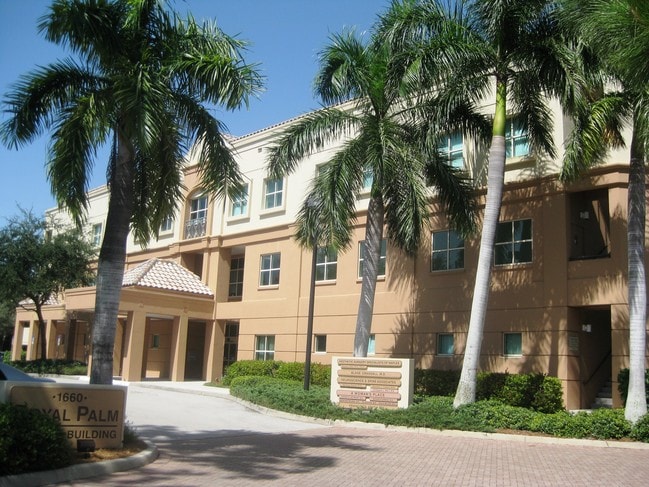
Property Record
1660 Medical Blvd, Naples, FL 34110

NEARBY LISTINGS FOR SALE OR LEASE
Property Detail
1660 Medical Blvd
Naples-Immokalee-Marco Island, FL
Royal Palm Building A Condominium
71360000025
Collier
Condominium
Florida
AE
North Naples
12021C0193J
Southwest Florida
3,540 SF
DEMOGRAPHICS near 1660 Medical Blvd
1 Mile
3 Mile
5 Mile
2024 Total Population
4,460
54,695
121,976
2029 Population
5,056
62,651
140,536
Pop Growth 2024-2029
+ 13.36%
+ 14.55%
+ 15.22%
Average Age
51
54
53
2024 Total Households
1,907
25,628
56,641
HH Growth 2024-2029
+ 12.85%
+ 14.34%
+ 14.85%
Median Household Inc
$76,193
$86,999
$84,053
Avg Household Size
2.10
2.00
2.10
2024 Avg HH Vehicles
2.00
2.00
2.00
Median Home Value
$399,372
$537,641
$494,431
Median Year Built
1992
1995
1995
Nearby Places
Map Layers
Map Styles
 Street
 Aerial
- Restaurants
- Banks
- Shops
- Fitness
- Groceries
PUBLIC TRANSPORTATION
AIRPORT
Southwest Florida International
DRIVE
WALK
Distance
Southwest Florida International
36 min
26.0 mi
Freight Ports
Port Everglades
DRIVE
WALK
Distance
Port Everglades
127 min
112.7 mi
SALE & LEASE HISTORY
LISTING DATE
SALE/LEASE

Sep 24, 2016
For Lease
Nearby Properties
Address
Land Use
TOTAL SIZE
Lot Size
Zoning
Address
Land Use
TOTAL SIZE
Lot Size
Zoning
770,104 SF
26.22 AC
PUD
Address
Land Use
TOTAL SIZE
Lot Size
Zoning
993,493 SF
86.10 AC
PUD
Address
Land Use
TOTAL SIZE
Lot Size
Zoning
735,070 SF
41.34 AC
A
Address
Land Use
TOTAL SIZE
Lot Size
Zoning
377,883 SF
20.34 AC
PUD
Address
Land Use
TOTAL SIZE
Lot Size
Zoning
906,730 SF
7.86 AC
Address
Land Use
TOTAL SIZE
Lot Size
Zoning
313,544 SF
60 AC
A
Address
Land Use
TOTAL SIZE
Lot Size
Zoning
325,993 SF
35.92 AC
A
Address
Land Use
TOTAL SIZE
Lot Size
Zoning
110,908 SF
210.45 AC
A
Address
Land Use
TOTAL SIZE
Lot Size
Zoning
292,967 SF
13.12 AC
PUD
Address
Land Use
TOTAL SIZE
Lot Size
Zoning
426,074 SF
23.25 AC
PUD
Address
Land Use
TOTAL SIZE
Lot Size
Zoning
252,506 SF
36.27 AC
PUD
Address
Land Use
TOTAL SIZE
Lot Size
Zoning
87,499 SF
4.36 AC
Address
Land Use
TOTAL SIZE
Lot Size
Zoning
72,844 SF
15.94 AC
RSF-1
Address
Land Use
TOTAL SIZE
Lot Size
Zoning
435,724 SF
64.61 AC
PUD
Address
Land Use
TOTAL SIZE
Lot Size
Zoning
10,831 SF
155 AC
RMF-16
Address
Land Use
TOTAL SIZE
Lot Size
Zoning
174,770 SF
3.65 AC
PUD
Address
Land Use
TOTAL SIZE
Lot Size
Zoning
227,264 SF
8.72 AC
A
Address
Land Use
TOTAL SIZE
Lot Size
Zoning
363,194 SF
2.51 AC
A
Address
Land Use
TOTAL SIZE
Lot Size
Zoning
181,774 SF
6.19 AC
PUD
Address
Land Use
TOTAL SIZE
Lot Size
Zoning
155,918 SF
27.31 AC
PUD
Address
Land Use
TOTAL SIZE
Lot Size
Zoning
174,365 SF
18.56 AC
PUD
Address
Land Use
TOTAL SIZE
Lot Size
Zoning
206,687 SF
19.85 AC
PUD
Address
Land Use
TOTAL SIZE
Lot Size
Zoning
128,681 SF
49.55 AC
A
Address
Land Use
TOTAL SIZE
Lot Size
Zoning
139,947 SF
4.99 AC
PUD
Address
Land Use
TOTAL SIZE
Lot Size
Zoning
253,108 SF
32.47 AC
PUD
Address
Land Use
TOTAL SIZE
Lot Size
Zoning
230,920 SF
7.80 AC
C-4
Address
Land Use
TOTAL SIZE
Lot Size
Zoning
223,844 SF
27.55 AC
PUD
Address
Land Use
TOTAL SIZE
Lot Size
Zoning
112,623 SF
13.10 AC
PUD
Address
Land Use
TOTAL SIZE
Lot Size
Zoning
4.95 AC
C-3
Address
Land Use
TOTAL SIZE
Lot Size
Zoning
329,031 SF
20 AC
A
The World's #1 Commercial Real Estate Marketplace
Connect with us
© 2025 CoStar Group
The information above has been obtained from sources believed reliable. While we do not doubt its accuracy we have not verified it and make no guarantee, warranty or representation about it. It is your responsibility to independently confirm its accuracy and completeness. Any projections, opinions, assumptions, or estimates used are for example only and do not represent the current or future performance of the property. The value of this transaction to you depends on tax and other factors which should be evaluated by your tax, financial, and legal advisors. You and your advisors should conduct a careful, independent investigation of the property to determine to your satisfaction the suitability of the property for your needs.