Property Record
1661 N Latson Rd, Howell, MI 48843
NEARBY LISTINGS FOR SALE OR LEASE
Property Detail
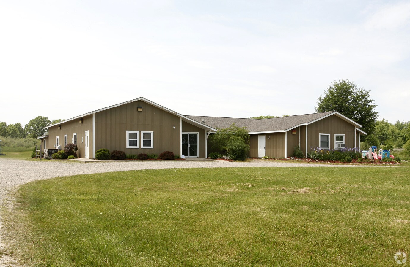
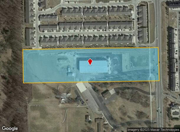
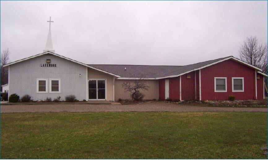
1661 N Latson Rd
07-29-200-012
Part Of Sec 29 T3n R5e
Commercialacreage
SEC 29 T3N R5E COM AT E 1/4 COR , TH N1*E ALG E SEC LINE & C/L LATSON RD. 656.35 FT TO POB, TH N88*W 1328.32 FT, TH N1*E
X
Livingston
26093C0307D
Michigan
0
10.01 AC
2024
Livingston County
7126011000
Detroit
4,308 SF
Detroit-Warren-Dearborn, MI
DEMOGRAPHICS near 1661 N Latson Rd
1 Mile
3 Mile
5 Mile
2024 Total Population
3,108
21,756
45,151
2029 Population
3,219
22,408
46,450
Pop Growth 2024-2029
+ 3.57%
+ 3.00%
+ 2.88%
Average Age
40
41
41
2024 Total Households
1,091
8,788
17,814
HH Growth 2024-2029
+ 3.57%
+ 3.03%
+ 2.88%
Median Household Inc
$122,693
$86,936
$86,741
Avg Household Size
2.80
2.40
2.50
2024 Avg HH Vehicles
2.00
2.00
2.00
Median Home Value
$335,450
$279,899
$284,981
Median Year Built
2005
1996
1993
Nearby Places
- Restaurants
- Banks
- Shops
- Fitness
- Groceries
PUBLIC TRANSPORTATION
AIRPORT
Bishop International
DRIVE
WALK
Distance
Bishop International
51 min
32.6 mi
Freight Ports
Port of Toledo
DRIVE
WALK
Distance
Port of Toledo
110 min
87.7 mi
Nearby Properties
Address
Land Use
TOTAL SIZE
Lot Size
Zoning
Address
Land Use
TOTAL SIZE
Lot Size
Zoning
1,296 SF
19.42 AC
MUPUD
Address
Land Use
TOTAL SIZE
Lot Size
Zoning
199,635 SF
19.85 AC
RPUD
Address
Land Use
TOTAL SIZE
Lot Size
Zoning
210,003 SF
29.17 AC
MUPUD
Address
Land Use
TOTAL SIZE
Lot Size
Zoning
81,417 SF
13.10 AC
R-M
Address
Land Use
TOTAL SIZE
Lot Size
Zoning
161,366 SF
18.67 AC
HDR
Address
Land Use
TOTAL SIZE
Lot Size
Zoning
165,868 SF
27.80 AC
HDR
Address
Land Use
TOTAL SIZE
Lot Size
Zoning
60,900 SF
5.74 AC
NRPUD
Address
Land Use
TOTAL SIZE
Lot Size
Zoning
134,688 SF
14.97 AC
NRPUD
Address
Land Use
TOTAL SIZE
Lot Size
Zoning
87,349 SF
9.68 AC
C,RM,PUD
Address
Land Use
TOTAL SIZE
Lot Size
Zoning
220,091 SF
21.88 AC
NRPUD
Address
Land Use
TOTAL SIZE
Lot Size
Zoning
96,896 SF
12.11 AC
HDR
Address
Land Use
TOTAL SIZE
Lot Size
Zoning
91,380 SF
11.55 AC
HDR
Address
Land Use
TOTAL SIZE
Lot Size
Zoning
15.74 AC
RM
Address
Land Use
TOTAL SIZE
Lot Size
Zoning
43,959 SF
33.51 AC
IFZ
Address
Land Use
TOTAL SIZE
Lot Size
Zoning
57,582 SF
5.32 AC
C,RM,PUD
Address
Land Use
TOTAL SIZE
Lot Size
Zoning
121,265 SF
15.10 AC
RCD
Address
Land Use
TOTAL SIZE
Lot Size
Zoning
79,801 SF
10.60 AC
B-2
Address
Land Use
TOTAL SIZE
Lot Size
Zoning
116,885 SF
13.78 AC
RCD
Address
Land Use
TOTAL SIZE
Lot Size
Zoning
93,620 SF
17.47 AC
MUPUD
Address
Land Use
TOTAL SIZE
Lot Size
Zoning
75,407 SF
159.26 AC
R2
Address
Land Use
TOTAL SIZE
Lot Size
Zoning
121,850 SF
11.85 AC
I-1
Address
Land Use
TOTAL SIZE
Lot Size
Zoning
56,960 SF
11.27 AC
GCD
Address
Land Use
TOTAL SIZE
Lot Size
Zoning
92,475 SF
18.66 AC
MI
Address
Land Use
TOTAL SIZE
Lot Size
Zoning
40,005 SF
4.87 AC
RM
Address
Land Use
TOTAL SIZE
Lot Size
Zoning
40,005 SF
3.30 AC
RM
Address
Land Use
TOTAL SIZE
Lot Size
Zoning
12,870 SF
5.04 AC
C,RM,PUD
Address
Land Use
TOTAL SIZE
Lot Size
Zoning
40,005 SF
2.74 AC
RM
Address
Land Use
TOTAL SIZE
Lot Size
Zoning
44,100 SF
5.24 AC
MUPUD
Address
Land Use
TOTAL SIZE
Lot Size
Zoning
4,032 SF
22.33 AC
PRF
Address
Land Use
TOTAL SIZE
Lot Size
Zoning
43,122 SF
0.39 AC
PUD
The World's #1 Commercial Real Estate Marketplace
Connect with us
© 2025 CoStar Group
The information above has been obtained from sources believed reliable. While we do not doubt its accuracy we have not verified it and make no guarantee, warranty or representation about it. It is your responsibility to independently confirm its accuracy and completeness. Any projections, opinions, assumptions, or estimates used are for example only and do not represent the current or future performance of the property. The value of this transaction to you depends on tax and other factors which should be evaluated by your tax, financial, and legal advisors. You and your advisors should conduct a careful, independent investigation of the property to determine to your satisfaction the suitability of the property for your needs.