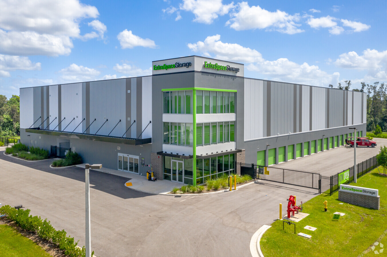
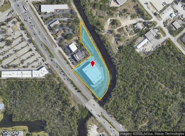
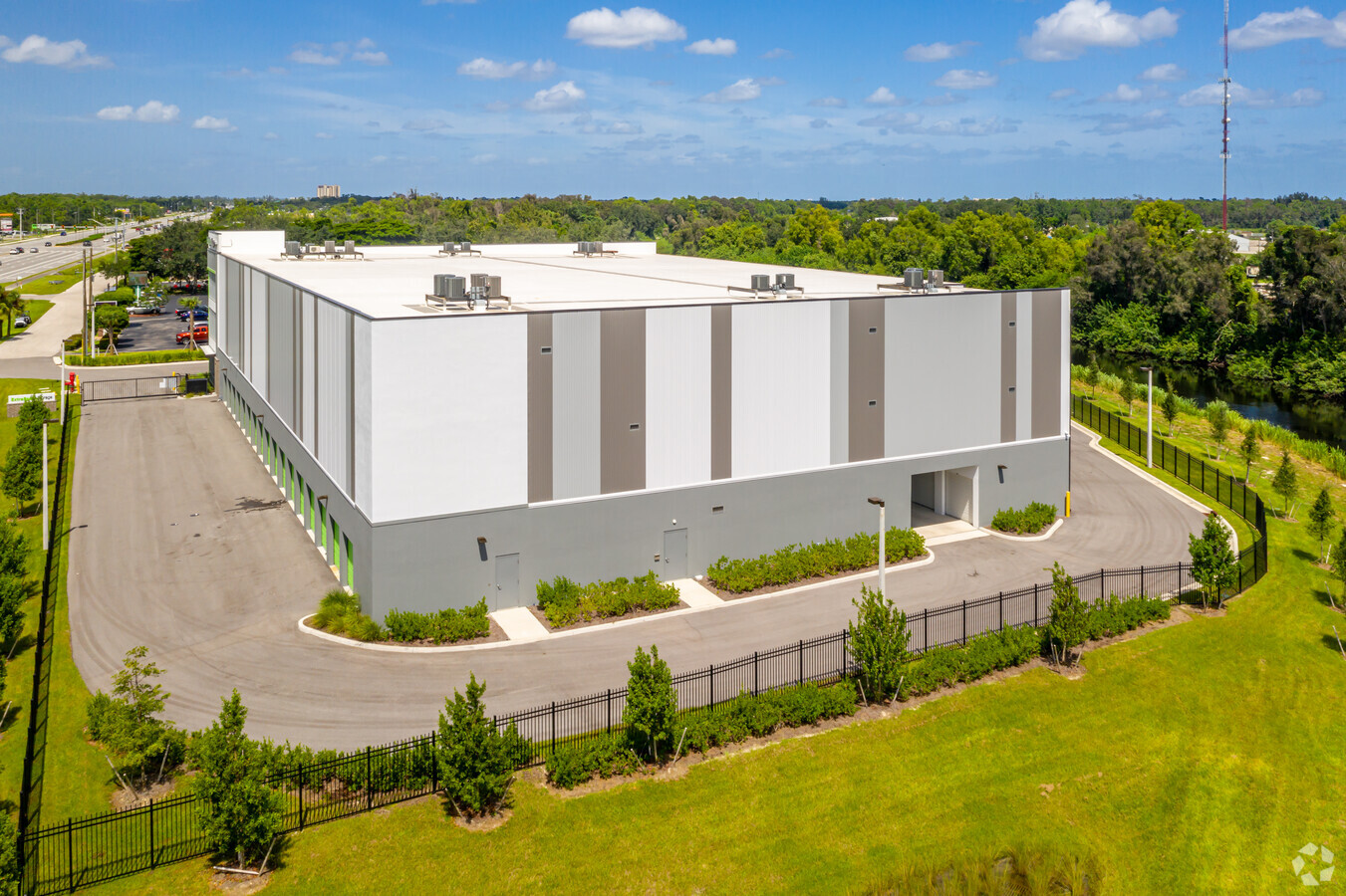
Property Record
16641 S Tamiami Trl, Fort Myers, FL 33908

NEARBY LISTINGS FOR SALE OR LEASE
Property Detail
16641 S Tamiami Trl
Cape Coral-Fort Myers, FL
S. 41 Corridor
06-46-25-00-00013.001B
PARL IN NW 1/4 AS DESC IN OR 2006 PG 2153 + OR 3072 PG 1249 PAR IN MULTI SECS 01-46-24 LESS OR 3319/3709
Warehouse
Lee
AE
Florida
12071C0438H
1b
2023
3.67 AC
2024
S Ft Myers/San Carlos
050105
Southwest Florida
96,403 SF
DEMOGRAPHICS near 16641 S Tamiami Trl
1 Mile
3 Mile
5 Mile
2024 Total Population
3,730
33,267
115,803
2029 Population
4,421
39,256
137,086
Pop Growth 2024-2029
+ 18.53%
+ 18.00%
+ 18.38%
Average Age
50
48
49
2024 Total Households
1,854
15,131
52,848
HH Growth 2024-2029
+ 18.02%
+ 17.68%
+ 18.15%
Median Household Inc
$69,612
$72,839
$67,881
Avg Household Size
2.00
2.10
2.10
2024 Avg HH Vehicles
2.00
2.00
2.00
Median Home Value
$273,230
$288,151
$268,161
Median Year Built
1987
1990
1992
Nearby Places
- Restaurants
- Banks
- Shops
- Fitness
- Groceries
PUBLIC TRANSPORTATION
AIRPORT
Southwest Florida International
DRIVE
WALK
Distance
Southwest Florida International
20 min
11.3 mi
Freight Ports
Port Manatee
DRIVE
WALK
Distance
Port Manatee
129 min
109.1 mi
Nearby Properties
Address
Land Use
TOTAL SIZE
Lot Size
Zoning
Address
Land Use
TOTAL SIZE
Lot Size
Zoning
741,488 SF
23.22 AC
CPD
Address
Land Use
TOTAL SIZE
Lot Size
Zoning
462,334 SF
32.45 AC
MPD
Address
Land Use
TOTAL SIZE
Lot Size
Zoning
562,104 SF
18.98 AC
RPD
Address
Land Use
TOTAL SIZE
Lot Size
Zoning
576,858 SF
77.73 AC
CF-2
Address
Land Use
TOTAL SIZE
Lot Size
Zoning
346,817 SF
26.28 AC
MPD
Address
Land Use
TOTAL SIZE
Lot Size
Zoning
59,832 SF
4.23 AC
CPD
Address
Land Use
TOTAL SIZE
Lot Size
Zoning
270,752 SF
45.08 AC
IPD
Address
Land Use
TOTAL SIZE
Lot Size
Zoning
170,495 SF
7.80 AC
CPD
Address
Land Use
TOTAL SIZE
Lot Size
Zoning
198,225 SF
28.77 AC
IPD
Address
Land Use
TOTAL SIZE
Lot Size
Zoning
263,160 SF
19.96 AC
IPD
Address
Land Use
TOTAL SIZE
Lot Size
Zoning
34.63 AC
AG-2
Address
Land Use
TOTAL SIZE
Lot Size
Zoning
7.06 AC
MPD
Address
Land Use
TOTAL SIZE
Lot Size
Zoning
316,597 SF
19.19 AC
IPD
Address
Land Use
TOTAL SIZE
Lot Size
Zoning
406,192 SF
2.75 AC
CPD
Address
Land Use
TOTAL SIZE
Lot Size
Zoning
21.13 AC
H
Address
Land Use
TOTAL SIZE
Lot Size
Zoning
129,016 SF
9.76 AC
CPD
Address
Land Use
TOTAL SIZE
Lot Size
Zoning
122,339 SF
19.39 AC
RPD
Address
Land Use
TOTAL SIZE
Lot Size
Zoning
180,386 SF
10.11 AC
IPD
Address
Land Use
TOTAL SIZE
Lot Size
Zoning
118,193 SF
11.05 AC
CPD
Address
Land Use
TOTAL SIZE
Lot Size
Zoning
123,050 SF
15.90 AC
CPD
Address
Land Use
TOTAL SIZE
Lot Size
Zoning
125,656 SF
20.82 AC
AG-2
Address
Land Use
TOTAL SIZE
Lot Size
Zoning
127,740 SF
1.48 AC
CPD
Address
Land Use
TOTAL SIZE
Lot Size
Zoning
277,794 SF
47.85 AC
IPD
Address
Land Use
TOTAL SIZE
Lot Size
Zoning
89,321 SF
11.40 AC
CPD
Address
Land Use
TOTAL SIZE
Lot Size
Zoning
89,049 SF
11.59 AC
CPD
Address
Land Use
TOTAL SIZE
Lot Size
Zoning
70,426 SF
9.06 AC
CPD
Address
Land Use
TOTAL SIZE
Lot Size
Zoning
95,928 SF
10 AC
IPD
Address
Land Use
TOTAL SIZE
Lot Size
Zoning
19,510 SF
2.21 AC
AG-2
Address
Land Use
TOTAL SIZE
Lot Size
Zoning
228,715 SF
27.52 AC
CPD
The World's #1 Commercial Real Estate Marketplace
Connect with us
© 2025 CoStar Group
The information above has been obtained from sources believed reliable. While we do not doubt its accuracy we have not verified it and make no guarantee, warranty or representation about it. It is your responsibility to independently confirm its accuracy and completeness. Any projections, opinions, assumptions, or estimates used are for example only and do not represent the current or future performance of the property. The value of this transaction to you depends on tax and other factors which should be evaluated by your tax, financial, and legal advisors. You and your advisors should conduct a careful, independent investigation of the property to determine to your satisfaction the suitability of the property for your needs.