Property Record
15505 New Halls Ferry Rd, Florissant, MO 63031

This Property Is For Sale
NEARBY LISTINGS FOR SALE OR LEASE
-
-
View all Florissant listings for sale on LoopNet.com
Property Detail
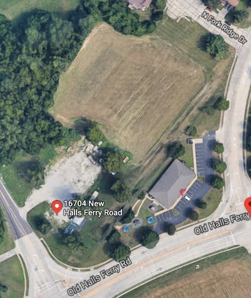
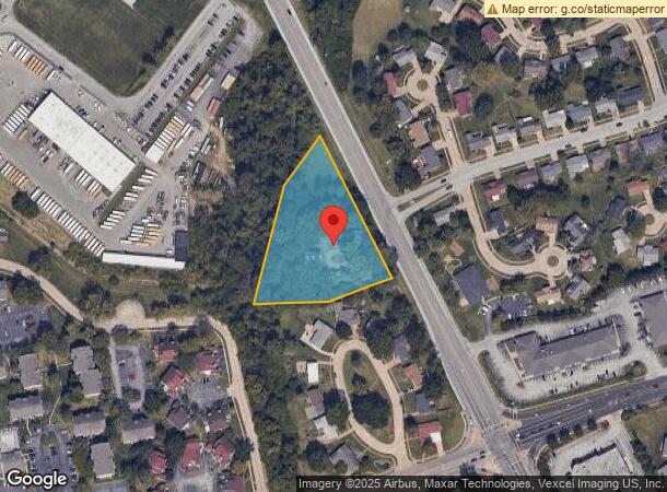
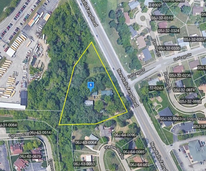
15505 New Halls Ferry Rd
St. Louis, MO-IL
Elisha Patterson Estate
05J-32-0016
St. Louis
Sfr
Missouri
AE
2.23 AC
29183C0325G
North County
2,312 SF
St. Louis
DEMOGRAPHICS near 15505 New Halls Ferry Rd
1 Mile
3 Mile
5 Mile
2024 Total Population
6,759
44,769
102,864
2029 Population
6,571
43,688
100,586
Pop Growth 2024-2029
(2.78%)
(2.41%)
(2.21%)
Average Age
42
40
40
2024 Total Households
2,425
17,034
40,654
HH Growth 2024-2029
(2.85%)
(2.45%)
(2.26%)
Median Household Inc
$98,741
$73,386
$66,631
Avg Household Size
2.70
2.60
2.40
2024 Avg HH Vehicles
2.00
2.00
2.00
Median Home Value
$219,672
$163,846
$154,201
Median Year Built
1983
1971
1967
Nearby Places
- Restaurants
- Banks
- Shops
- Fitness
- Groceries
PUBLIC TRANSPORTATION
COMMUTER RAIL
Lambert Airport East Terminal (Lambert Airport Shiloh-Scott - St. Louis MetroLink (MetroLink))
DRIVE
WALK
Distance
Lambert Airport East Terminal (Lambert Airport Shiloh-Scott - St. Louis MetroLink (MetroLink))
16 min
8.6 mi
Lambert Airport Main Terminal (Lambert Airport Shiloh-Scott - St. Louis MetroLink (MetroLink))
DRIVE
WALK
Distance
Lambert Airport Main Terminal (Lambert Airport Shiloh-Scott - St. Louis MetroLink (MetroLink))
18 min
9.2 mi
AIRPORT
St Louis Lambert International
DRIVE
WALK
Distance
St Louis Lambert International
15 min
7.1 mi
Freight Ports
Port Milwaukee
DRIVE
WALK
Distance
Port Milwaukee
425 min
374.4 mi
Nearby Properties
Address
Land Use
TOTAL SIZE
Lot Size
Zoning
Address
Land Use
TOTAL SIZE
Lot Size
Zoning
47,184 SF
71.66 AC
R4
Address
Land Use
TOTAL SIZE
Lot Size
Zoning
71.29 AC
24R4
Address
Land Use
TOTAL SIZE
Lot Size
Zoning
296,795 SF
286.21 AC
C-8
Address
Land Use
TOTAL SIZE
Lot Size
Zoning
271,184 SF
13.67 AC
B3
Address
Land Use
TOTAL SIZE
Lot Size
Zoning
15.37 AC
R
Address
Land Use
TOTAL SIZE
Lot Size
Zoning
93,136 SF
108.76 AC
Address
Land Use
TOTAL SIZE
Lot Size
Zoning
169,426 SF
26.38 AC
R1
Address
Land Use
TOTAL SIZE
Lot Size
Zoning
21.29 AC
24R4
Address
Land Use
TOTAL SIZE
Lot Size
Zoning
2,429 SF
79.10 AC
NU
Address
Land Use
TOTAL SIZE
Lot Size
Zoning
1,560 SF
12.84 AC
R4
Address
Land Use
TOTAL SIZE
Lot Size
Zoning
999 SF
21.20 AC
R
Address
Land Use
TOTAL SIZE
Lot Size
Zoning
17.26 AC
24R4
Address
Land Use
TOTAL SIZE
Lot Size
Zoning
6.20 AC
24R4
Address
Land Use
TOTAL SIZE
Lot Size
Zoning
320,176 SF
9.83 AC
24MFD
Address
Land Use
TOTAL SIZE
Lot Size
Zoning
134,837 SF
11.43 AC
R4
Address
Land Use
TOTAL SIZE
Lot Size
Zoning
93,504 SF
12.16 AC
24R4
Address
Land Use
TOTAL SIZE
Lot Size
Zoning
25,394 SF
67.31 AC
M2
Address
Land Use
TOTAL SIZE
Lot Size
Zoning
354,790 SF
22.46 AC
B6
Address
Land Use
TOTAL SIZE
Lot Size
Zoning
90,450 SF
3.49 AC
24B3
Address
Land Use
TOTAL SIZE
Lot Size
Zoning
90,796 SF
8.62 AC
B3
Address
Land Use
TOTAL SIZE
Lot Size
Zoning
106,935 SF
8.25 AC
24B5
Address
Land Use
TOTAL SIZE
Lot Size
Zoning
12.83 AC
24R4
Address
Land Use
TOTAL SIZE
Lot Size
Zoning
146,186 SF
8.24 AC
R4
Address
Land Use
TOTAL SIZE
Lot Size
Zoning
149,105 SF
9.71 AC
R4
Address
Land Use
TOTAL SIZE
Lot Size
Zoning
1,797 SF
23.66 AC
NU
Address
Land Use
TOTAL SIZE
Lot Size
Zoning
121,945 SF
10.10 AC
24B5
Address
Land Use
TOTAL SIZE
Lot Size
Zoning
16.58 AC
24R4
Address
Land Use
TOTAL SIZE
Lot Size
Zoning
87,459 SF
41.15 AC
A
Address
Land Use
TOTAL SIZE
Lot Size
Zoning
14.23 AC
24R4
Address
Land Use
TOTAL SIZE
Lot Size
Zoning
96,094 SF
8.84 AC
103R-2
The World's #1 Commercial Real Estate Marketplace
Connect with us
© 2025 CoStar Group
The information above has been obtained from sources believed reliable. While we do not doubt its accuracy we have not verified it and make no guarantee, warranty or representation about it. It is your responsibility to independently confirm its accuracy and completeness. Any projections, opinions, assumptions, or estimates used are for example only and do not represent the current or future performance of the property. The value of this transaction to you depends on tax and other factors which should be evaluated by your tax, financial, and legal advisors. You and your advisors should conduct a careful, independent investigation of the property to determine to your satisfaction the suitability of the property for your needs.