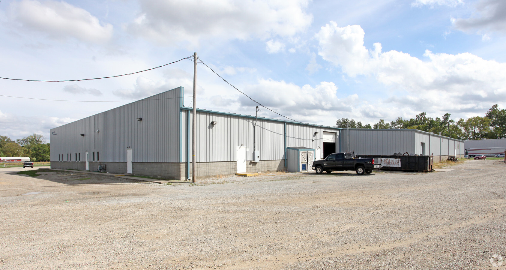
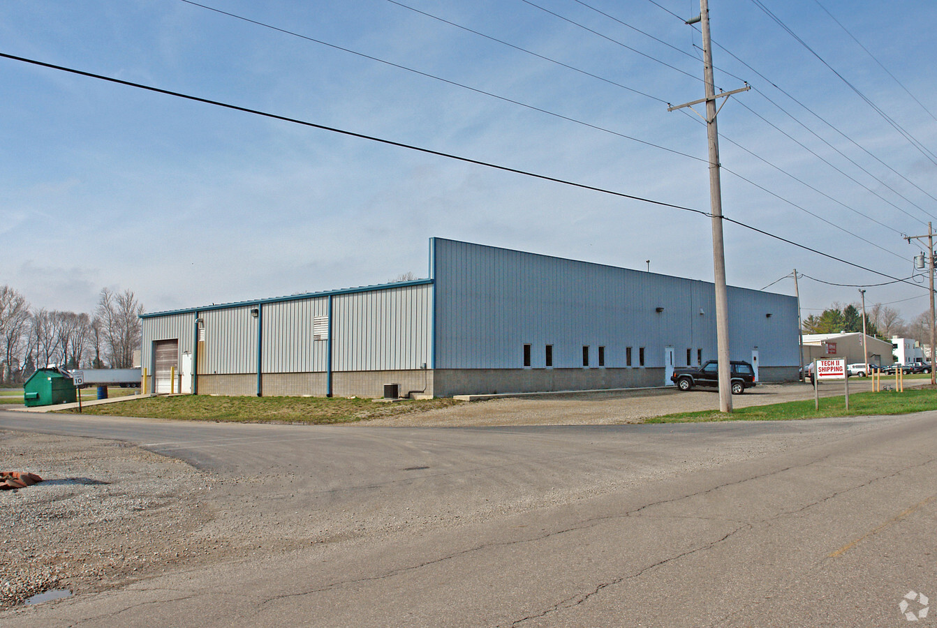
Property Record
1675 W County Line Rd, Urbana, OH 43078
NEARBY LISTINGS FOR SALE OR LEASE
-
-
View all Urbana listings for sale on LoopNet.com
Property Detail
1675 W County Line Rd
05-00200-00500-0048
N E PT N E QR
Industrialgeneral
Clark
X
Ohio
39023C0064E
48
2023
1.51 AC
2024
Northeast Dayton
002602
Cincinnati/Dayton
23,604 SF
Springfield, OH
DEMOGRAPHICS near 1675 W County Line Rd
1 Mile
3 Mile
5 Mile
2024 Total Population
142
2,634
21,359
2029 Population
136
2,573
20,947
Pop Growth 2024-2029
(4.23%)
(2.32%)
(1.93%)
Average Age
43
44
46
2024 Total Households
53
1,036
9,459
HH Growth 2024-2029
(3.77%)
(2.22%)
(1.91%)
Median Household Inc
$81,250
$76,562
$67,016
Avg Household Size
2.50
2.40
2.20
2024 Avg HH Vehicles
3.00
2.00
2.00
Median Home Value
$226,666
$197,245
$171,048
Median Year Built
1975
1980
1977
Nearby Places
- Restaurants
- Banks
- Shops
- Fitness
- Groceries
PUBLIC TRANSPORTATION
AIRPORT
James M Cox Dayton International
DRIVE
WALK
Distance
James M Cox Dayton International
41 min
32.7 mi
Freight Ports
Port of Toledo
DRIVE
WALK
Distance
Port of Toledo
179 min
124.3 mi
Nearby Properties
Address
Land Use
TOTAL SIZE
Lot Size
Zoning
Address
Land Use
TOTAL SIZE
Lot Size
Zoning
1,667,526 SF
104.07 AC
I-1
Address
Land Use
TOTAL SIZE
Lot Size
Zoning
521,780 SF
206.66 AC
I-1
Address
Land Use
TOTAL SIZE
Lot Size
Zoning
120,870 SF
16.37 AC
Address
Land Use
TOTAL SIZE
Lot Size
Zoning
64,600 SF
15.08 AC
I-1
Address
Land Use
TOTAL SIZE
Lot Size
Zoning
10,060 SF
4.75 AC
I-1
Address
Land Use
TOTAL SIZE
Lot Size
Zoning
100,280 SF
5.33 AC
A-1
Address
Land Use
TOTAL SIZE
Lot Size
Zoning
129,148 SF
8.82 AC
I-1
Address
Land Use
TOTAL SIZE
Lot Size
Zoning
2,563 SF
41.27 AC
Address
Land Use
TOTAL SIZE
Lot Size
Zoning
48,000 SF
43.44 AC
Address
Land Use
TOTAL SIZE
Lot Size
Zoning
30,000 SF
3.49 AC
I-1
Address
Land Use
TOTAL SIZE
Lot Size
Zoning
2,648 SF
174.76 AC
I-1
Address
Land Use
TOTAL SIZE
Lot Size
Zoning
72,345 SF
4 AC
I-1
Address
Land Use
TOTAL SIZE
Lot Size
Zoning
118,600 SF
12.99 AC
I-1
Address
Land Use
TOTAL SIZE
Lot Size
Zoning
1,392 SF
31.23 AC
Address
Land Use
TOTAL SIZE
Lot Size
Zoning
14,740 SF
59.06 AC
B-4
Address
Land Use
TOTAL SIZE
Lot Size
Zoning
159.87 AC
Address
Land Use
TOTAL SIZE
Lot Size
Zoning
169.12 AC
A-1
Address
Land Use
TOTAL SIZE
Lot Size
Zoning
27,800 SF
5.92 AC
I-1
Address
Land Use
TOTAL SIZE
Lot Size
Zoning
53,584 SF
5.17 AC
B-3
Address
Land Use
TOTAL SIZE
Lot Size
Zoning
49,191 SF
3.64 AC
M-2
Address
Land Use
TOTAL SIZE
Lot Size
Zoning
159.22 AC
I-1
Address
Land Use
TOTAL SIZE
Lot Size
Zoning
832 SF
128.83 AC
A-1
Address
Land Use
TOTAL SIZE
Lot Size
Zoning
2,092 SF
136.41 AC
A-1
Address
Land Use
TOTAL SIZE
Lot Size
Zoning
23,104 SF
23.80 AC
B-4
Address
Land Use
TOTAL SIZE
Lot Size
Zoning
14,017 SF
12.04 AC
PD-M
Address
Land Use
TOTAL SIZE
Lot Size
Zoning
131.45 AC
Address
Land Use
TOTAL SIZE
Lot Size
Zoning
2,096 SF
126.33 AC
R-2
Address
Land Use
TOTAL SIZE
Lot Size
Zoning
27,846 SF
3.81 AC
I-1
Address
Land Use
TOTAL SIZE
Lot Size
Zoning
33,808 SF
4.24 AC
I-1
Address
Land Use
TOTAL SIZE
Lot Size
Zoning
118.05 AC
A-1
The World's #1 Commercial Real Estate Marketplace
Connect with us
© 2025 CoStar Group
The information above has been obtained from sources believed reliable. While we do not doubt its accuracy we have not verified it and make no guarantee, warranty or representation about it. It is your responsibility to independently confirm its accuracy and completeness. Any projections, opinions, assumptions, or estimates used are for example only and do not represent the current or future performance of the property. The value of this transaction to you depends on tax and other factors which should be evaluated by your tax, financial, and legal advisors. You and your advisors should conduct a careful, independent investigation of the property to determine to your satisfaction the suitability of the property for your needs.