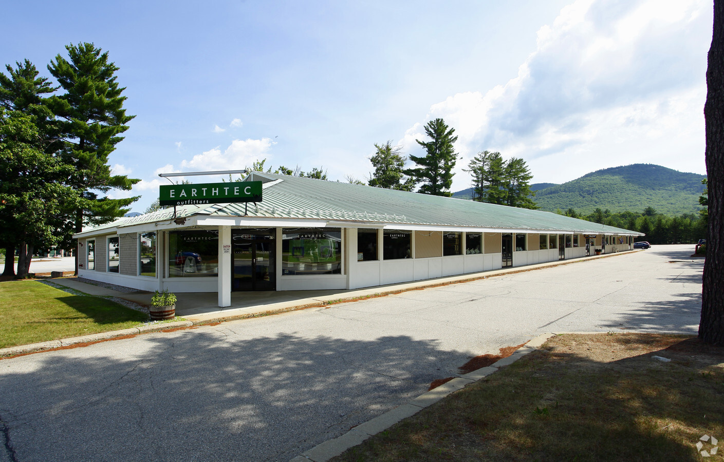
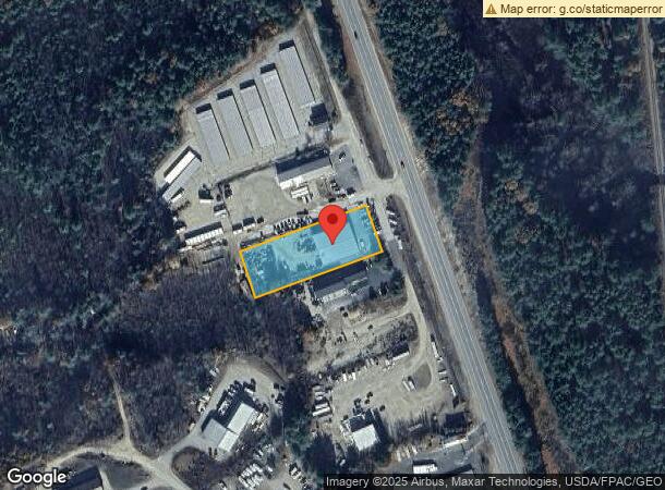
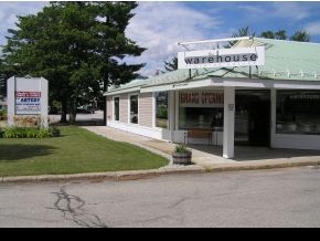
Property Record
1675 White Mountain Hwy, Sanbornville, NH 03872
NEARBY LISTINGS FOR SALE OR LEASE
-
-
View all Sanbornville listings for sale on LoopNet.com
Property Detail
1675 White Mountain Hwy
X
Carroll
33003C0770D
New Hampshire
2023
1 AC
2023
Other Market Areas
956000
WKFD-000211-020000
8,600 SF
Commercialbuilding
DEMOGRAPHICS near 1675 White Mountain Hwy
1 Mile
3 Mile
5 Mile
2024 Total Population
147
2,084
6,143
2029 Population
167
2,303
6,644
Pop Growth 2024-2029
+ 13.61%
+ 10.51%
+ 8.16%
Average Age
47
46
47
2024 Total Households
67
917
2,756
HH Growth 2024-2029
+ 13.43%
+ 10.36%
+ 7.80%
Median Household Inc
$61,071
$76,838
$69,303
Avg Household Size
2.20
2.20
2.10
2024 Avg HH Vehicles
2.00
2.00
2.00
Median Home Value
$296,666
$275,330
$270,634
Median Year Built
1988
1983
1980
Nearby Places
- Restaurants
- Banks
- Shops
- Fitness
- Groceries
Nearby Properties
Address
Land Use
TOTAL SIZE
Lot Size
Zoning
Address
Land Use
TOTAL SIZE
Lot Size
Zoning
0.99 AC
V/RVIL
Address
Land Use
TOTAL SIZE
Lot Size
Zoning
54,318 SF
9.80 AC
R1R1 R
Address
Land Use
TOTAL SIZE
Lot Size
Zoning
11,339 SF
0.25 AC
V/RWS
Address
Land Use
TOTAL SIZE
Lot Size
Zoning
19,255 SF
9.69 AC
V/RWS
Address
Land Use
TOTAL SIZE
Lot Size
Zoning
22,272 SF
2.31 AC
V/RWS
Address
Land Use
TOTAL SIZE
Lot Size
Zoning
2,036 SF
4.97 AC
B&CBUS
Address
Land Use
TOTAL SIZE
Lot Size
Zoning
1,944 SF
56.71 AC
AGRAGR
Address
Land Use
TOTAL SIZE
Lot Size
Zoning
2,281 SF
1.34 AC
R2GEL
Address
Land Use
TOTAL SIZE
Lot Size
Zoning
1.70 AC
R2GEL
Address
Land Use
TOTAL SIZE
Lot Size
Zoning
1,729 SF
0.20 AC
V/RWS
Address
Land Use
TOTAL SIZE
Lot Size
Zoning
22,023 SF
2.46 AC
B&CBUS
Address
Land Use
TOTAL SIZE
Lot Size
Zoning
3,562 SF
9.70 AC
R2LL W
Address
Land Use
TOTAL SIZE
Lot Size
Zoning
2,663 SF
0.64 AC
R2LL W
Address
Land Use
TOTAL SIZE
Lot Size
Zoning
6,781 SF
0.39 AC
R1.0T
Address
Land Use
TOTAL SIZE
Lot Size
Zoning
512 SF
1.80 AC
R2GEL
Address
Land Use
TOTAL SIZE
Lot Size
Zoning
2.40 AC
R2LL W
Address
Land Use
TOTAL SIZE
Lot Size
Zoning
2,411 SF
0.99 AC
V/RWS
Address
Land Use
TOTAL SIZE
Lot Size
Zoning
3,000 SF
20.90 AC
R2LL L
Address
Land Use
TOTAL SIZE
Lot Size
Zoning
4,312 SF
3.56 AC
B&CBUS
Address
Land Use
TOTAL SIZE
Lot Size
Zoning
12,000 SF
2.52 AC
LI INL
Address
Land Use
TOTAL SIZE
Lot Size
Zoning
2,493 SF
0.59 AC
R2LL L
Address
Land Use
TOTAL SIZE
Lot Size
Zoning
5,042 SF
1.50 AC
V/RWS
Address
Land Use
TOTAL SIZE
Lot Size
Zoning
1.20 AC
R2GEL
Address
Land Use
TOTAL SIZE
Lot Size
Zoning
1,062 SF
8.53 AC
RES3 R
Address
Land Use
TOTAL SIZE
Lot Size
Zoning
6,546 SF
1.90 AC
V/RWS
Address
Land Use
TOTAL SIZE
Lot Size
Zoning
2,603 SF
1.60 AC
R2LL L
Address
Land Use
TOTAL SIZE
Lot Size
Zoning
1,210 SF
0.79 AC
R2LL L
Address
Land Use
TOTAL SIZE
Lot Size
Zoning
4,358 SF
8 AC
RES3 R
Address
Land Use
TOTAL SIZE
Lot Size
Zoning
4,751 SF
1.50 AC
R1R1 R
Address
Land Use
TOTAL SIZE
Lot Size
Zoning
3,880 SF
5.18 AC
B&CBUS
The World's #1 Commercial Real Estate Marketplace
Connect with us
© 2025 CoStar Group
The information above has been obtained from sources believed reliable. While we do not doubt its accuracy we have not verified it and make no guarantee, warranty or representation about it. It is your responsibility to independently confirm its accuracy and completeness. Any projections, opinions, assumptions, or estimates used are for example only and do not represent the current or future performance of the property. The value of this transaction to you depends on tax and other factors which should be evaluated by your tax, financial, and legal advisors. You and your advisors should conduct a careful, independent investigation of the property to determine to your satisfaction the suitability of the property for your needs.