Property Record
1676 Hebron Rd, Heath, OH 43056
NEARBY LISTINGS FOR SALE OR LEASE
-
-
View all Heath listings for sale on LoopNet.com
Property Detail
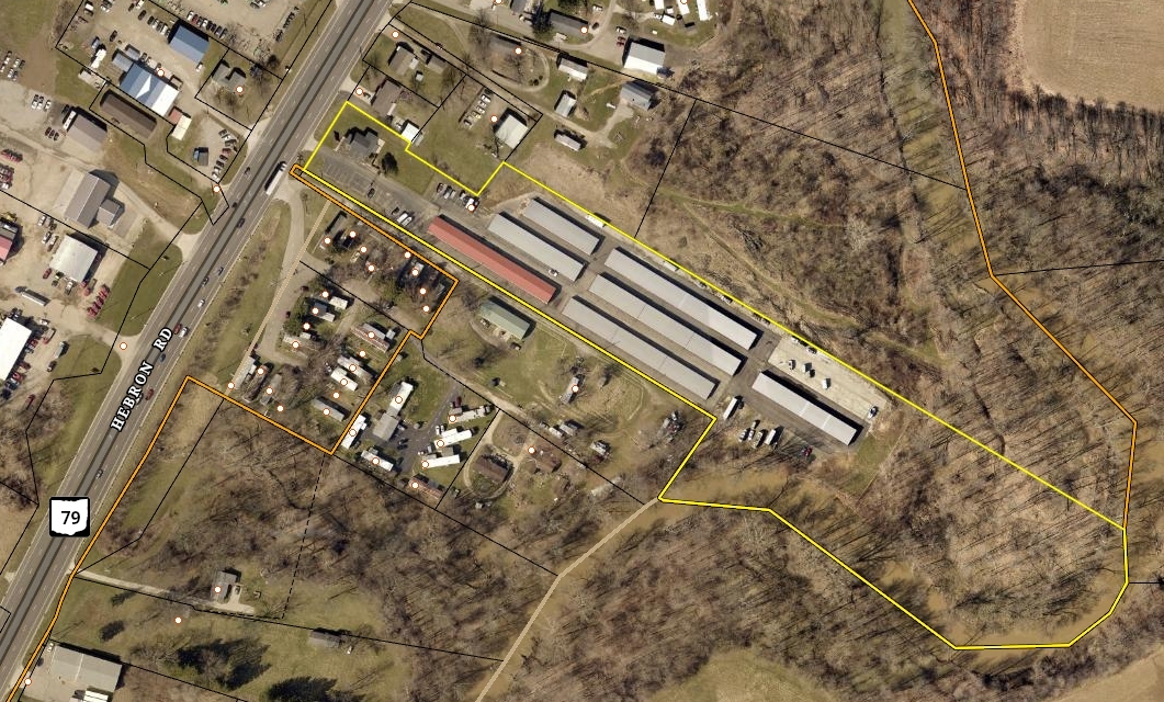
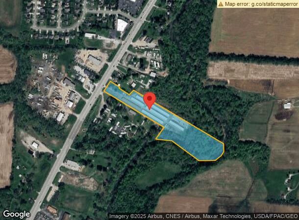
1676 Hebron Rd
Columbus, OH
United States Of Military Lands
080-330096-00.000
8.754 AC LOT 11 R12 T1 Q2
Publicstorage
Licking
AE
Ohio
39089C0339J
11
2023
8.75 AC
2023
Licking County
752802
Columbus
1,872 SF
DEMOGRAPHICS near 1676 Hebron Rd
1 Mile
3 Mile
5 Mile
2024 Total Population
1,131
15,955
53,923
2029 Population
1,195
16,723
56,445
Pop Growth 2024-2029
+ 5.66%
+ 4.81%
+ 4.68%
Average Age
43
42
41
2024 Total Households
458
6,829
22,107
HH Growth 2024-2029
+ 5.68%
+ 4.80%
+ 4.71%
Median Household Inc
$72,203
$60,822
$61,871
Avg Household Size
2.40
2.30
2.30
2024 Avg HH Vehicles
2.00
2.00
2.00
Median Home Value
$164,432
$153,953
$174,124
Median Year Built
1996
1974
1969
Nearby Places
- Restaurants
- Banks
- Shops
- Fitness
- Groceries
PUBLIC TRANSPORTATION
AIRPORT
John Glenn Columbus International
DRIVE
WALK
Distance
John Glenn Columbus International
42 min
33.3 mi
Rickenbacker International
DRIVE
WALK
Distance
Rickenbacker International
45 min
35.5 mi
Freight Ports
Port of Toledo
DRIVE
WALK
Distance
Port of Toledo
200 min
164.7 mi
Nearby Properties
Address
Land Use
TOTAL SIZE
Lot Size
Zoning
Address
Land Use
TOTAL SIZE
Lot Size
Zoning
212,744 SF
19.16 AC
Address
Land Use
TOTAL SIZE
Lot Size
Zoning
750,000 SF
50.61 AC
Address
Land Use
TOTAL SIZE
Lot Size
Zoning
69,244 SF
38 AC
Address
Land Use
TOTAL SIZE
Lot Size
Zoning
401,863 SF
22.18 AC
Address
Land Use
TOTAL SIZE
Lot Size
Zoning
50,871 SF
51.13 AC
Address
Land Use
TOTAL SIZE
Lot Size
Zoning
570,284 SF
56.17 AC
Address
Land Use
TOTAL SIZE
Lot Size
Zoning
67,824 SF
16.26 AC
Address
Land Use
TOTAL SIZE
Lot Size
Zoning
187,286 SF
113.76 AC
Address
Land Use
TOTAL SIZE
Lot Size
Zoning
3,108 SF
19.22 AC
Address
Land Use
TOTAL SIZE
Lot Size
Zoning
69,782 SF
2.41 AC
Address
Land Use
TOTAL SIZE
Lot Size
Zoning
223,436 SF
19.22 AC
Address
Land Use
TOTAL SIZE
Lot Size
Zoning
398,678 SF
12.04 AC
Address
Land Use
TOTAL SIZE
Lot Size
Zoning
4,018,110 SF
19.93 AC
Address
Land Use
TOTAL SIZE
Lot Size
Zoning
172,603 SF
15.88 AC
Address
Land Use
TOTAL SIZE
Lot Size
Zoning
59,992 SF
118.45 AC
Address
Land Use
TOTAL SIZE
Lot Size
Zoning
18,198 SF
12.83 AC
Address
Land Use
TOTAL SIZE
Lot Size
Zoning
19,200 SF
14.56 AC
Address
Land Use
TOTAL SIZE
Lot Size
Zoning
150,000 SF
11.18 AC
Address
Land Use
TOTAL SIZE
Lot Size
Zoning
4,080 SF
12.84 AC
Address
Land Use
TOTAL SIZE
Lot Size
Zoning
50,482 SF
13.91 AC
Address
Land Use
TOTAL SIZE
Lot Size
Zoning
248,400 SF
12.08 AC
Address
Land Use
TOTAL SIZE
Lot Size
Zoning
112,430 SF
15.33 AC
Address
Land Use
TOTAL SIZE
Lot Size
Zoning
523,249 SF
40 AC
Address
Land Use
TOTAL SIZE
Lot Size
Zoning
192,701 SF
10.28 AC
Address
Land Use
TOTAL SIZE
Lot Size
Zoning
135,148 SF
14.94 AC
Address
Land Use
TOTAL SIZE
Lot Size
Zoning
73,372 SF
21.86 AC
Address
Land Use
TOTAL SIZE
Lot Size
Zoning
60,060 SF
18 AC
Address
Land Use
TOTAL SIZE
Lot Size
Zoning
Address
Land Use
TOTAL SIZE
Lot Size
Zoning
49,967 SF
10 AC
Address
Land Use
TOTAL SIZE
Lot Size
Zoning
61,570 SF
5.35 AC
The World's #1 Commercial Real Estate Marketplace
Connect with us
© 2025 CoStar Group
The information above has been obtained from sources believed reliable. While we do not doubt its accuracy we have not verified it and make no guarantee, warranty or representation about it. It is your responsibility to independently confirm its accuracy and completeness. Any projections, opinions, assumptions, or estimates used are for example only and do not represent the current or future performance of the property. The value of this transaction to you depends on tax and other factors which should be evaluated by your tax, financial, and legal advisors. You and your advisors should conduct a careful, independent investigation of the property to determine to your satisfaction the suitability of the property for your needs.