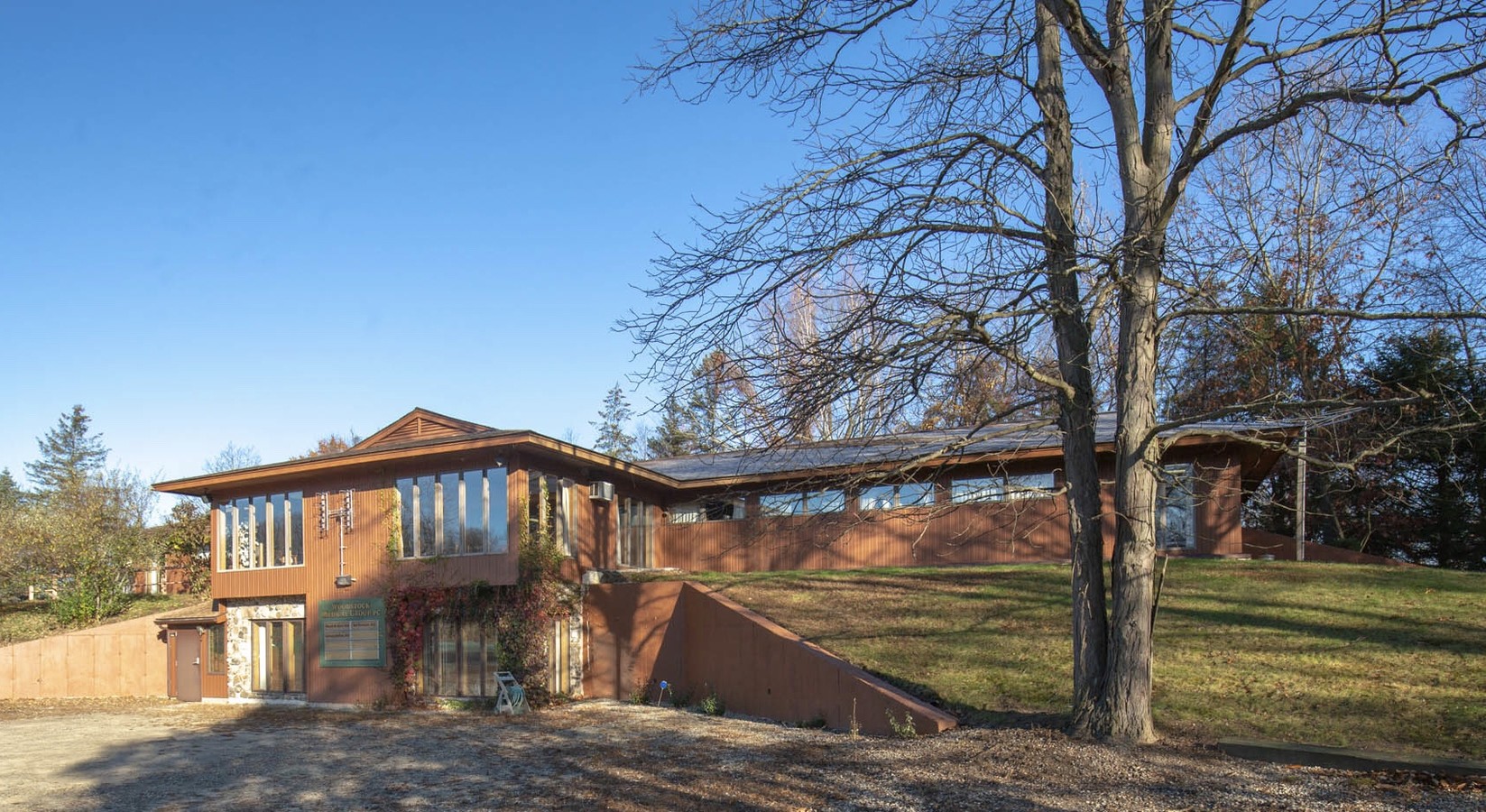
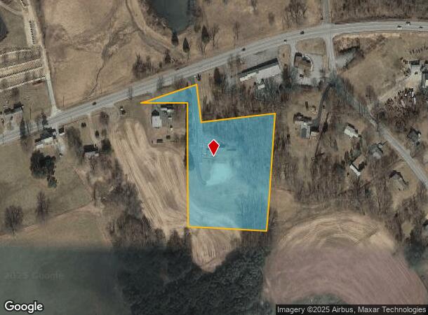
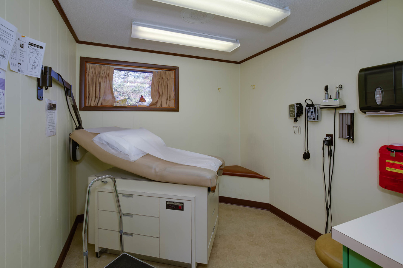
Property Record
168 Route 171, Woodstock, CT 06281
NEARBY LISTINGS FOR SALE OR LEASE
-
-
View all Woodstock listings for sale on LoopNet.com
Property Detail
168 Route 171
Worcester, MA-CT
Windham
WOOD-005779-000062-000011J
Connecticut
Commercialbuilding
11j
2024
4 AC
2024
Windham County
901102
Hartford
4,115 SF
DEMOGRAPHICS near 168 Route 171
1 Mile
3 Mile
5 Mile
2024 Total Population
1,043
11,784
18,989
2029 Population
1,038
11,779
18,963
Pop Growth 2024-2029
(0.48%)
(0.04%)
(0.14%)
Average Age
43
41
42
2024 Total Households
438
4,963
7,852
HH Growth 2024-2029
(0.46%)
+ 0.04%
(0.08%)
Median Household Inc
$88,784
$74,496
$77,328
Avg Household Size
2.30
2.30
2.30
2024 Avg HH Vehicles
2.00
2.00
2.00
Median Home Value
$285,810
$229,487
$251,376
Median Year Built
1981
1964
1966
Nearby Places
- Restaurants
- Banks
- Shops
- Fitness
- Groceries
PUBLIC TRANSPORTATION
AIRPORT
Worcester Regional
DRIVE
WALK
Distance
Worcester Regional
46 min
30.9 mi
Freight Ports
Port of Davisville, RI
DRIVE
WALK
Distance
Port of Davisville, RI
70 min
52.3 mi
SALE & LEASE HISTORY
LISTING DATE
SALE/LEASE

Jan 09, 2020
For Sale
Nearby Properties
Address
Land Use
TOTAL SIZE
Lot Size
Zoning
Address
Land Use
TOTAL SIZE
Lot Size
Zoning
13.76 AC
Address
Land Use
TOTAL SIZE
Lot Size
Zoning
16,392 SF
101.85 AC
Address
Land Use
TOTAL SIZE
Lot Size
Zoning
199,059 SF
31.65 AC
Address
Land Use
TOTAL SIZE
Lot Size
Zoning
119.01 AC
Address
Land Use
TOTAL SIZE
Lot Size
Zoning
17.41 AC
Address
Land Use
TOTAL SIZE
Lot Size
Zoning
104,330 SF
15 AC
Address
Land Use
TOTAL SIZE
Lot Size
Zoning
37,203 SF
7.21 AC
Address
Land Use
TOTAL SIZE
Lot Size
Zoning
4,212 SF
8.25 AC
Address
Land Use
TOTAL SIZE
Lot Size
Zoning
7,009 SF
15.70 AC
RA80
Address
Land Use
TOTAL SIZE
Lot Size
Zoning
55,340 SF
4 AC
0
Address
Land Use
TOTAL SIZE
Lot Size
Zoning
92,080 SF
7.10 AC
Address
Land Use
TOTAL SIZE
Lot Size
Zoning
10.08 AC
Address
Land Use
TOTAL SIZE
Lot Size
Zoning
62,369 SF
46.40 AC
0
Address
Land Use
TOTAL SIZE
Lot Size
Zoning
38.20 AC
RA80
Address
Land Use
TOTAL SIZE
Lot Size
Zoning
64,209 SF
4.91 AC
Address
Land Use
TOTAL SIZE
Lot Size
Zoning
41,730 SF
21.30 AC
Address
Land Use
TOTAL SIZE
Lot Size
Zoning
135,012 SF
31.12 AC
0
Address
Land Use
TOTAL SIZE
Lot Size
Zoning
72,281 SF
2.84 AC
Address
Land Use
TOTAL SIZE
Lot Size
Zoning
16,771 SF
4.04 AC
0
Address
Land Use
TOTAL SIZE
Lot Size
Zoning
4.60 AC
Address
Land Use
TOTAL SIZE
Lot Size
Zoning
3.03 AC
Address
Land Use
TOTAL SIZE
Lot Size
Zoning
1.20 AC
0
Address
Land Use
TOTAL SIZE
Lot Size
Zoning
15,002 SF
6.27 AC
C-1
Address
Land Use
TOTAL SIZE
Lot Size
Zoning
52,724 SF
6.46 AC
Address
Land Use
TOTAL SIZE
Lot Size
Zoning
62,624 SF
14.25 AC
Address
Land Use
TOTAL SIZE
Lot Size
Zoning
28,187 SF
9.95 AC
Address
Land Use
TOTAL SIZE
Lot Size
Zoning
32,700 SF
2.61 AC
Address
Land Use
TOTAL SIZE
Lot Size
Zoning
43.90 AC
0
Address
Land Use
TOTAL SIZE
Lot Size
Zoning
18,268 SF
3 AC
Address
Land Use
TOTAL SIZE
Lot Size
Zoning
15,859 SF
0.65 AC
The World's #1 Commercial Real Estate Marketplace
Connect with us
© 2025 CoStar Group
The information above has been obtained from sources believed reliable. While we do not doubt its accuracy we have not verified it and make no guarantee, warranty or representation about it. It is your responsibility to independently confirm its accuracy and completeness. Any projections, opinions, assumptions, or estimates used are for example only and do not represent the current or future performance of the property. The value of this transaction to you depends on tax and other factors which should be evaluated by your tax, financial, and legal advisors. You and your advisors should conduct a careful, independent investigation of the property to determine to your satisfaction the suitability of the property for your needs.