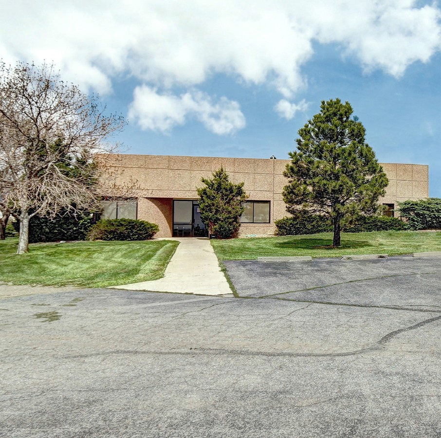
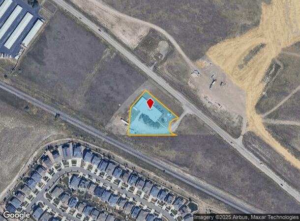
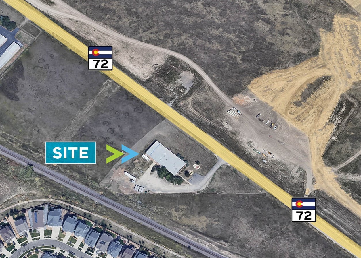
Property Record
16800 Highway 72, Arvada, CO 80007

Current Lease Availabilities
NEARBY LISTINGS FOR SALE OR LEASE
-
-
View all Arvada listings for lease on LoopNet.com
Property Detail
16800 Highway 72
Denver-Aurora-Lakewood, CO
Rocky Flats Industrial Dist Flg 1 Adjust
20-234-01-012
SECTION 23 TOWNSHIP 02 RANGE 70 SUBDIVISIONCD 647202 SUBDIVISIONNAME ROCKY FLATS INDUSTRIAL DIST FLG 1 ADJUSTMENT 1 LOT 001B SIZE: 53143 VALUE: 1.22
Industrialgeneral
Jefferson
X
Colorado
08059C0177G
1b
2023
1.22 AC
2024
West Denver
009837
Denver
11,392 SF
DEMOGRAPHICS near 16800 Highway 72
1 Mile
3 Mile
5 Mile
2024 Total Population
4,116
26,302
86,836
2029 Population
4,077
26,033
85,737
Pop Growth 2024-2029
(0.95%)
(1.02%)
(1.27%)
Average Age
36
40
42
2024 Total Households
1,294
8,976
32,653
HH Growth 2024-2029
(1.08%)
(1.24%)
(1.30%)
Median Household Inc
$171,994
$153,477
$124,442
Avg Household Size
3.20
2.90
2.60
2024 Avg HH Vehicles
2.00
2.00
2.00
Median Home Value
$802,219
$739,818
$649,048
Median Year Built
2011
2007
1988
Nearby Places
- Restaurants
- Banks
- Shops
- Fitness
- Groceries
PUBLIC TRANSPORTATION
COMMUTER RAIL
Wheat Ridge - Ward Station Track 1 (Union Station to Wheat Ridge Ward Station - Regional Transportation District)
DRIVE
WALK
Distance
Wheat Ridge - Ward Station Track 1 (Union Station to Wheat Ridge Ward Station - Regional Transportation District)
14 min
7.4 mi
Arvada Ridge Station Track 1 (Union Station to Wheat Ridge Ward Station - Regional Transportation District)
DRIVE
WALK
Distance
Arvada Ridge Station Track 1 (Union Station to Wheat Ridge Ward Station - Regional Transportation District)
14 min
8.3 mi
AIRPORT
Denver International
DRIVE
WALK
Distance
Denver International
50 min
35.6 mi
Freight Ports
Tulsa Port Of Catoosa
DRIVE
WALK
Distance
Tulsa Port Of Catoosa
747 min
721.1 mi
Nearby Properties
Address
Land Use
TOTAL SIZE
Lot Size
Zoning
Address
Land Use
TOTAL SIZE
Lot Size
Zoning
253,643 SF
50.87 AC
A2
Address
Land Use
TOTAL SIZE
Lot Size
Zoning
1,968.53 AC
Address
Land Use
TOTAL SIZE
Lot Size
Zoning
68,300 SF
6 AC
Address
Land Use
TOTAL SIZE
Lot Size
Zoning
110,235 SF
2.32 AC
Address
Land Use
TOTAL SIZE
Lot Size
Zoning
53,051 SF
70.19 AC
I2
Address
Land Use
TOTAL SIZE
Lot Size
Zoning
580.19 AC
Address
Land Use
TOTAL SIZE
Lot Size
Zoning
121,192 SF
12.43 AC
Address
Land Use
TOTAL SIZE
Lot Size
Zoning
95,412 SF
5.32 AC
Address
Land Use
TOTAL SIZE
Lot Size
Zoning
44,797 SF
4.35 AC
Address
Land Use
TOTAL SIZE
Lot Size
Zoning
164,963 SF
4.56 AC
Address
Land Use
TOTAL SIZE
Lot Size
Zoning
89,535 SF
2.88 AC
Address
Land Use
TOTAL SIZE
Lot Size
Zoning
97,803 SF
10.02 AC
Address
Land Use
TOTAL SIZE
Lot Size
Zoning
50,529 SF
23.88 AC
Address
Land Use
TOTAL SIZE
Lot Size
Zoning
43,403 SF
34.07 AC
Address
Land Use
TOTAL SIZE
Lot Size
Zoning
20,173 SF
142.57 AC
A2
Address
Land Use
TOTAL SIZE
Lot Size
Zoning
53,400 SF
6.40 AC
Address
Land Use
TOTAL SIZE
Lot Size
Zoning
75.88 AC
Address
Land Use
TOTAL SIZE
Lot Size
Zoning
320 AC
A2
Address
Land Use
TOTAL SIZE
Lot Size
Zoning
295.40 AC
Address
Land Use
TOTAL SIZE
Lot Size
Zoning
22,858 SF
2.16 AC
Address
Land Use
TOTAL SIZE
Lot Size
Zoning
23,906 SF
1.14 AC
Address
Land Use
TOTAL SIZE
Lot Size
Zoning
37,296 SF
8.45 AC
PD
Address
Land Use
TOTAL SIZE
Lot Size
Zoning
13,180 SF
2.86 AC
Address
Land Use
TOTAL SIZE
Lot Size
Zoning
13,050 SF
1.37 AC
Address
Land Use
TOTAL SIZE
Lot Size
Zoning
10,886 SF
1.47 AC
Address
Land Use
TOTAL SIZE
Lot Size
Zoning
59.51 AC
Address
Land Use
TOTAL SIZE
Lot Size
Zoning
14,677 SF
2.20 AC
Address
Land Use
TOTAL SIZE
Lot Size
Zoning
224.74 AC
Address
Land Use
TOTAL SIZE
Lot Size
Zoning
12,789 SF
1.83 AC
Address
Land Use
TOTAL SIZE
Lot Size
Zoning
5,672 SF
1.34 AC
The World's #1 Commercial Real Estate Marketplace
Connect with us
© 2025 CoStar Group
The information above has been obtained from sources believed reliable. While we do not doubt its accuracy we have not verified it and make no guarantee, warranty or representation about it. It is your responsibility to independently confirm its accuracy and completeness. Any projections, opinions, assumptions, or estimates used are for example only and do not represent the current or future performance of the property. The value of this transaction to you depends on tax and other factors which should be evaluated by your tax, financial, and legal advisors. You and your advisors should conduct a careful, independent investigation of the property to determine to your satisfaction the suitability of the property for your needs.