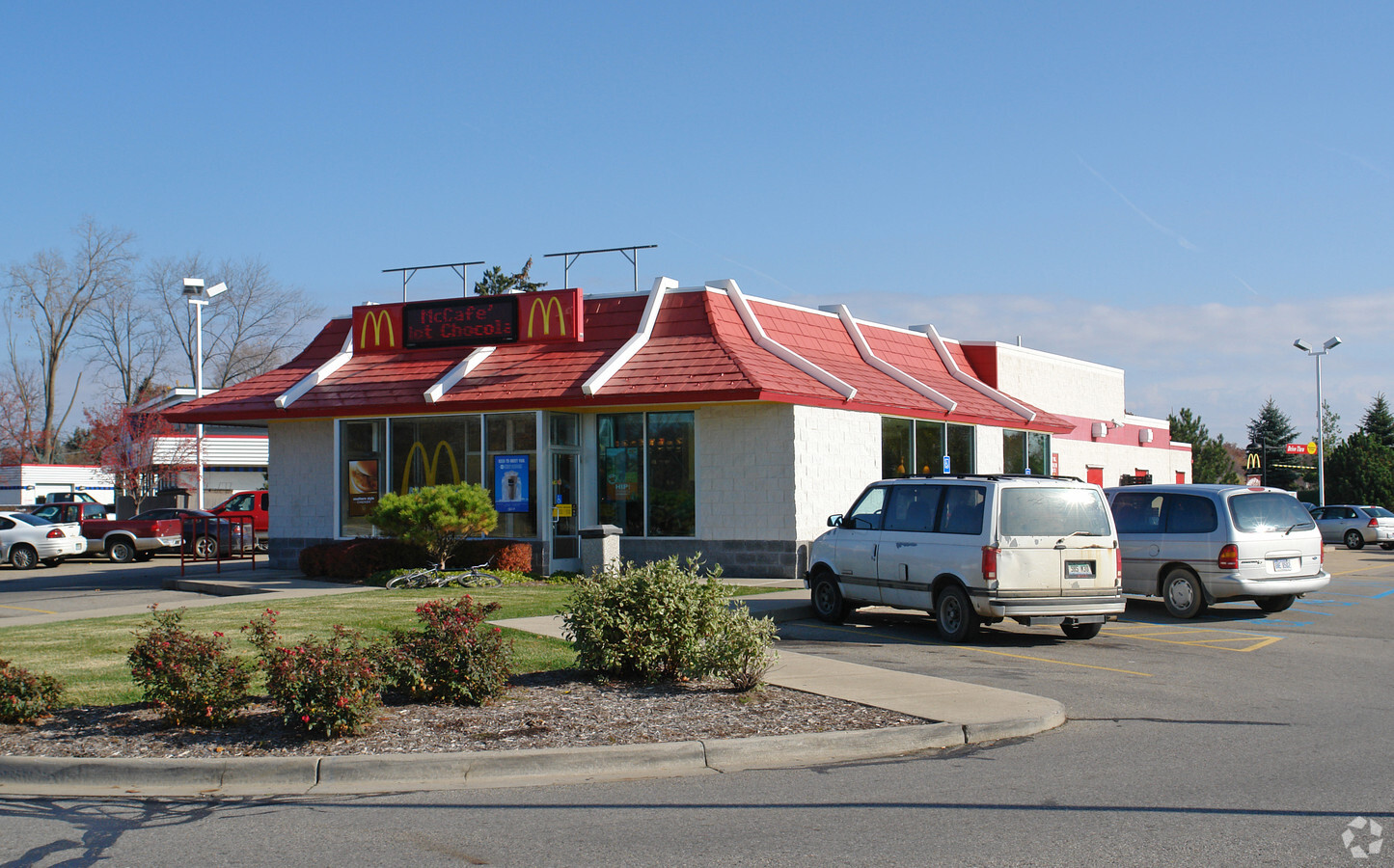
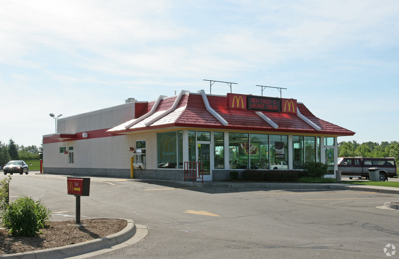
Property Record
16827 Marsh Rd, East Lansing, MI 48823
NEARBY LISTINGS FOR SALE OR LEASE
Property Detail
16827 Marsh Rd
010-034-400-045-02
COM AT S 1/4 COR OF SEC 34 T5N R1W, TH N 872 FT TO POB, TH N 140.32 FT, N 35DEG E 31.06 FT, TH E 332.04 FT, S 165.65 FT, W 350 FT TO POB. (NEW 2000, FROM034-400-045-00)
Restaurantdrivein
Clinton
X
Michigan
26065C0043D
1.32 AC
2024
East Lansing
2024
West Michigan
003902
Lansing-East Lansing, MI
3,909 SF
DEMOGRAPHICS near 16827 Marsh Rd
1 Mile
3 Mile
5 Mile
2024 Total Population
3,292
26,714
82,312
2029 Population
3,309
26,750
82,214
Pop Growth 2024-2029
+ 0.52%
+ 0.13%
(0.12%)
Average Age
42
41
36
2024 Total Households
1,350
11,925
34,452
HH Growth 2024-2029
+ 0.22%
+ 0.09%
(0.15%)
Median Household Inc
$77,344
$72,511
$59,710
Avg Household Size
2.40
2.20
2.20
2024 Avg HH Vehicles
2.00
2.00
2.00
Median Home Value
$339,769
$260,576
$254,938
Median Year Built
1990
1985
1981
Nearby Places
- Restaurants
- Banks
- Shops
- Fitness
- Groceries
PUBLIC TRANSPORTATION
COMMUTER RAIL
East Lansing Amtrak Station (Blue Water - Amtrak)
DRIVE
WALK
Distance
East Lansing Amtrak Station (Blue Water - Amtrak)
14 min
7.1 mi
AIRPORT
Capital Region International
DRIVE
WALK
Distance
Capital Region International
22 min
11.5 mi
Freight Ports
Port of Toledo
DRIVE
WALK
Distance
Port of Toledo
152 min
119.1 mi
Nearby Properties
Address
Land Use
TOTAL SIZE
Lot Size
Zoning
Address
Land Use
TOTAL SIZE
Lot Size
Zoning
32,946 SF
64.40 AC
RD
Address
Land Use
TOTAL SIZE
Lot Size
Zoning
215,335 SF
38.10 AC
RM08
Address
Land Use
TOTAL SIZE
Lot Size
Zoning
3,504 SF
30.61 AC
DEVELOPMEN
Address
Land Use
TOTAL SIZE
Lot Size
Zoning
9,280 SF
24.38 AC
RC
Address
Land Use
TOTAL SIZE
Lot Size
Zoning
4,784 SF
24.06 AC
RC
Address
Land Use
TOTAL SIZE
Lot Size
Zoning
149,799 SF
9.60 AC
Address
Land Use
TOTAL SIZE
Lot Size
Zoning
15,918 SF
23.13 AC
RC
Address
Land Use
TOTAL SIZE
Lot Size
Zoning
158,696 SF
24.74 AC
DEVELOPMEN
Address
Land Use
TOTAL SIZE
Lot Size
Zoning
3,792 SF
34.73 AC
RD
Address
Land Use
TOTAL SIZE
Lot Size
Zoning
16,248 SF
9.57 AC
RC
Address
Land Use
TOTAL SIZE
Lot Size
Zoning
15,102 SF
19.59 AC
RC
Address
Land Use
TOTAL SIZE
Lot Size
Zoning
114,593 SF
26.07 AC
Address
Land Use
TOTAL SIZE
Lot Size
Zoning
26,646 SF
16.37 AC
DEVELOPMEN
Address
Land Use
TOTAL SIZE
Lot Size
Zoning
56,636 SF
6.58 AC
RR
Address
Land Use
TOTAL SIZE
Lot Size
Zoning
11,014 SF
9.37 AC
DEVELOPMEN
Address
Land Use
TOTAL SIZE
Lot Size
Zoning
15.60 AC
RM22
Address
Land Use
TOTAL SIZE
Lot Size
Zoning
12,900 SF
5 AC
MDR
Address
Land Use
TOTAL SIZE
Lot Size
Zoning
39,346 SF
5.63 AC
RA
Address
Land Use
TOTAL SIZE
Lot Size
Zoning
3,933 SF
19.24 AC
RC
Address
Land Use
TOTAL SIZE
Lot Size
Zoning
7,468 SF
6.90 AC
RC
Address
Land Use
TOTAL SIZE
Lot Size
Zoning
2,812 SF
10.50 AC
RD
Address
Land Use
TOTAL SIZE
Lot Size
Zoning
143,060 SF
20.01 AC
Address
Land Use
TOTAL SIZE
Lot Size
Zoning
3,687 SF
10.67 AC
RD
Address
Land Use
TOTAL SIZE
Lot Size
Zoning
36,806 SF
12.28 AC
HDD
Address
Land Use
TOTAL SIZE
Lot Size
Zoning
3 AC
RM32
Address
Land Use
TOTAL SIZE
Lot Size
Zoning
23,226 SF
5.25 AC
RC
Address
Land Use
TOTAL SIZE
Lot Size
Zoning
1,800 SF
5.09 AC
RC
Address
Land Use
TOTAL SIZE
Lot Size
Zoning
4,152 SF
33.15 AC
DEVELOPMEN
Address
Land Use
TOTAL SIZE
Lot Size
Zoning
17,894 SF
5.47 AC
RA
Address
Land Use
TOTAL SIZE
Lot Size
Zoning
26,012 SF
2.66 AC
RC
The World's #1 Commercial Real Estate Marketplace
Connect with us
© 2025 CoStar Group
The information above has been obtained from sources believed reliable. While we do not doubt its accuracy we have not verified it and make no guarantee, warranty or representation about it. It is your responsibility to independently confirm its accuracy and completeness. Any projections, opinions, assumptions, or estimates used are for example only and do not represent the current or future performance of the property. The value of this transaction to you depends on tax and other factors which should be evaluated by your tax, financial, and legal advisors. You and your advisors should conduct a careful, independent investigation of the property to determine to your satisfaction the suitability of the property for your needs.