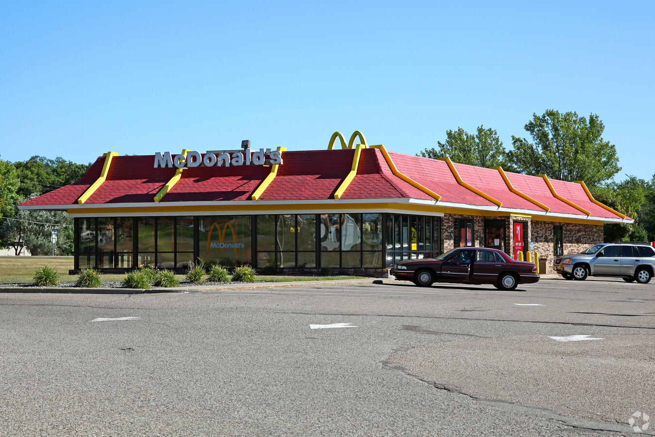
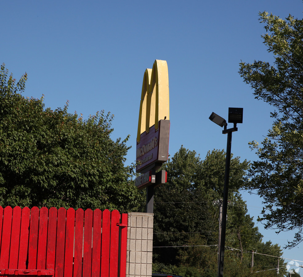
Property Record
16831 Highway 13 S, Prior Lake, MN 55372
NEARBY LISTINGS FOR SALE OR LEASE
-
-
View all Prior Lake listings for sale on LoopNet.com
Property Detail
16831 Highway 13 S
Minneapolis/St Paul
Radermachers 2Nd Addn
Minneapolis-St. Paul-Bloomington, MN-WI
Scott
25-497-001-0
Minnesota
Commercialnec
1.58 AC
5,040 SF
Burnsville
DEMOGRAPHICS near 16831 Highway 13 S
1 Mile
3 Mile
5 Mile
2024 Total Population
6,780
28,144
63,276
2029 Population
7,191
29,926
67,333
Pop Growth 2024-2029
+ 6.06%
+ 6.33%
+ 6.41%
Average Age
40
40
39
2024 Total Households
2,714
10,399
22,056
HH Growth 2024-2029
+ 6.30%
+ 6.52%
+ 6.64%
Median Household Inc
$79,949
$115,308
$127,003
Avg Household Size
2.50
2.70
2.80
2024 Avg HH Vehicles
2.00
2.00
2.00
Median Home Value
$343,733
$420,415
$423,185
Median Year Built
1989
1994
1999
Nearby Places
- Restaurants
- Banks
- Shops
- Fitness
- Groceries
PUBLIC TRANSPORTATION
AIRPORT
Minneapolis-St Paul International/Wold-Chamberlain
DRIVE
WALK
Distance
Minneapolis-St Paul International/Wold-Chamberlain
33 min
22.4 mi
Freight Ports
Port Milwaukee
DRIVE
WALK
Distance
Port Milwaukee
396 min
355.0 mi
Nearby Properties
Address
Land Use
TOTAL SIZE
Lot Size
Zoning
Address
Land Use
TOTAL SIZE
Lot Size
Zoning
120.50 AC
Address
Land Use
TOTAL SIZE
Lot Size
Zoning
323,174 SF
54.99 AC
Address
Land Use
TOTAL SIZE
Lot Size
Zoning
237,045 SF
2.55 AC
Address
Land Use
TOTAL SIZE
Lot Size
Zoning
225,368 SF
34.46 AC
Address
Land Use
TOTAL SIZE
Lot Size
Zoning
48,508 SF
3.58 AC
Address
Land Use
TOTAL SIZE
Lot Size
Zoning
97,096 SF
15.34 AC
Address
Land Use
TOTAL SIZE
Lot Size
Zoning
119,558 SF
4.68 AC
Address
Land Use
TOTAL SIZE
Lot Size
Zoning
54,864 SF
12.12 AC
Address
Land Use
TOTAL SIZE
Lot Size
Zoning
81,229 SF
5.42 AC
Address
Land Use
TOTAL SIZE
Lot Size
Zoning
83,120 SF
0.90 AC
Address
Land Use
TOTAL SIZE
Lot Size
Zoning
29,654 SF
3.16 AC
Address
Land Use
TOTAL SIZE
Lot Size
Zoning
92,600 SF
3.55 AC
Address
Land Use
TOTAL SIZE
Lot Size
Zoning
61,998 SF
1.60 AC
Address
Land Use
TOTAL SIZE
Lot Size
Zoning
78.80 AC
Address
Land Use
TOTAL SIZE
Lot Size
Zoning
57,618 SF
18.68 AC
Address
Land Use
TOTAL SIZE
Lot Size
Zoning
71,922 SF
12.20 AC
Address
Land Use
TOTAL SIZE
Lot Size
Zoning
Address
Land Use
TOTAL SIZE
Lot Size
Zoning
25,576 SF
19.50 AC
A1
Address
Land Use
TOTAL SIZE
Lot Size
Zoning
36,604 SF
3.78 AC
Address
Land Use
TOTAL SIZE
Lot Size
Zoning
58,650 SF
7.07 AC
Address
Land Use
TOTAL SIZE
Lot Size
Zoning
33,020 SF
3.08 AC
Address
Land Use
TOTAL SIZE
Lot Size
Zoning
33,110 SF
2.70 AC
Address
Land Use
TOTAL SIZE
Lot Size
Zoning
Address
Land Use
TOTAL SIZE
Lot Size
Zoning
65.29 AC
A2
Address
Land Use
TOTAL SIZE
Lot Size
Zoning
49,128 SF
3.47 AC
Address
Land Use
TOTAL SIZE
Lot Size
Zoning
27,595 SF
4.63 AC
Address
Land Use
TOTAL SIZE
Lot Size
Zoning
17,447 SF
6.39 AC
The World's #1 Commercial Real Estate Marketplace
Connect with us
© 2025 CoStar Group
The information above has been obtained from sources believed reliable. While we do not doubt its accuracy we have not verified it and make no guarantee, warranty or representation about it. It is your responsibility to independently confirm its accuracy and completeness. Any projections, opinions, assumptions, or estimates used are for example only and do not represent the current or future performance of the property. The value of this transaction to you depends on tax and other factors which should be evaluated by your tax, financial, and legal advisors. You and your advisors should conduct a careful, independent investigation of the property to determine to your satisfaction the suitability of the property for your needs.