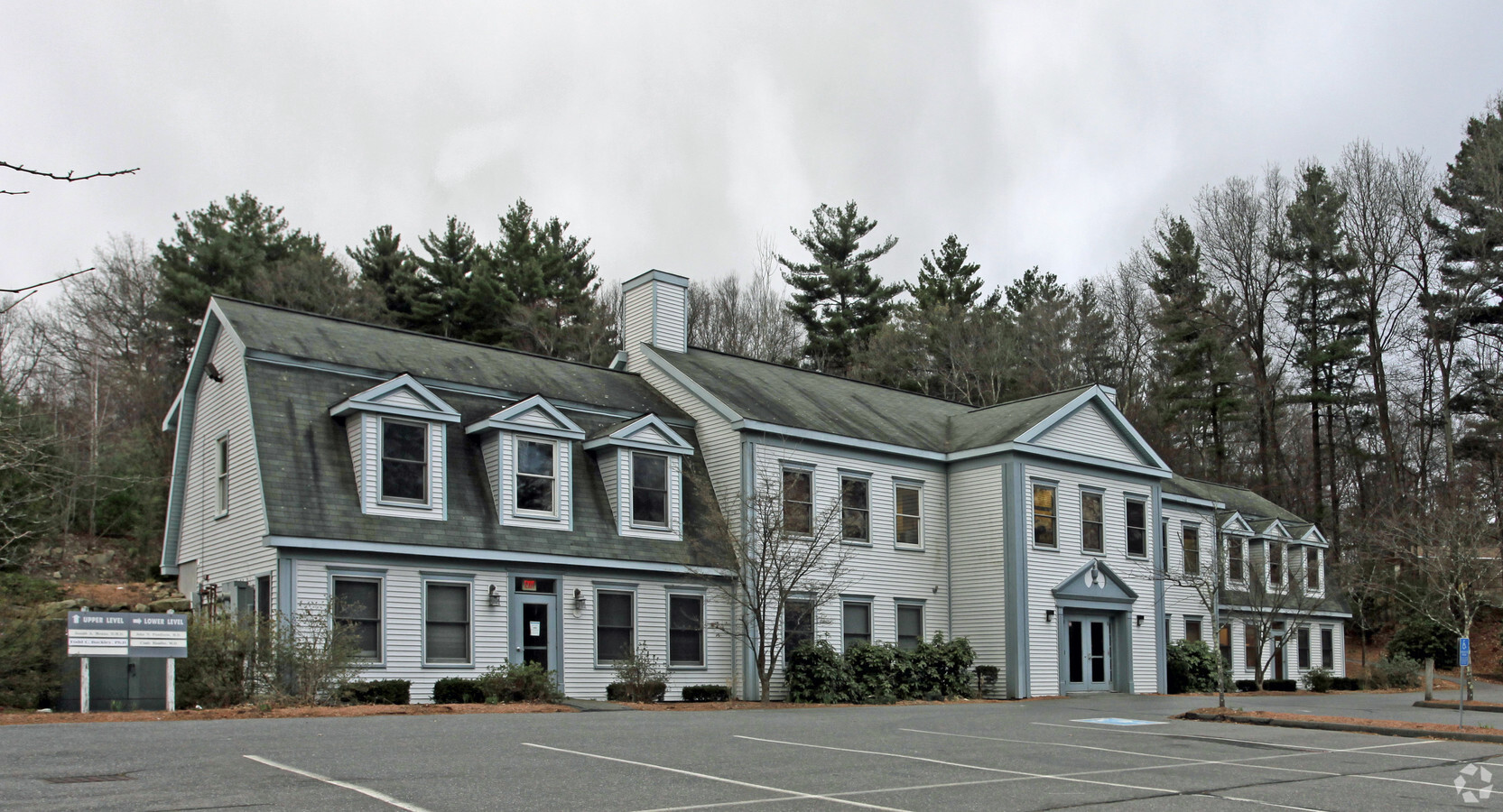
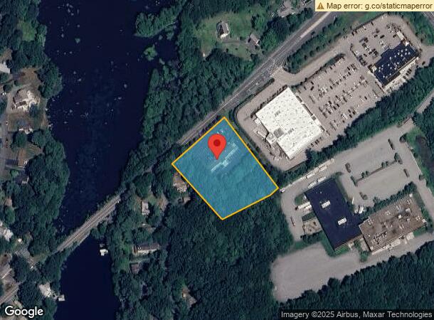
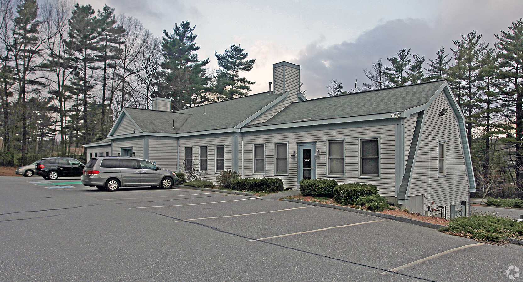
Property Record
169 W Main St, Hopkinton, MA 01748
NEARBY LISTINGS FOR SALE OR LEASE
Property Detail
169 W Main St
HOPK-000023R-000090-A000000
Middlesex
Medicalbuilding
Massachusetts
X
a
25017C0610F
2.01 AC
2025
Hopkinton/Holliston
2025
Boston
320102
Boston-Cambridge-Newton, MA-NH
8,192 SF
DEMOGRAPHICS near 169 W Main St
1 Mile
3 Mile
5 Mile
2024 Total Population
2,637
17,753
64,491
2029 Population
2,623
17,736
64,286
Pop Growth 2024-2029
(0.53%)
(0.10%)
(0.32%)
Average Age
40
41
41
2024 Total Households
932
6,132
23,365
HH Growth 2024-2029
(0.64%)
(0.16%)
(0.40%)
Median Household Inc
$165,261
$176,960
$136,735
Avg Household Size
2.80
2.80
2.70
2024 Avg HH Vehicles
2.00
2.00
2.00
Median Home Value
$669,877
$661,747
$570,132
Median Year Built
1986
1986
1979
Nearby Places
- Restaurants
- Banks
- Shops
- Fitness
- Groceries
PUBLIC TRANSPORTATION
COMMUTER RAIL
Southborough (Framingham/Worcester Line - Massachusetts Bay Transportation Authority Commuter Rail (Purple Line))
DRIVE
WALK
Distance
Southborough (Framingham/Worcester Line - Massachusetts Bay Transportation Authority Commuter Rail (Purple Line))
9 min
5.0 mi
Ashland (Framingham/Worcester Line - Massachusetts Bay Transportation Authority Commuter Rail (Purple Line))
DRIVE
WALK
Distance
Ashland (Framingham/Worcester Line - Massachusetts Bay Transportation Authority Commuter Rail (Purple Line))
15 min
6.4 mi
AIRPORT
Worcester Regional
DRIVE
WALK
Distance
Worcester Regional
39 min
23.9 mi
Freight Ports
Port of Boston
DRIVE
WALK
Distance
Port of Boston
48 min
35.2 mi
SALE & LEASE HISTORY
LISTING DATE
SALE/LEASE

Feb 12, 2020
For Sale
Nearby Properties
Address
Land Use
TOTAL SIZE
Lot Size
Zoning
Address
Land Use
TOTAL SIZE
Lot Size
Zoning
35.54 AC
Address
Land Use
TOTAL SIZE
Lot Size
Zoning
97.74 AC
IA
Address
Land Use
TOTAL SIZE
Lot Size
Zoning
143,464 SF
108.03 AC
RB
Address
Land Use
TOTAL SIZE
Lot Size
Zoning
49.73 AC
IA
Address
Land Use
TOTAL SIZE
Lot Size
Zoning
29.43 AC
IA
Address
Land Use
TOTAL SIZE
Lot Size
Zoning
133,897 SF
11.17 AC
RB1
Address
Land Use
TOTAL SIZE
Lot Size
Zoning
94,399 SF
28.70 AC
RB1
Address
Land Use
TOTAL SIZE
Lot Size
Zoning
7.80 AC
BR
Address
Land Use
TOTAL SIZE
Lot Size
Zoning
162,890 SF
15.47 AC
Address
Land Use
TOTAL SIZE
Lot Size
Zoning
8.17 AC
B
Address
Land Use
TOTAL SIZE
Lot Size
Zoning
129,520 SF
19.42 AC
IA
Address
Land Use
TOTAL SIZE
Lot Size
Zoning
141,100 SF
20.53 AC
IA
Address
Land Use
TOTAL SIZE
Lot Size
Zoning
36.90 AC
RA
Address
Land Use
TOTAL SIZE
Lot Size
Zoning
48,269 SF
9.22 AC
Address
Land Use
TOTAL SIZE
Lot Size
Zoning
101,450 SF
11.46 AC
Address
Land Use
TOTAL SIZE
Lot Size
Zoning
1,100 SF
796.20 AC
A
Address
Land Use
TOTAL SIZE
Lot Size
Zoning
63,600 SF
4.93 AC
IA
Address
Land Use
TOTAL SIZE
Lot Size
Zoning
68,722 SF
10.29 AC
Address
Land Use
TOTAL SIZE
Lot Size
Zoning
57,744 SF
10.49 AC
BD
Address
Land Use
TOTAL SIZE
Lot Size
Zoning
264.56 AC
Address
Land Use
TOTAL SIZE
Lot Size
Zoning
87,706 SF
7.61 AC
A
Address
Land Use
TOTAL SIZE
Lot Size
Zoning
154,604 SF
10.38 AC
IA
Address
Land Use
TOTAL SIZE
Lot Size
Zoning
70,744 SF
20.94 AC
IA
Address
Land Use
TOTAL SIZE
Lot Size
Zoning
63,600 SF
6.64 AC
IA
Address
Land Use
TOTAL SIZE
Lot Size
Zoning
66,000 SF
7.06 AC
IA
Address
Land Use
TOTAL SIZE
Lot Size
Zoning
69,000 SF
6.80 AC
IA
Address
Land Use
TOTAL SIZE
Lot Size
Zoning
78,077 SF
19.30 AC
A
Address
Land Use
TOTAL SIZE
Lot Size
Zoning
42,534 SF
6.23 AC
Address
Land Use
TOTAL SIZE
Lot Size
Zoning
61,088 SF
7.20 AC
IA
Address
Land Use
TOTAL SIZE
Lot Size
Zoning
63,597 SF
7 AC
IA
The World's #1 Commercial Real Estate Marketplace
Connect with us
© 2025 CoStar Group
The information above has been obtained from sources believed reliable. While we do not doubt its accuracy we have not verified it and make no guarantee, warranty or representation about it. It is your responsibility to independently confirm its accuracy and completeness. Any projections, opinions, assumptions, or estimates used are for example only and do not represent the current or future performance of the property. The value of this transaction to you depends on tax and other factors which should be evaluated by your tax, financial, and legal advisors. You and your advisors should conduct a careful, independent investigation of the property to determine to your satisfaction the suitability of the property for your needs.