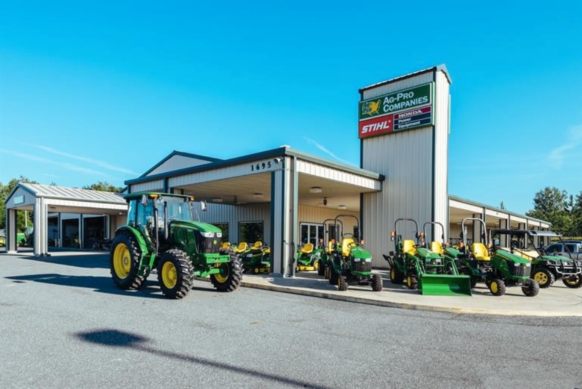
Property Record
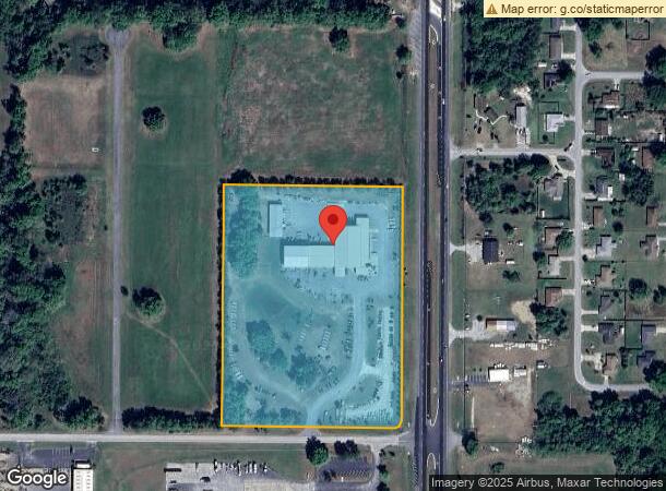
1695 Nw 63Rd St, Ocala, FL 34475
NEARBY LISTINGS FOR SALE OR LEASE
Property Detail
1695 Nw 63Rd St
13326-000-00
SEC 24 TWP 14 RGE 21 COM AT PT 520.22 FT S & 100 FT W OF NE COR OF E 1/2 OF SE 1/4 OF SE 1/4 OF SEC 24 BEING POB TH S 00-25-37 W 388.50 FT TH N 89-22-50 W 561.24 FT TH N 00-26-26 E 388.50 FT TH S 89-22-50 E 561.15 FT TO POB. & COM AT PT 520.22 FT S &
Storebuilding
Marion
X
Florida
12083C0319D
9.90 AC
2023
Outlying Marion County
2023
Ocala
001500
Ocala, FL
30,866 SF
DEMOGRAPHICS near 1695 Nw 63Rd St
1 Mile
3 Mile
5 Mile
2024 Total Population
1,503
14,060
50,866
2029 Population
1,694
15,864
57,312
Pop Growth 2024-2029
+ 12.71%
+ 12.83%
+ 12.67%
Average Age
40
40
42
2024 Total Households
584
5,482
20,012
HH Growth 2024-2029
+ 12.67%
+ 12.82%
+ 12.88%
Median Household Inc
$37,272
$44,724
$45,661
Avg Household Size
2.50
2.50
2.40
2024 Avg HH Vehicles
2.00
2.00
2.00
Median Home Value
$219,776
$205,494
$170,662
Median Year Built
1989
1986
1985
Nearby Places
- Restaurants
- Banks
- Shops
- Fitness
- Groceries
Nearby Properties
Address
Land Use
TOTAL SIZE
Lot Size
Zoning
Address
Land Use
TOTAL SIZE
Lot Size
Zoning
350,895 SF
27.85 AC
M1
Address
Land Use
TOTAL SIZE
Lot Size
Zoning
140,920 SF
28.09 AC
M2
Address
Land Use
TOTAL SIZE
Lot Size
Zoning
384,930 SF
17.76 AC
M1
Address
Land Use
TOTAL SIZE
Lot Size
Zoning
116,876 SF
23.78 AC
M2
Address
Land Use
TOTAL SIZE
Lot Size
Zoning
73,361 SF
23.20 AC
GU
Address
Land Use
TOTAL SIZE
Lot Size
Zoning
64,438 SF
12.27 AC
B4
Address
Land Use
TOTAL SIZE
Lot Size
Zoning
47,984 SF
448.37 AC
PUD
Address
Land Use
TOTAL SIZE
Lot Size
Zoning
66,531 SF
26.96 AC
B2
Address
Land Use
TOTAL SIZE
Lot Size
Zoning
Address
Land Use
TOTAL SIZE
Lot Size
Zoning
44,100 SF
9.60 AC
R3
Address
Land Use
TOTAL SIZE
Lot Size
Zoning
72,855 SF
47.31 AC
B2
Address
Land Use
TOTAL SIZE
Lot Size
Zoning
89,640 SF
33.21 AC
B5
Address
Land Use
TOTAL SIZE
Lot Size
Zoning
79,249 SF
14.46 AC
R3
Address
Land Use
TOTAL SIZE
Lot Size
Zoning
458,983 SF
35.14 AC
M1
Address
Land Use
TOTAL SIZE
Lot Size
Zoning
57,558 SF
9.18 AC
B4
Address
Land Use
TOTAL SIZE
Lot Size
Zoning
16,986 SF
52.87 AC
PD
Address
Land Use
TOTAL SIZE
Lot Size
Zoning
47,900 SF
10.29 AC
B5
Address
Land Use
TOTAL SIZE
Lot Size
Zoning
58,133 SF
29.25 AC
INST
Address
Land Use
TOTAL SIZE
Lot Size
Zoning
41,195 SF
4 AC
B5
Address
Land Use
TOTAL SIZE
Lot Size
Zoning
16,430 SF
59.07 AC
A3
Address
Land Use
TOTAL SIZE
Lot Size
Zoning
26,677 SF
3.71 AC
GU
Address
Land Use
TOTAL SIZE
Lot Size
Zoning
115,909 SF
11.09 AC
RPUD
Address
Land Use
TOTAL SIZE
Lot Size
Zoning
10,894 SF
35.86 AC
B3
Address
Land Use
TOTAL SIZE
Lot Size
Zoning
96,441 SF
11.02 AC
M1
Address
Land Use
TOTAL SIZE
Lot Size
Zoning
11,645 SF
7.81 AC
B4
Address
Land Use
TOTAL SIZE
Lot Size
Zoning
43,737 SF
4.02 AC
B4
Address
Land Use
TOTAL SIZE
Lot Size
Zoning
103,208 SF
17.91 AC
INST
Address
Land Use
TOTAL SIZE
Lot Size
Zoning
49,915 SF
5 AC
PUD
Address
Land Use
TOTAL SIZE
Lot Size
Zoning
13,494 SF
40.14 AC
A1
Address
Land Use
TOTAL SIZE
Lot Size
Zoning
9,117 SF
18.84 AC
B3
The World's #1 Commercial Real Estate Marketplace
Connect with us
© 2025 CoStar Group
The information above has been obtained from sources believed reliable. While we do not doubt its accuracy we have not verified it and make no guarantee, warranty or representation about it. It is your responsibility to independently confirm its accuracy and completeness. Any projections, opinions, assumptions, or estimates used are for example only and do not represent the current or future performance of the property. The value of this transaction to you depends on tax and other factors which should be evaluated by your tax, financial, and legal advisors. You and your advisors should conduct a careful, independent investigation of the property to determine to your satisfaction the suitability of the property for your needs.