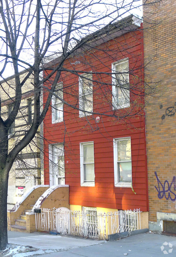
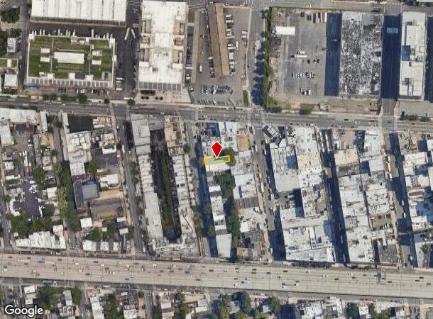
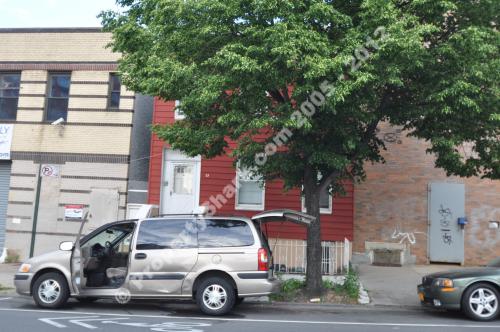
Property Record
17 Vanderbilt Ave, Brooklyn, NY 11205
NEARBY LISTINGS FOR SALE OR LEASE
Property Detail
17 Vanderbilt Ave
New York-Jersey City-White Plains, NY-NJ
Kings
01872-0017
New York
Sfr
0.06 AC
X
North Brooklyn
3604970203F
Long Island (New York)
1,890 SF
DEMOGRAPHICS near 17 Vanderbilt Ave
1 Mile
3 Mile
5 Mile
2024 Total Population
172,299
1,271,950
2,829,543
2029 Population
166,195
1,202,254
2,663,202
Pop Growth 2024-2029
(3.54%)
(5.48%)
(5.88%)
Average Age
34
38
38
2024 Total Households
65,410
545,706
1,188,406
HH Growth 2024-2029
(3.84%)
(5.93%)
(6.14%)
Median Household Inc
$78,852
$91,479
$87,343
Avg Household Size
2.50
2.20
2.30
2024 Avg HH Vehicles
.00
.00
.00
Median Home Value
$907,335
$1,020,469
$894,669
Median Year Built
1968
1948
1949
Nearby Places
- Restaurants
- Banks
- Shops
- Fitness
- Groceries
PUBLIC TRANSPORTATION
TRANSIT/SUBWAY
Clinton-Washington Avenues (G Line) (G - New York MTA Subway (The Subway))
DRIVE
WALK
Distance
Clinton-Washington Avenues (G Line) (G - New York MTA Subway (The Subway))
2 min
14 min
0.8 mi
Fulton Street (G Line) (G - New York MTA Subway (The Subway))
DRIVE
WALK
Distance
Fulton Street (G Line) (G - New York MTA Subway (The Subway))
4 min
19 min
1.0 mi
Lafayette Avenue (A - New York MTA Subway (The Subway), C - New York MTA Subway (The Subway))
DRIVE
WALK
Distance
Lafayette Avenue (A - New York MTA Subway (The Subway), C - New York MTA Subway (The Subway))
4 min
20 min
1.0 mi
COMMUTER RAIL
Flatbush Avenue Station (Far Rockaway Branch - Long Island Rail Road, Hempstead Branch - Long Island Rail Road, Long Beach Branch - Long Island Rail Road, West Hempstead Branch - Long Island Rail Road)
DRIVE
WALK
Distance
Flatbush Avenue Station (Far Rockaway Branch - Long Island Rail Road, Hempstead Branch - Long Island Rail Road, Long Beach Branch - Long Island Rail Road, West Hempstead Branch - Long Island Rail Road)
5 min
1.4 mi
Nostrand Avenue Station (Far Rockaway Branch - Long Island Rail Road, Hempstead Branch - Long Island Rail Road, Long Beach Branch - Long Island Rail Road, West Hempstead Branch - Long Island Rail Road)
DRIVE
WALK
Distance
Nostrand Avenue Station (Far Rockaway Branch - Long Island Rail Road, Hempstead Branch - Long Island Rail Road, Long Beach Branch - Long Island Rail Road, West Hempstead Branch - Long Island Rail Road)
8 min
2.2 mi
AIRPORT
La Guardia
DRIVE
WALK
Distance
La Guardia
15 min
8.8 mi
Newark Liberty International
DRIVE
WALK
Distance
Newark Liberty International
28 min
14.7 mi
John F. Kennedy International
DRIVE
WALK
Distance
John F. Kennedy International
26 min
16.9 mi
Freight Ports
NY - Red Hook Container Terminal
DRIVE
WALK
Distance
NY - Red Hook Container Terminal
1 min
2.0 mi
SALE & LEASE HISTORY
LISTING DATE
SALE/LEASE

Oct 16, 2017
For Sale
Jan 26, 2017
For Sale
Nearby Properties
Address
Land Use
TOTAL SIZE
Lot Size
Zoning
Address
Land Use
TOTAL SIZE
Lot Size
Zoning
8,966,500 SF
19.14 AC
C6-4
Address
Land Use
TOTAL SIZE
Lot Size
Zoning
2,354,289 SF
3.96 AC
C6-4
Address
Land Use
TOTAL SIZE
Lot Size
Zoning
2,812,739 SF
2.10 AC
C5-3
Address
Land Use
TOTAL SIZE
Lot Size
Zoning
2,157,862 SF
2.23 AC
BPC
Address
Land Use
TOTAL SIZE
Lot Size
Zoning
2,255,659 SF
4.58 AC
BPC
Address
Land Use
TOTAL SIZE
Lot Size
Zoning
2,124,441 SF
17.29 AC
R8
Address
Land Use
TOTAL SIZE
Lot Size
Zoning
2,233,692 SF
1.90 AC
BPC
Address
Land Use
TOTAL SIZE
Lot Size
Zoning
1,636,000 SF
1.08 AC
C6-4
Address
Land Use
TOTAL SIZE
Lot Size
Zoning
1,104,505 SF
2.32 AC
C4-7
Address
Land Use
TOTAL SIZE
Lot Size
Zoning
1,909,502 SF
2.37 AC
BPC
Address
Land Use
TOTAL SIZE
Lot Size
Zoning
940,000 SF
1.44 AC
C6-2
Address
Land Use
TOTAL SIZE
Lot Size
Zoning
1,780,030 SF
5.07 AC
BPC
Address
Land Use
TOTAL SIZE
Lot Size
Zoning
2,210,200 SF
2.58 AC
C5-5
Address
Land Use
TOTAL SIZE
Lot Size
Zoning
1,362,190 SF
C5-5
Address
Land Use
TOTAL SIZE
Lot Size
Zoning
3,122,165 SF
19.02 AC
R7-2
Address
Land Use
TOTAL SIZE
Lot Size
Zoning
1,653,794 SF
3.14 AC
C6-4
Address
Land Use
TOTAL SIZE
Lot Size
Zoning
1,043,803 SF
1.59 AC
M1-6
Address
Land Use
TOTAL SIZE
Lot Size
Zoning
1,260,362 SF
4.32 AC
C1-7
Address
Land Use
TOTAL SIZE
Lot Size
Zoning
1,385,425 SF
6.43 AC
R8
Address
Land Use
TOTAL SIZE
Lot Size
Zoning
1,740,736 SF
4.28 AC
C6-4
Address
Land Use
TOTAL SIZE
Lot Size
Zoning
1,617,206 SF
1.23 AC
C5-5
Address
Land Use
TOTAL SIZE
Lot Size
Zoning
1,440,960 SF
2.17 AC
BPC
Address
Land Use
TOTAL SIZE
Lot Size
Zoning
1,499,568 SF
1.66 AC
C5-5
Address
Land Use
TOTAL SIZE
Lot Size
Zoning
1,092,665 SF
1.06 AC
C62A
Address
Land Use
TOTAL SIZE
Lot Size
Zoning
2,542,066 SF
175.96 AC
R3-2
Address
Land Use
TOTAL SIZE
Lot Size
Zoning
1,597,965 SF
1.14 AC
C5-5
Address
Land Use
TOTAL SIZE
Lot Size
Zoning
972,820 SF
1.98 AC
M1-6
Address
Land Use
TOTAL SIZE
Lot Size
Zoning
1,075,808 SF
1.12 AC
C5-5
Address
Land Use
TOTAL SIZE
Lot Size
Zoning
758 SF
1.45 AC
PARK
Address
Land Use
TOTAL SIZE
Lot Size
Zoning
1,000,746 SF
1.44 AC
M1-6
The World's #1 Commercial Real Estate Marketplace
Connect with us
© 2025 CoStar Group
The information above has been obtained from sources believed reliable. While we do not doubt its accuracy we have not verified it and make no guarantee, warranty or representation about it. It is your responsibility to independently confirm its accuracy and completeness. Any projections, opinions, assumptions, or estimates used are for example only and do not represent the current or future performance of the property. The value of this transaction to you depends on tax and other factors which should be evaluated by your tax, financial, and legal advisors. You and your advisors should conduct a careful, independent investigation of the property to determine to your satisfaction the suitability of the property for your needs.