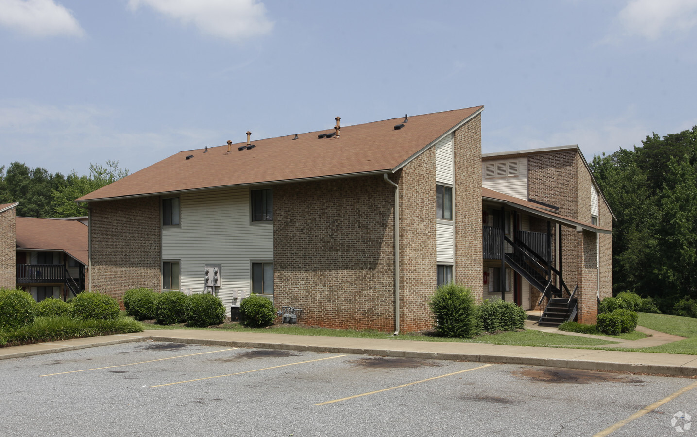
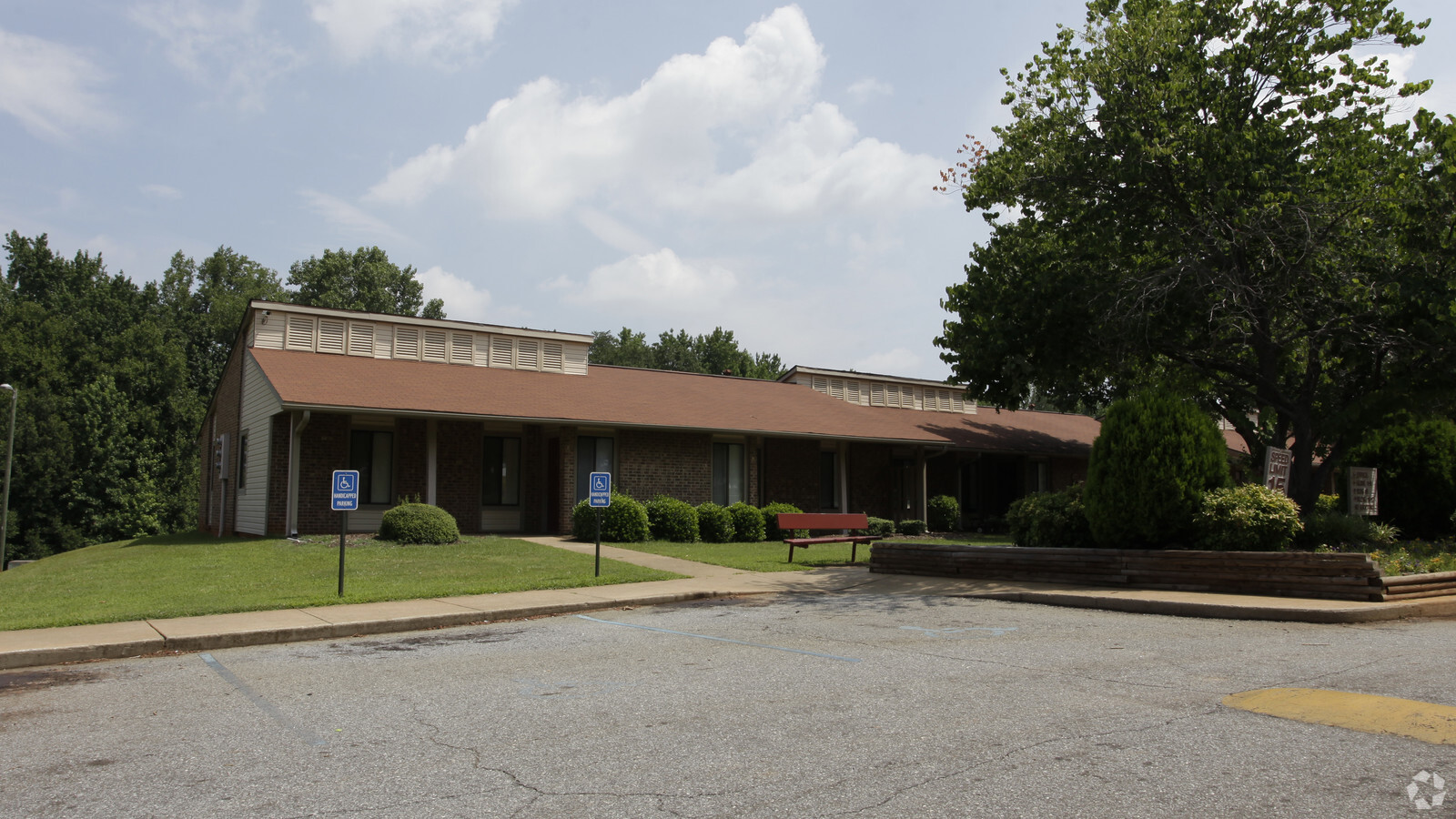
Property Record
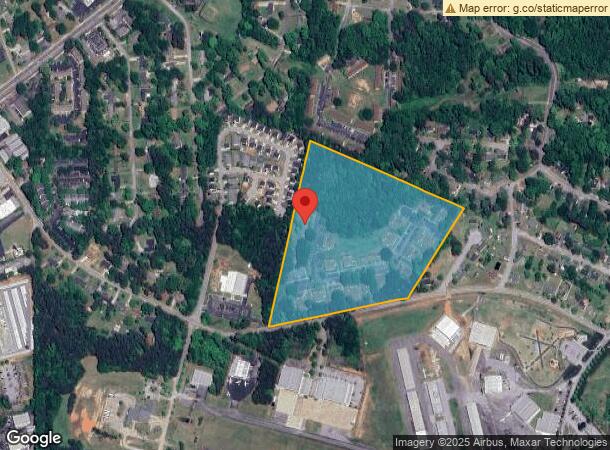
170 Kensington Dr, Spartanburg, SC 29306
NEARBY LISTINGS FOR SALE OR LEASE
Property Detail
170 Kensington Dr
6-21-15-039.01
N SIDE KENSINGTON DRIVE & W OF CHATHAM CIRCLE PB 86-128 DB 47Y-141
Officebuilding
Spartanburg
X
South Carolina
45083C0262D
20 AC
2024
Park Hills
2023
Greenville/Spartanburg
020701
Spartanburg, SC
2,520 SF
DEMOGRAPHICS near 170 Kensington Dr
1 Mile
3 Mile
5 Mile
2024 Total Population
5,395
51,366
96,591
2029 Population
6,082
58,579
109,683
Pop Growth 2024-2029
+ 12.73%
+ 14.04%
+ 13.55%
Average Age
38
38
39
2024 Total Households
2,244
20,518
37,855
HH Growth 2024-2029
+ 13.01%
+ 14.35%
+ 14.00%
Median Household Inc
$47,500
$46,195
$49,757
Avg Household Size
2.30
2.40
2.40
2024 Avg HH Vehicles
2.00
2.00
2.00
Median Home Value
$145,491
$149,150
$171,099
Median Year Built
1970
1978
1979
Nearby Places
- Restaurants
- Banks
- Shops
- Fitness
- Groceries
PUBLIC TRANSPORTATION
COMMUTER RAIL
Spartanburg Amtrak Station (Crescent - Amtrak)
DRIVE
WALK
Distance
Spartanburg Amtrak Station (Crescent - Amtrak)
9 min
3.3 mi
AIRPORT
Greenville Spartanburg International
DRIVE
WALK
Distance
Greenville Spartanburg International
32 min
18.5 mi
Freight Ports
North Charleston Terminal
DRIVE
WALK
Distance
North Charleston Terminal
218 min
193.4 mi
Nearby Properties
Address
Land Use
TOTAL SIZE
Lot Size
Zoning
Address
Land Use
TOTAL SIZE
Lot Size
Zoning
5,000 SF
19.69 AC
Address
Land Use
TOTAL SIZE
Lot Size
Zoning
3,352 SF
14 AC
Address
Land Use
TOTAL SIZE
Lot Size
Zoning
50,096 SF
5.88 AC
Address
Land Use
TOTAL SIZE
Lot Size
Zoning
7,245 SF
18.10 AC
Address
Land Use
TOTAL SIZE
Lot Size
Zoning
2,100 SF
10.12 AC
Address
Land Use
TOTAL SIZE
Lot Size
Zoning
2,637 SF
21.41 AC
Address
Land Use
TOTAL SIZE
Lot Size
Zoning
2,154 SF
42.76 AC
Address
Land Use
TOTAL SIZE
Lot Size
Zoning
3,446 SF
20.42 AC
Address
Land Use
TOTAL SIZE
Lot Size
Zoning
4,713 SF
16.87 AC
Address
Land Use
TOTAL SIZE
Lot Size
Zoning
4,598 SF
6.68 AC
Address
Land Use
TOTAL SIZE
Lot Size
Zoning
40,995 SF
0.74 AC
Address
Land Use
TOTAL SIZE
Lot Size
Zoning
9,710 SF
1.07 AC
Address
Land Use
TOTAL SIZE
Lot Size
Zoning
476,006 SF
36.54 AC
Address
Land Use
TOTAL SIZE
Lot Size
Zoning
1,782 SF
3.50 AC
Address
Land Use
TOTAL SIZE
Lot Size
Zoning
23,884 SF
3.90 AC
Address
Land Use
TOTAL SIZE
Lot Size
Zoning
227,480 SF
22.22 AC
Address
Land Use
TOTAL SIZE
Lot Size
Zoning
2,243 SF
20.62 AC
Address
Land Use
TOTAL SIZE
Lot Size
Zoning
69,836 SF
7.56 AC
Address
Land Use
TOTAL SIZE
Lot Size
Zoning
91,780 SF
2.30 AC
Address
Land Use
TOTAL SIZE
Lot Size
Zoning
4,920 SF
17.04 AC
Address
Land Use
TOTAL SIZE
Lot Size
Zoning
2,440 SF
10.07 AC
Address
Land Use
TOTAL SIZE
Lot Size
Zoning
44,199 SF
5.02 AC
Address
Land Use
TOTAL SIZE
Lot Size
Zoning
2,134 SF
27.72 AC
Address
Land Use
TOTAL SIZE
Lot Size
Zoning
4,128 SF
1.71 AC
Address
Land Use
TOTAL SIZE
Lot Size
Zoning
335,628 SF
17.93 AC
Address
Land Use
TOTAL SIZE
Lot Size
Zoning
6,907 SF
17.39 AC
Address
Land Use
TOTAL SIZE
Lot Size
Zoning
212,111 SF
14.10 AC
Address
Land Use
TOTAL SIZE
Lot Size
Zoning
37,668 SF
4.45 AC
Address
Land Use
TOTAL SIZE
Lot Size
Zoning
55,015 SF
7.75 AC
Address
Land Use
TOTAL SIZE
Lot Size
Zoning
27,136 SF
2.17 AC
The World's #1 Commercial Real Estate Marketplace
Connect with us
© 2025 CoStar Group
The information above has been obtained from sources believed reliable. While we do not doubt its accuracy we have not verified it and make no guarantee, warranty or representation about it. It is your responsibility to independently confirm its accuracy and completeness. Any projections, opinions, assumptions, or estimates used are for example only and do not represent the current or future performance of the property. The value of this transaction to you depends on tax and other factors which should be evaluated by your tax, financial, and legal advisors. You and your advisors should conduct a careful, independent investigation of the property to determine to your satisfaction the suitability of the property for your needs.