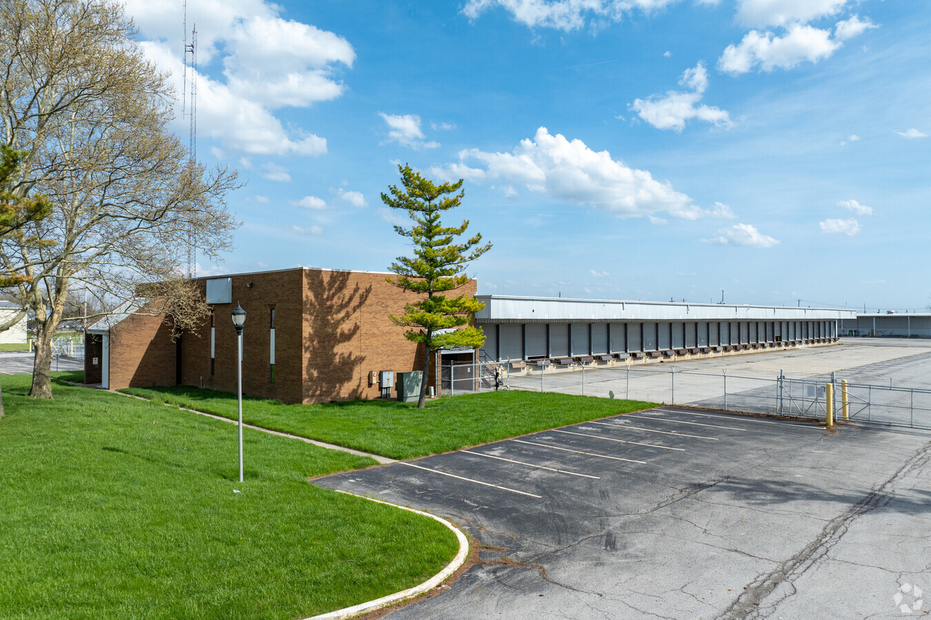
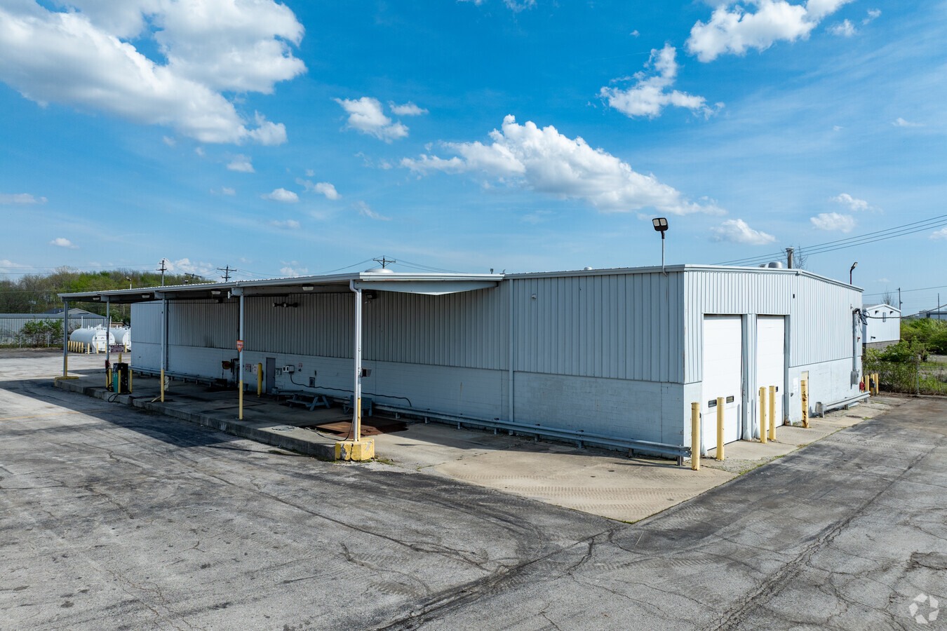
Property Record
1700 Georgesville Rd, Columbus, OH 43228
NEARBY LISTINGS FOR SALE OR LEASE
Property Detail
1700 Georgesville Rd
570-132280
Virginia Military Survey #1462
Truckterminal
PETERS & GANTZ RDS ENTRY 1462 6.543 ACRES
X
Franklin
39097C0200E
Ohio
2023
6.54 AC
2023
SW Columbus
008168
Columbus
35,868 SF
Columbus, OH
DEMOGRAPHICS near 1700 Georgesville Rd
1 Mile
3 Mile
5 Mile
2024 Total Population
6,959
69,710
168,146
2029 Population
6,923
69,417
168,360
Pop Growth 2024-2029
(0.52%)
(0.42%)
+ 0.13%
Average Age
34
36
37
2024 Total Households
2,586
26,217
64,726
HH Growth 2024-2029
(0.58%)
(0.53%)
+ 0.03%
Median Household Inc
$55,739
$59,602
$61,924
Avg Household Size
2.60
2.60
2.50
2024 Avg HH Vehicles
2.00
2.00
2.00
Median Home Value
$217,857
$189,470
$188,656
Median Year Built
1988
1985
1978
Nearby Places
- Restaurants
- Banks
- Shops
- Fitness
- Groceries
PUBLIC TRANSPORTATION
AIRPORT
Rickenbacker International
DRIVE
WALK
Distance
Rickenbacker International
23 min
16.1 mi
John Glenn Columbus International
DRIVE
WALK
Distance
John Glenn Columbus International
27 min
18.9 mi
Freight Ports
Port of Toledo
DRIVE
WALK
Distance
Port of Toledo
188 min
139.2 mi
SALE & LEASE HISTORY
LISTING DATE
SALE/LEASE

Oct 24, 2023
For Lease
Nearby Properties
Address
Land Use
TOTAL SIZE
Lot Size
Zoning
Address
Land Use
TOTAL SIZE
Lot Size
Zoning
1,367,463 SF
29.50 AC
Address
Land Use
TOTAL SIZE
Lot Size
Zoning
1,378,602 SF
101.09 AC
Address
Land Use
TOTAL SIZE
Lot Size
Zoning
262,551 SF
7 AC
Address
Land Use
TOTAL SIZE
Lot Size
Zoning
632,172 SF
43.38 AC
Address
Land Use
TOTAL SIZE
Lot Size
Zoning
257,723 SF
38.06 AC
Address
Land Use
TOTAL SIZE
Lot Size
Zoning
1,178,014 SF
152.63 AC
Address
Land Use
TOTAL SIZE
Lot Size
Zoning
1,418,013 SF
70.36 AC
Address
Land Use
TOTAL SIZE
Lot Size
Zoning
1,011,597 SF
49.94 AC
Address
Land Use
TOTAL SIZE
Lot Size
Zoning
2,247,456 SF
41.23 AC
Address
Land Use
TOTAL SIZE
Lot Size
Zoning
25,368 SF
27.22 AC
Address
Land Use
TOTAL SIZE
Lot Size
Zoning
742,062 SF
30.38 AC
Address
Land Use
TOTAL SIZE
Lot Size
Zoning
187,200 SF
9.02 AC
Address
Land Use
TOTAL SIZE
Lot Size
Zoning
493,000 SF
29.55 AC
Address
Land Use
TOTAL SIZE
Lot Size
Zoning
2,278,800 SF
23.74 AC
Address
Land Use
TOTAL SIZE
Lot Size
Zoning
202,330 SF
18.89 AC
Address
Land Use
TOTAL SIZE
Lot Size
Zoning
352,167 SF
177.98 AC
Address
Land Use
TOTAL SIZE
Lot Size
Zoning
1,626,129 SF
30.41 AC
Address
Land Use
TOTAL SIZE
Lot Size
Zoning
18,823 SF
14.73 AC
Address
Land Use
TOTAL SIZE
Lot Size
Zoning
377,088 SF
19.58 AC
Address
Land Use
TOTAL SIZE
Lot Size
Zoning
72,320 SF
2.52 AC
Address
Land Use
TOTAL SIZE
Lot Size
Zoning
52,283 SF
19.41 AC
Address
Land Use
TOTAL SIZE
Lot Size
Zoning
94,593 SF
7.97 AC
Address
Land Use
TOTAL SIZE
Lot Size
Zoning
205,147 SF
11.88 AC
Address
Land Use
TOTAL SIZE
Lot Size
Zoning
1,124,373 SF
21.92 AC
Address
Land Use
TOTAL SIZE
Lot Size
Zoning
108,732 SF
17.04 AC
Address
Land Use
TOTAL SIZE
Lot Size
Zoning
35,828 SF
15.81 AC
Address
Land Use
TOTAL SIZE
Lot Size
Zoning
385,851 SF
14.78 AC
Address
Land Use
TOTAL SIZE
Lot Size
Zoning
235,971 SF
19.41 AC
Address
Land Use
TOTAL SIZE
Lot Size
Zoning
241,560 SF
15.16 AC
Address
Land Use
TOTAL SIZE
Lot Size
Zoning
38,068 SF
281.60 AC
The World's #1 Commercial Real Estate Marketplace
Connect with us
© 2025 CoStar Group
The information above has been obtained from sources believed reliable. While we do not doubt its accuracy we have not verified it and make no guarantee, warranty or representation about it. It is your responsibility to independently confirm its accuracy and completeness. Any projections, opinions, assumptions, or estimates used are for example only and do not represent the current or future performance of the property. The value of this transaction to you depends on tax and other factors which should be evaluated by your tax, financial, and legal advisors. You and your advisors should conduct a careful, independent investigation of the property to determine to your satisfaction the suitability of the property for your needs.