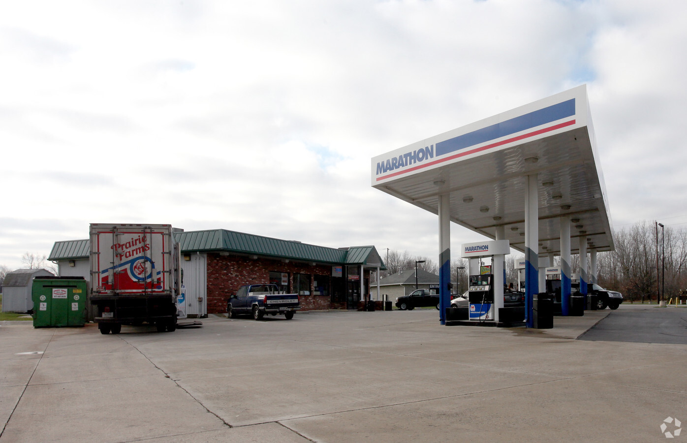
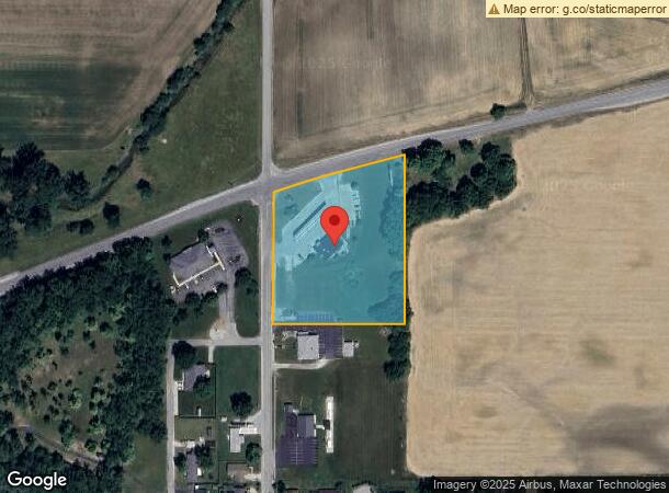
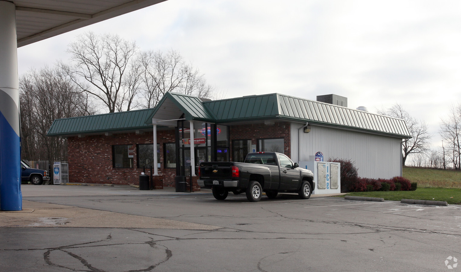
Property Record
1700 N Main St, Lapel, IN 46051
NEARBY LISTINGS FOR SALE OR LEASE
Property Detail
1700 N Main St
48-10-21-400-005.000-032
W2 E2 SE 3.4000ACRES STR: 21196 SECTION: PLAT: 00 IN: OUT:
Conveniencestore
Madison
X
Indiana
18057C0180G
3.40 AC
2023
Anderson/Madison Cnty
2024
Indianapolis
011100
Indianapolis-Carmel-Anderson, IN
2,869 SF
DEMOGRAPHICS near 1700 N Main St
1 Mile
3 Mile
5 Mile
2024 Total Population
1,668
3,515
6,520
2029 Population
1,675
3,630
6,798
Pop Growth 2024-2029
+ 0.42%
+ 3.27%
+ 4.26%
Average Age
40
41
41
2024 Total Households
692
1,385
2,525
HH Growth 2024-2029
+ 0.43%
+ 3.25%
+ 4.28%
Median Household Inc
$61,708
$72,543
$74,513
Avg Household Size
2.40
2.50
2.60
2024 Avg HH Vehicles
2.00
2.00
2.00
Median Home Value
$146,088
$182,390
$202,155
Median Year Built
1959
1966
1968
Nearby Places
- Restaurants
- Banks
- Shops
- Fitness
- Groceries
Nearby Properties
Address
Land Use
TOTAL SIZE
Lot Size
Zoning
Address
Land Use
TOTAL SIZE
Lot Size
Zoning
18,880 SF
3.70 AC
Address
Land Use
TOTAL SIZE
Lot Size
Zoning
2,048 SF
17.99 AC
Address
Land Use
TOTAL SIZE
Lot Size
Zoning
15,130 SF
23.45 AC
Address
Land Use
TOTAL SIZE
Lot Size
Zoning
9,004 SF
58.19 AC
Address
Land Use
TOTAL SIZE
Lot Size
Zoning
5,858 SF
16.80 AC
Address
Land Use
TOTAL SIZE
Lot Size
Zoning
10,828 SF
14.31 AC
Address
Land Use
TOTAL SIZE
Lot Size
Zoning
12,300 SF
16.33 AC
Address
Land Use
TOTAL SIZE
Lot Size
Zoning
26,996 SF
0.72 AC
Address
Land Use
TOTAL SIZE
Lot Size
Zoning
8,402 SF
10 AC
Address
Land Use
TOTAL SIZE
Lot Size
Zoning
6,272 SF
12.21 AC
Address
Land Use
TOTAL SIZE
Lot Size
Zoning
473 SF
1.83 AC
Address
Land Use
TOTAL SIZE
Lot Size
Zoning
14,200 SF
1.21 AC
Address
Land Use
TOTAL SIZE
Lot Size
Zoning
5,817 SF
12 AC
Address
Land Use
TOTAL SIZE
Lot Size
Zoning
7,162 SF
12.68 AC
Address
Land Use
TOTAL SIZE
Lot Size
Zoning
6,438 SF
8.41 AC
Address
Land Use
TOTAL SIZE
Lot Size
Zoning
5,000 SF
1.50 AC
Address
Land Use
TOTAL SIZE
Lot Size
Zoning
6,816 SF
13 AC
Address
Land Use
TOTAL SIZE
Lot Size
Zoning
5,552 SF
12.99 AC
Address
Land Use
TOTAL SIZE
Lot Size
Zoning
6,280 SF
10.22 AC
Address
Land Use
TOTAL SIZE
Lot Size
Zoning
3,360 SF
1.25 AC
Address
Land Use
TOTAL SIZE
Lot Size
Zoning
4,902 SF
52.42 AC
Address
Land Use
TOTAL SIZE
Lot Size
Zoning
7,576 SF
4 AC
Address
Land Use
TOTAL SIZE
Lot Size
Zoning
7,011 SF
1.74 AC
Address
Land Use
TOTAL SIZE
Lot Size
Zoning
6,148 SF
21.76 AC
Address
Land Use
TOTAL SIZE
Lot Size
Zoning
5,848 SF
3 AC
Address
Land Use
TOTAL SIZE
Lot Size
Zoning
4,123 SF
80 AC
Address
Land Use
TOTAL SIZE
Lot Size
Zoning
4,700 SF
13.88 AC
Address
Land Use
TOTAL SIZE
Lot Size
Zoning
4,125 SF
80 AC
Address
Land Use
TOTAL SIZE
Lot Size
Zoning
3,912 SF
60 AC
Address
Land Use
TOTAL SIZE
Lot Size
Zoning
11,312 SF
6.23 AC
The World's #1 Commercial Real Estate Marketplace
Connect with us
© 2025 CoStar Group
The information above has been obtained from sources believed reliable. While we do not doubt its accuracy we have not verified it and make no guarantee, warranty or representation about it. It is your responsibility to independently confirm its accuracy and completeness. Any projections, opinions, assumptions, or estimates used are for example only and do not represent the current or future performance of the property. The value of this transaction to you depends on tax and other factors which should be evaluated by your tax, financial, and legal advisors. You and your advisors should conduct a careful, independent investigation of the property to determine to your satisfaction the suitability of the property for your needs.